

Big Island Weather: Sunshine, Vog & Weaker Winds
Alerts
A Small Craft Advisory is posted for all Big Island waters through 6:00 a.m. Thursday for north winds up to 25 knots with higher gusts. Rough seas up to 14 feet are also forecasted through Thursday morning. Inexperienced mariners should avoid navigating in these conditions.
A High Surf Advisory is posted for north facing shores through 6:00 p.m. Thursday. Expect strong breaking waves, shore break and strong longshore and rip currents making swimming difficult and dangerous.
**Click directly on the images below to make them larger. Charts include: Big Island high/low forecasted temperatures, projected winds, chance of cloud cover, projected localized weather conditions, vog/SO2 forecast and expected wave heights.**
Today, Thursday, January 8, 2015
Trade winds are expected today from 10 to 15 mph. Windward and mauka areas are forecasted to be mostly clear with just isolated showers in the morning. Leeward spots across the Big Island should get lots of morning sunshine. As the land heats up, sea breezes are expected to develop which will lead to afternoon cloud cover and possible isolated showers. Hazy skies are expected in the afternoon for parts of the Big Island (see UHSOEST vog model above). High temperatures should fall in the range of 77° to 82°.
Sunrise: 6:57 a.m.
Sunset: 5:57 p.m.
UV index at 7 (“high” exposure level)
Tonight
Partly cloudy skies and isolated showers are expected for windward and mauka areas. Leeward spots may be cloudy to start but are expected to clear as the land breeze takes hold. Northeast winds are expected around 15 mph. Low temperatures are forecasted from 66° to 71° degrees.
Moonrise: 9:16 p.m.
Moonset: 9:54 a.m. on Jan. 9
Next New Moon: Jan. 20 at 3:14 a.m.
Next Full Moon: 1:09 p.m. on Feb. 3
Looking Ahead
Winds are expected to weaken on Thursday. Light southeast flow will then prevail into the weekend resulting in land and sea breezes over the islands and periods of vog and haze. A very gradual increase in moisture is expected towards the end of the week. The weekend will bring light east to southeast flow which will result in local land and sea breezes, and a few more showers. Temperatures will also gradually warm through the rest of the week.
Almanac for Hilo Airport
Maximum Temperature for today:
Normal 79°
Record 91° / Set in 1979
Minimum Temperature for today:
Normal 64°
Record 58° / Set in 1971
**Click here for your detailed Big Island surf report.**
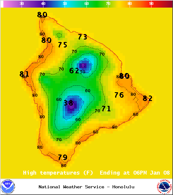
Image: NOAA / NWS
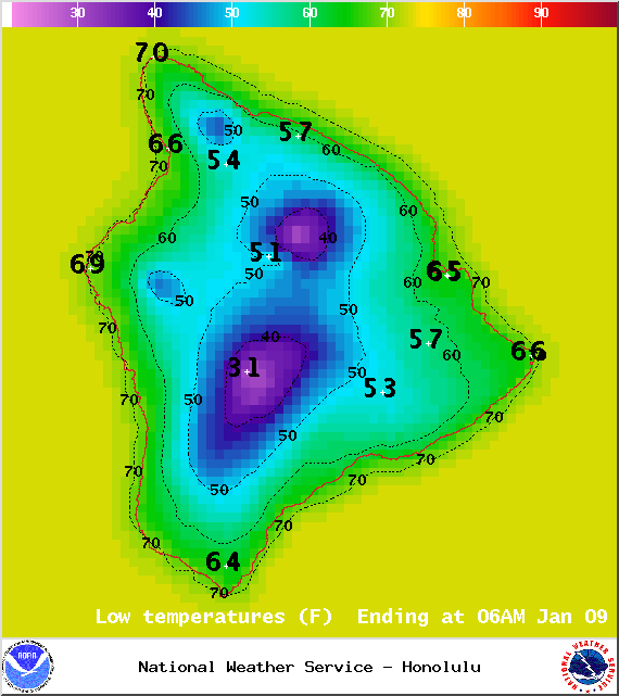
Image: NOAA / NWS
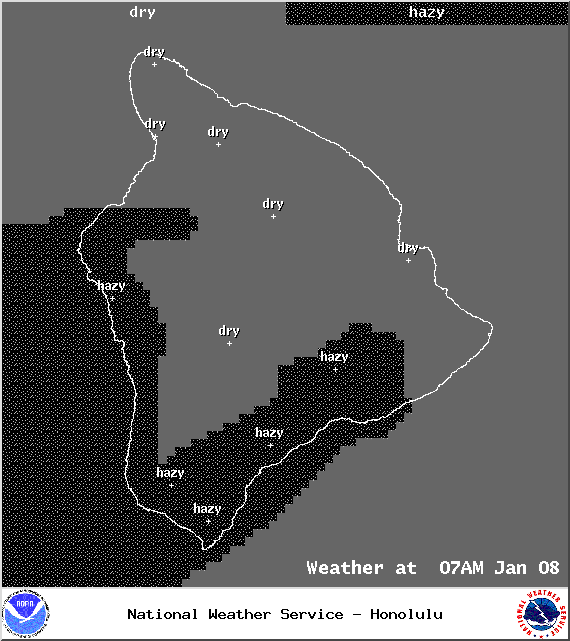
Image: NOAA / NWS
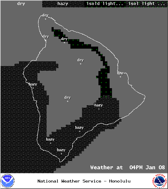
Image: NOAA / NWS
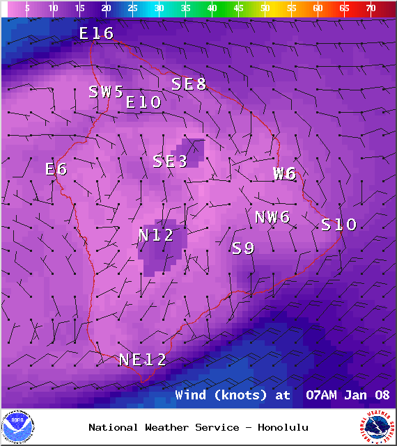
Image: NOAA / NWS
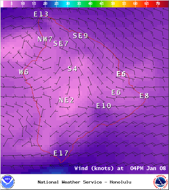
Image: NOAA / NWS
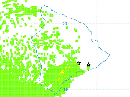
Image: UHSOEST
Image: NOAA / NWS
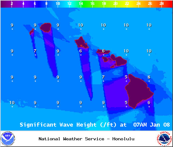
Image: NOAA / NWS
Sponsored Content


