

Overlapping Swells Expected Through Weekend
Alerts
All weather alerts are posted HERE.
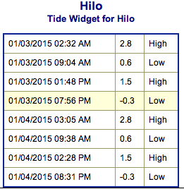
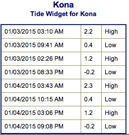
**Both Saturday and Sunday weather charts are below. Look at the time stamp to determine which day and time the chart is for. Click directly on the images below to make them larger. Charts include: Big Island projected winds, tides, swell direction & period and expected wave heights.**
 Big Island Surf Forecast, Saturday, January 3, 2015
Hilo side: Surf heights are expected from knee to shoulder high at the best breaks along the Hamakua coast on Saturday.
Kona side: Surf heights in the overhead range early in the day on Saturday.
South: Surf is overhead early in the day and dropping.
New west-northwest to north-west swell is expected to build on Saturday and peak on Sunday. Overlapping shorter period swell out of the north-northwest and north is also expected over the weekend. Since swells are coming from many different directions it may be haphazard at times.
 Pending development, a smaller west-northwest is forecasted by midweek and a larger swell could be generated for the end of the week as well.
Nothing of note out of the SPAC to get excited about.
Keep in mind, surf heights are measured on the face of the wave from trough to crest. Heights vary from beach to beach, and at the same beach, from break to break.
**Click here for your detailed Big Island weather report.**
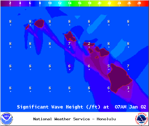
Image: NOAA / NWS
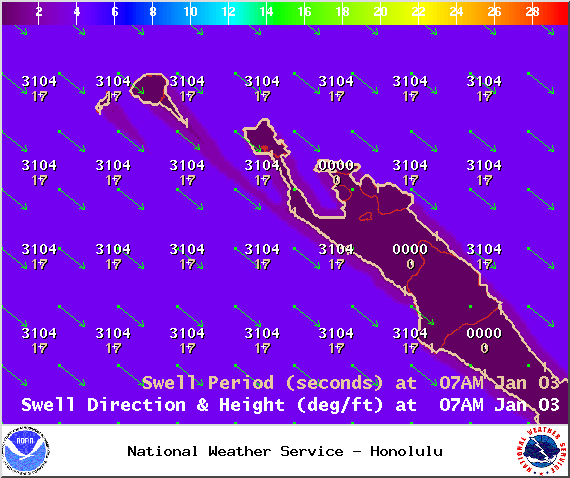
Image: NOAA / NWS
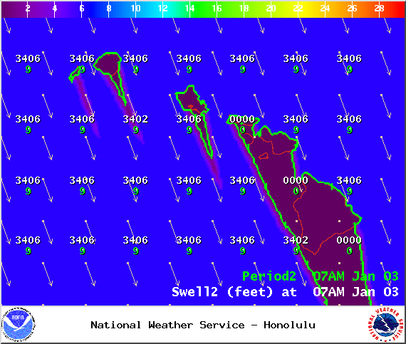
Image: NOAA / NWS
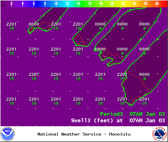
Image: NOAA / NWS
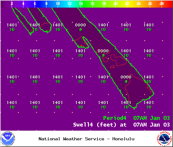
Image: NOAA / NWS
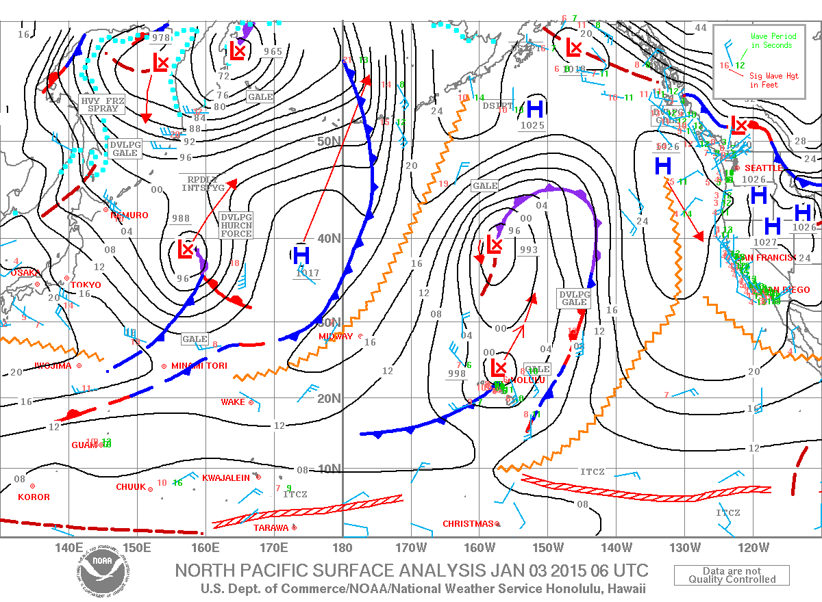
Image: NOAA / NWS
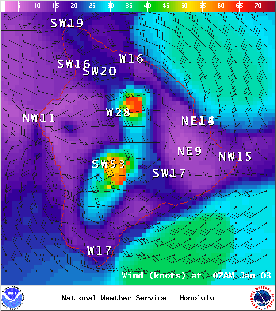
Image: NOAA / NWS
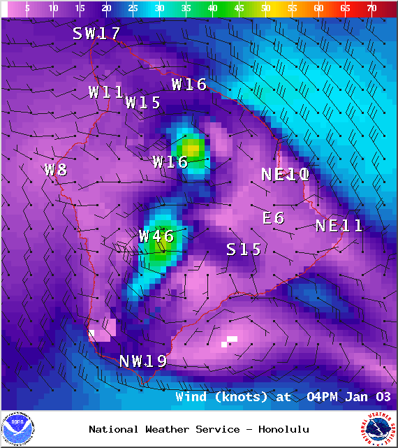
Image: NOAA / NWS
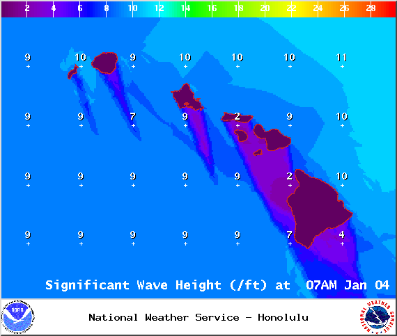
Image: NOAA / NWS
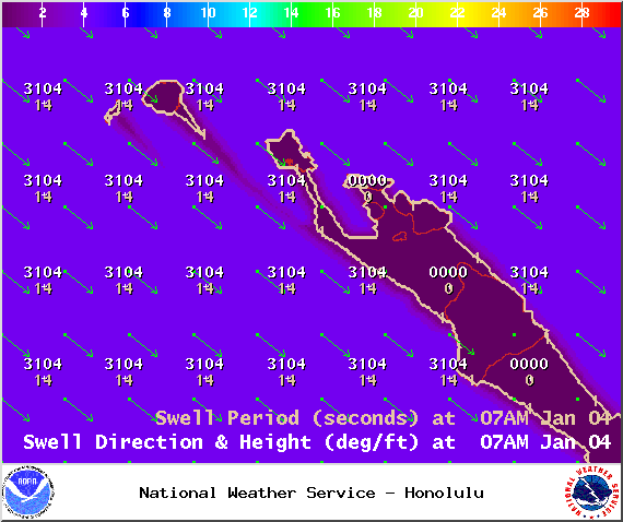
Image: NOAA / NWS
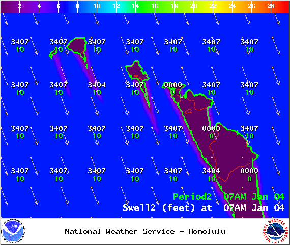
Image: NOAA / NWS
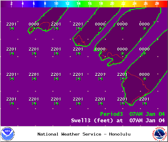
Image: NOAA / NWS
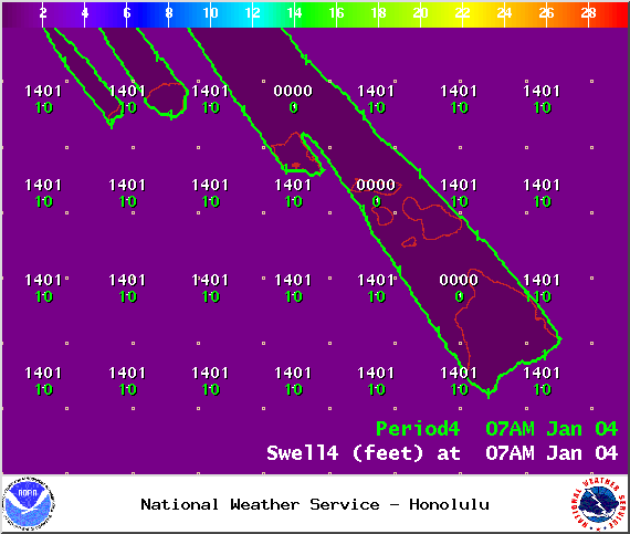
Image: NOAA / NWS
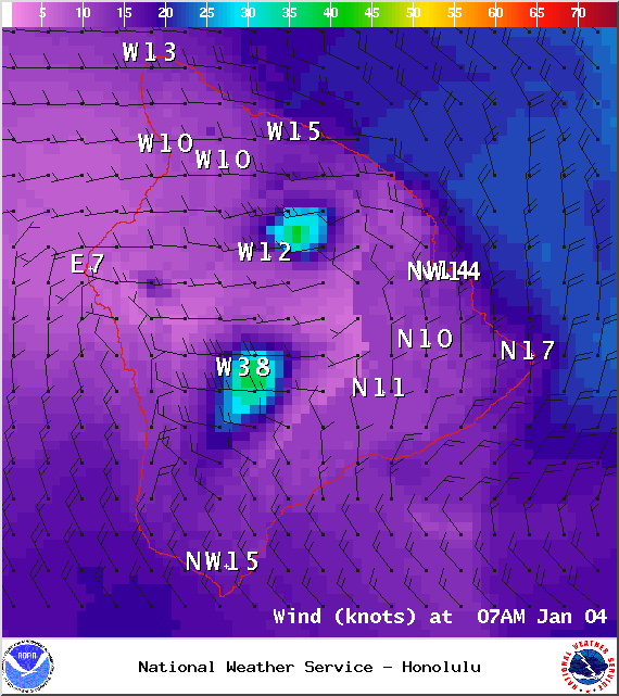
Image: NOAA / NWS
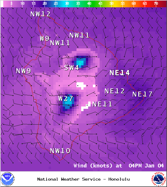
Image: NOAA / NWS
Sponsored Content


