

Blustery With Passing Showers Today
Alerts
All weather alerts are posted HERE.
**Click directly on the images below to make them larger. Charts include: Big Island high/low forecasted temperatures, projected winds, chance of cloud cover, projected localized weather conditions, vog/SO2 forecast and expected wave heights.**
Today, Saturday, January 3, 2015
Windy conditions are expected today out of the northwest from 15 to 30 mph, gusting to 55 mph in some spots and much stronger at the summits. Showers may be heavy at times and a chance of thunderstorms exists. The chance for showers and thunderstorms diminishes as the day goes on. High temperatures should fall in the range of 75° to 80°.
Sunrise: 6:55 a.m.
Sunset: 5:54 p.m.
UV index at 6 (“high” exposure level)
Tonight
Partly cloudy skies are expected tonight with scattered windward and mauka showers. Northwest winds are expected from 15 to 25 mph. Low temperatures are forecasted from 63° to 69° degrees.
Moonrise: 5:04 p.m.
Moonset: 6:25 a.m. on Jan. 4
Next Full Moon: Jan. 4 at 6:54 p.m.
Next New Moon: Jan. 20 at 3:14 a.m.
Sunday, January 4, 2015
Winds are expected out of the northwest today from 15 to 25 mph. Scattered morning and evening showers are expected for windward spots. Highs from 77° to 82° and lows from 66° to 71°.
Sunrise: 6:56 a.m.
Sunset: 5:55 p.m.
UV index at 6 (“high” exposure level)
Looking Ahead
Winds will shift out of the northwest and showers will diminish after the front pushes through. Cool and dry weather is expected behind the front on Sunday, with a relatively dry trade wind pattern expected for early next week. A weak front may cause winds to weaken and veer late in the work week.
Almanac for Hilo Airport
Maximum Temperature for today:
Normal 79°
Record 86° / Set in 1958 and tied in 1974
Minimum Temperature for today:
Normal 64°
Record 58° / Set in 1960 and tied in 1960
**Click here for your detailed Big Island surf report.**
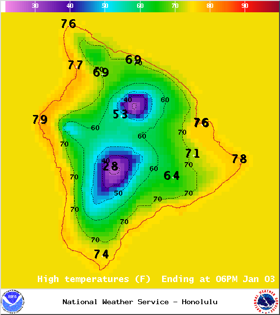
Image: NOAA / NWS
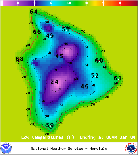
Image: NOAA / NWS
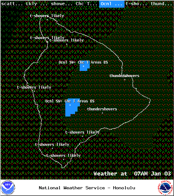
Image: NOAA / NWS
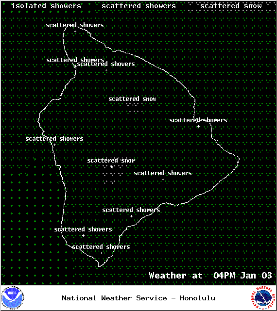
Image: NOAA / NWS
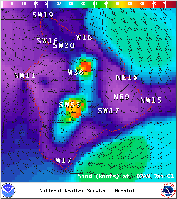
Image: NOAA / NWS
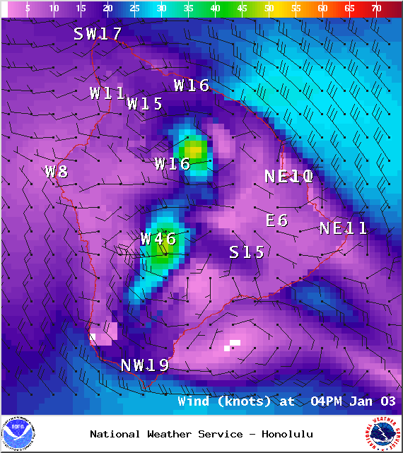
Image: NOAA / NWS
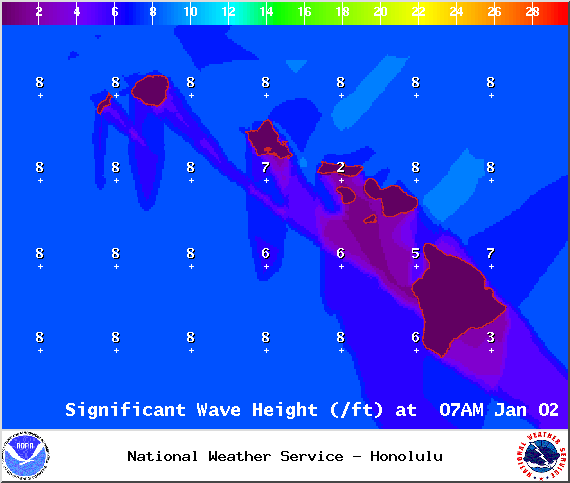
Image: NOAA / NWS
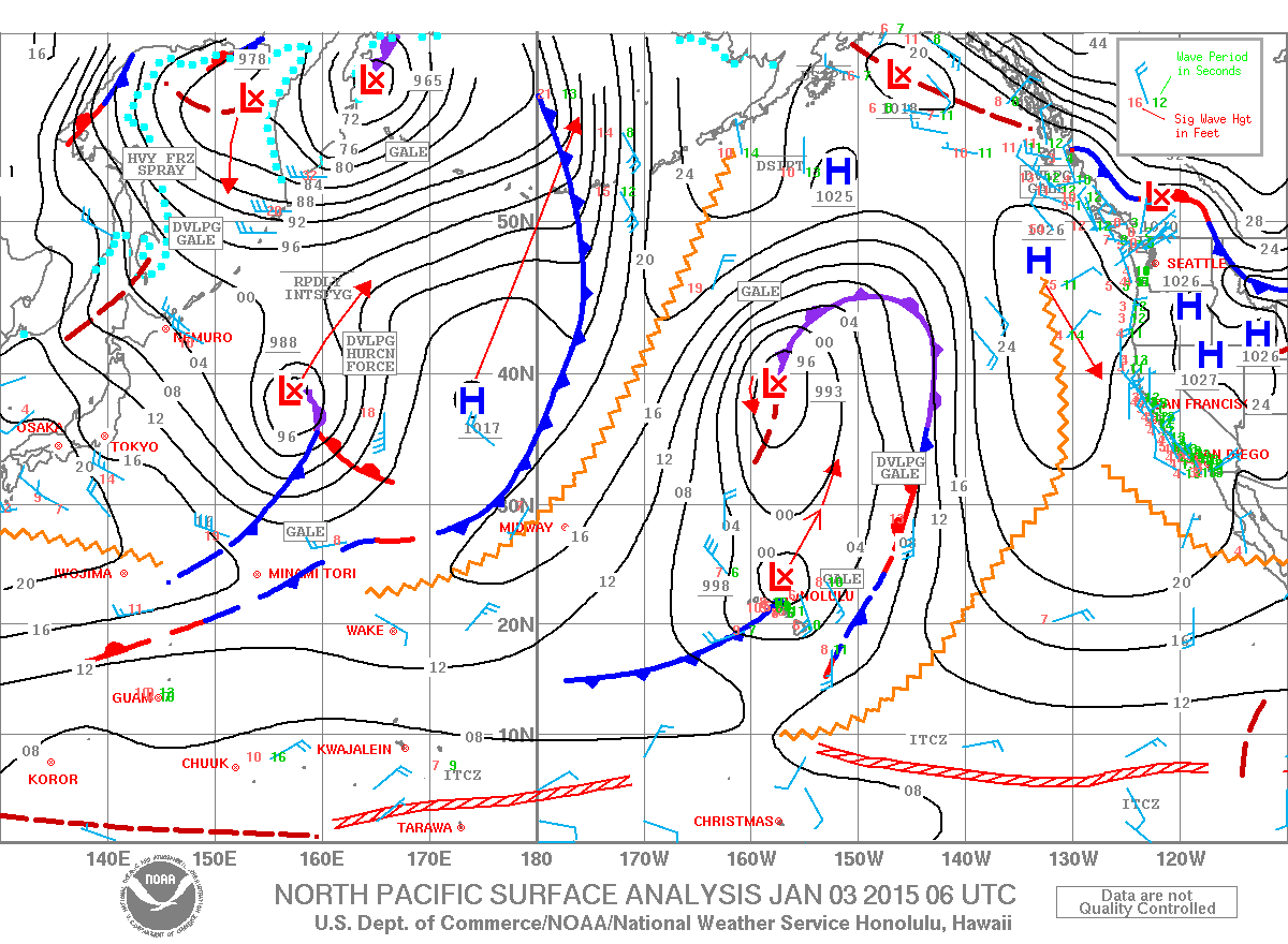
Image: NOAA / NWS
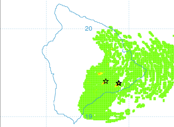
Image: UHSOEST
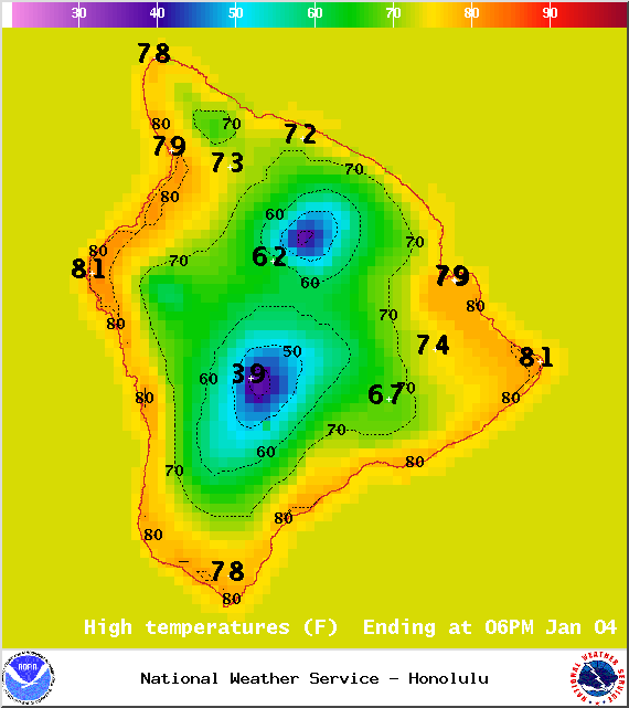
Image: NOAA / NWS
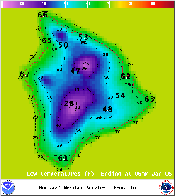
Image: NOAA / NWS
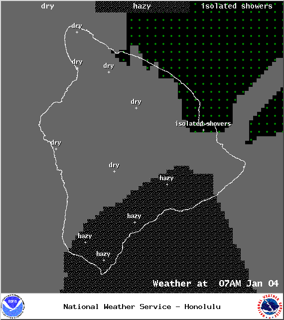
Image: NOAA / NWS

Image: NOAA / NWS
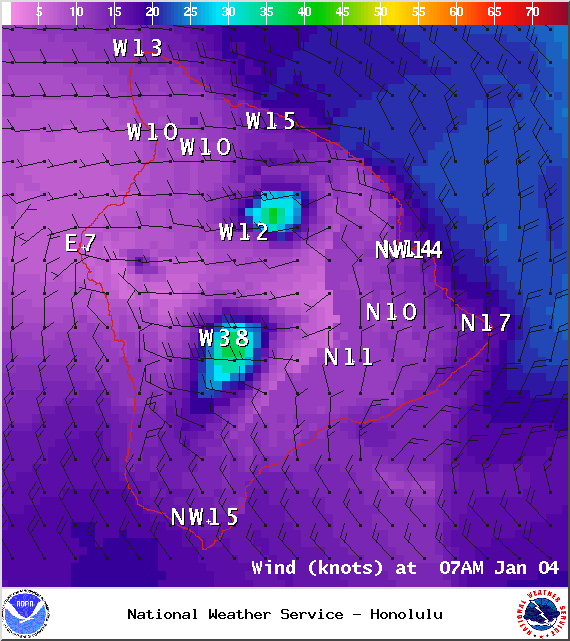
Image: NOAA / NWS
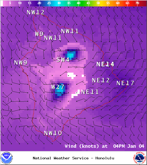
Image: NOAA / NWS
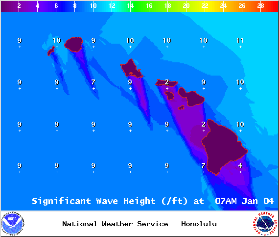
Image: NOAA / NWS
Sponsored Content


