

WEEKEND WEATHER: Partly Sunny With Isolated Showers
Alerts
A Wind Advisory is posted for the summits of Mauna Kea and Mauna Loa through 6:00 p.m. Sunday. North winds from 35 to 50 mph are expected with gusts over 60 mph.
**Weather charts for both Saturday and Sunday are below. Click directly on the images to make them larger. Charts include: Big Island high/low forecasted temperatures, projected winds, chance of cloud cover, projected localized weather conditions, vog/SO2 forecast and expected wave heights.**
Today, Saturday, December 27, 2014
Today, we expect mostly sunny skies in the morning with building clouds as the day goes on. Isolated showers are forecasted in the afternoon. Winds are variable from 5 to 15 mph. High temperatures should fall in the range of 77° to 82°.
Sunrise: 6:53 a.m.
Sunset: 5:50 p.m.
UV index at 6 (“high” exposure level)
Tonight
Clear skies are expected tonight on the Big Island with just isolated showers for windward spots. North winds are expected from 5 to 15 mph. Low temperatures from 66° to 71° degrees.
Moonrise: 11:34 a.m.
Moonset: 12:01 a.m. on Dec. 28
Next Full Moon: Jan. 4 at 6:54 p.m.
Next New Moon: Jan. 20 at 3:14 a.m.
Sunday, December 28, 2014
Winds are expected out of the northeast today from 5 to 20 mph. Isolated showers are expected for windward spots during the day with scattered showers at night. Highs from 77° to 82° and lows from 66° to 71°.
Sunrise: 6:53 a.m.
Sunset: 5:51 p.m.
UV index at 6 (“high” exposure level)
Looking Ahead
Light northerly winds and cool temperatures are expected through the weekend. Clouds and light showers will linger mainly over north through west slopes. More typical trade-wind conditions will return gradually by Sunday night and Monday. A weak front is forecasted to move southeast across the state from Tuesday into Wednesday (New Year’s Eve). A stronger front may bring heavier rainfall late in the week.
Almanac for Hilo Airport
Maximum Temperature for today:
Normal 79°
Record 87° / Set in 1996
Minimum Temperature for today:
Normal 64°
Record 60° / Set in 1960 and tied in 1998
**Click here for your detailed Big Island surf report.**
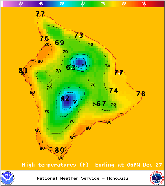
Image: NOAA / NWS
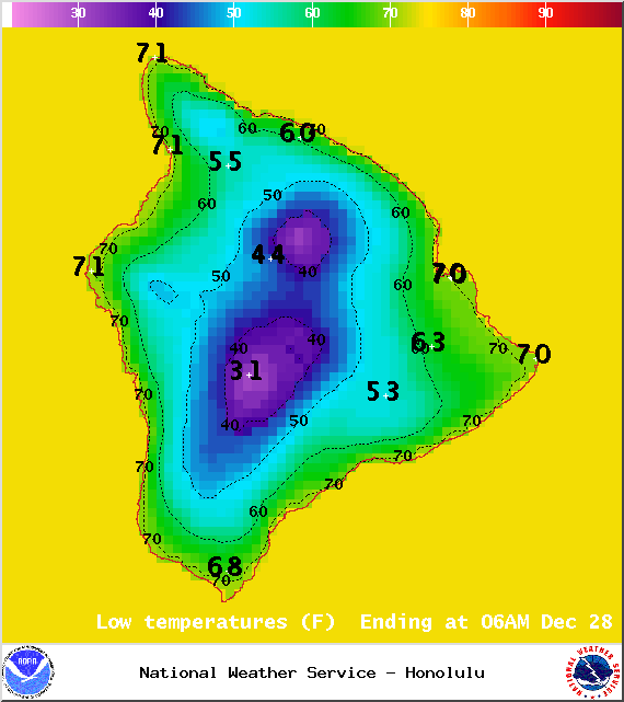
Image: NOAA / NWS
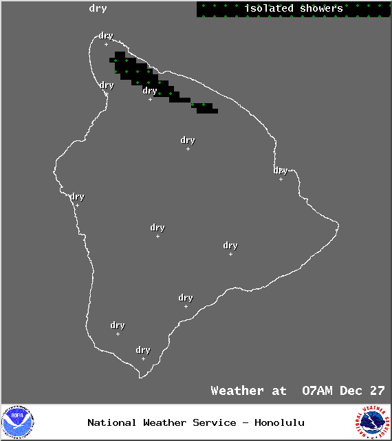
Image: NOAA / NWS
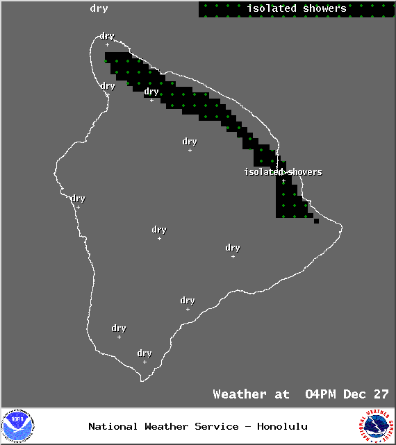
Image: NOAA / NWS
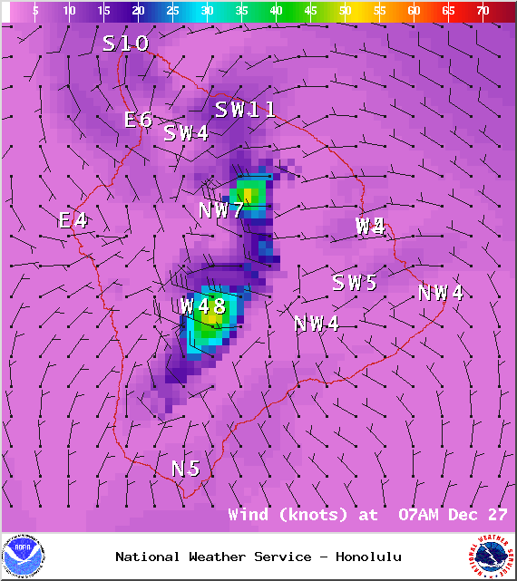
Image: NOAA / NWS
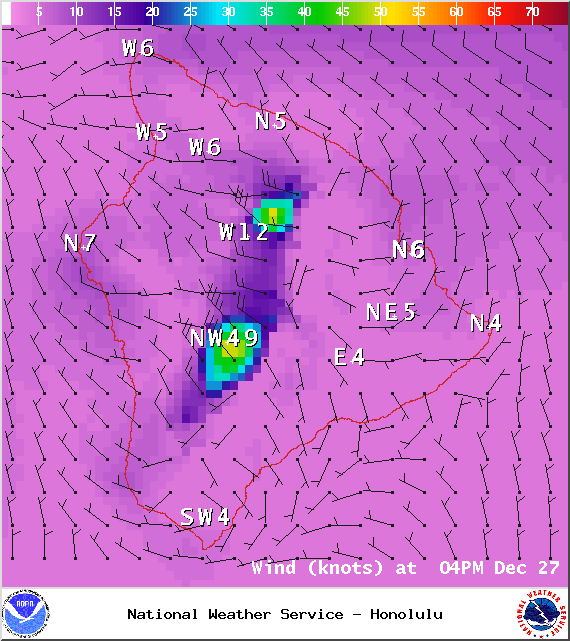
Image: NOAA / NWS
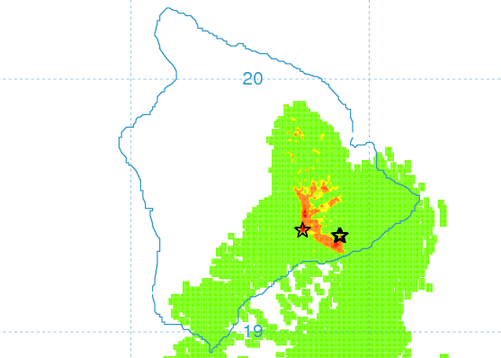
Saturday afternoon vog forecast / Image: UHSOEST
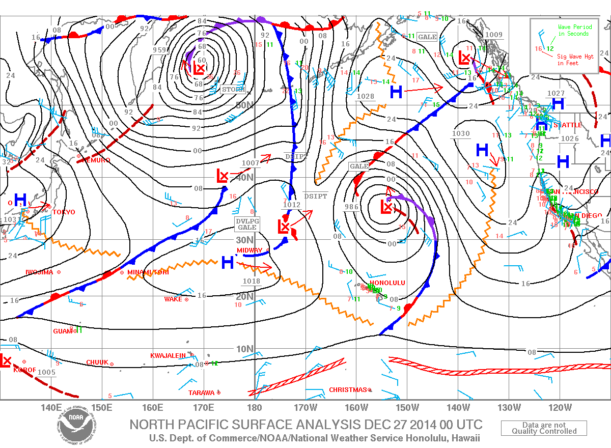
Image: NOAA / NWS
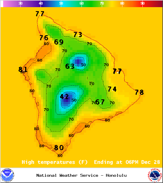
Image: NOAA / NWS
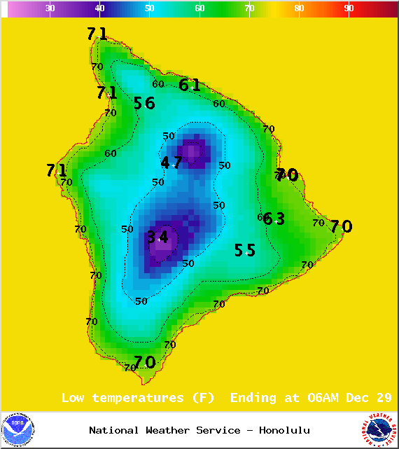
Image: NOAA / NWS
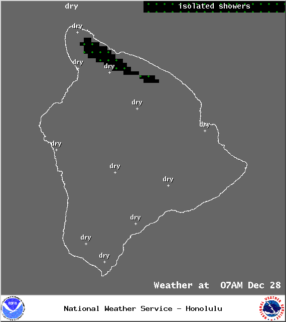
Image: NOAA / NWS
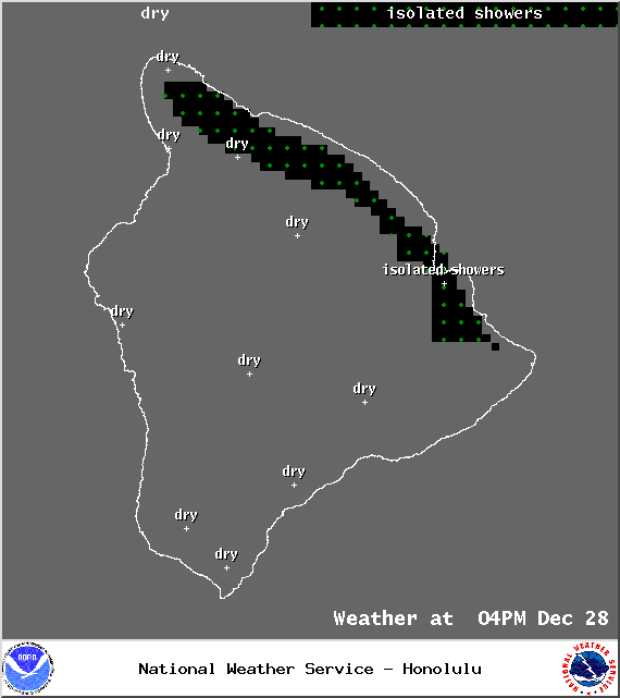
Image: NOAA / NWS
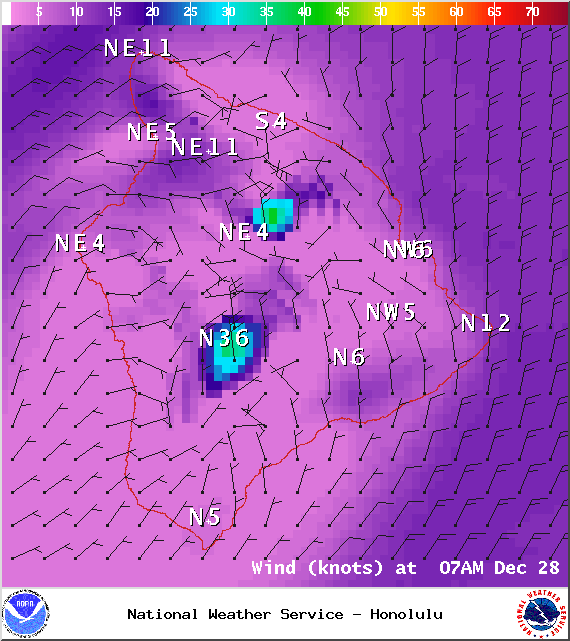
Image: NOAA / NWS
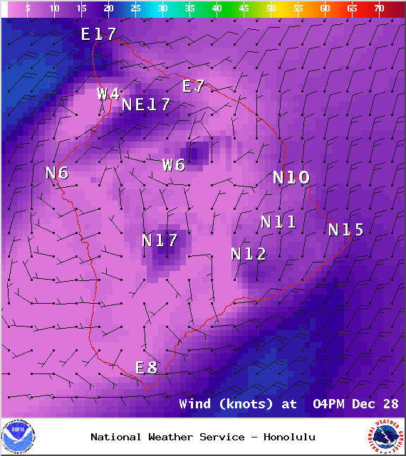
Image: NOAA / NWS
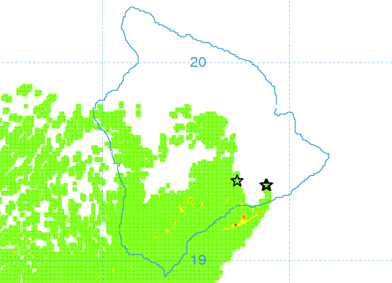
Sunday afternoon vog forecast / Image: UHSOEST
Sponsored Content


