

Some Vog, Lots of Sunshine on Christmas Day
Alerts
The Blizzard Warning for the summits of Mauna Kea and Mauna Loa has been replaced by a Wind Advisory until 6:00 p.m. this evening with 35 – 50 mph winds expected. Gusts could reach 60 mph. The summit road is closed.
The Small Craft Advisory has been extended for Big Island windward waters and the Alenuihaha channel through 6:00 p.m. Thursday. Winds of 15 to 20 knots are expected and rough seas from 6 to 12 feet.
**Click directly on the images below to make them larger. Charts include: Big Island high/low forecasted temperatures, projected winds, chance of cloud cover, projected localized weather conditions, vog/SO2 forecast and expected wave heights.**
Today, Thursday, December 25, 2014
Today, we expect mostly sunny skies with isolated showers for windward spots in the afternoon. Windy conditions are expected at our summits. Otherwise, winds are forecasted out of the west at 15 mph. The UHSOEST vog model shows voggy conditions for the Hilo side in the afternoon. High temperatures should fall in the range of 75° to 81°.
Sunrise: 6:52 a.m.
Sunset: 5:49 p.m.
UV index at 6 (“high” exposure level)
Tonight
Clear skies are expected tonight on the Big Island. West winds are expected around 15 mph. Low temperatures from 69° to 74° degrees.
Moonrise: 10:02 a.m.
Moonset: 10:02 p.m.
Next Full Moon: Jan. 4 at 6:54 p.m.
Next New Moon: Jan. 20 at 3:14 a.m.
Looking Ahead
The disturbance that has been creating the potential for severe weather is expected to slowly lift northeast and away from the Hawaiian islands over the next couple of days. Drier conditions are expected in its wake. Cool northerly winds are expected to shift out of the northeast and bring more typical trade wind weather starting late in the weekend. The wind forecast is iffy over the next couple of days as a weather situation is still developing. Look out for updates to the short term wind forecast as things begin to become more certain. Another cold front is forecasted for the middle of next week.
Almanac for Hilo Airport
Maximum Temperature for today:
Normal 79°
Record 87° / Set in 1980
Minimum Temperature for today:
Normal 65°
Record 58° / Set in 1955
**Click here for your detailed Big Island surf report.**
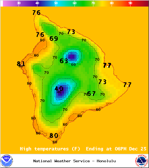
Image: NOAA/NWS
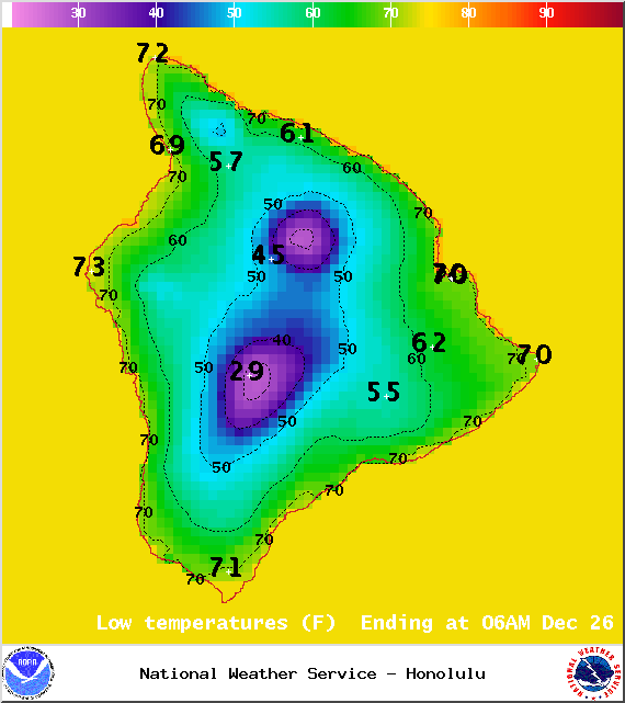
Image: NOAA/NWS
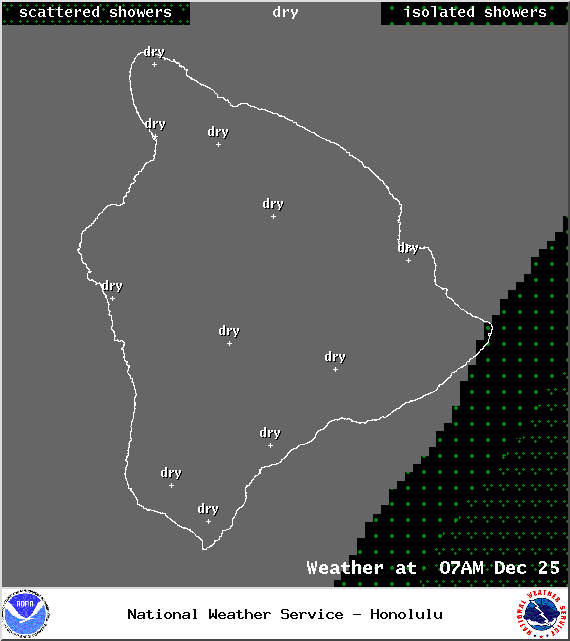
Image: NOAA/NWS
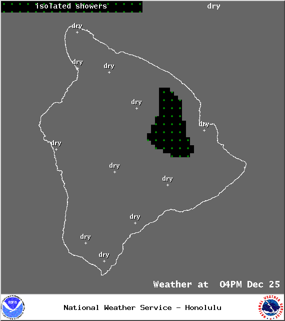
Image: NOAA/NWS
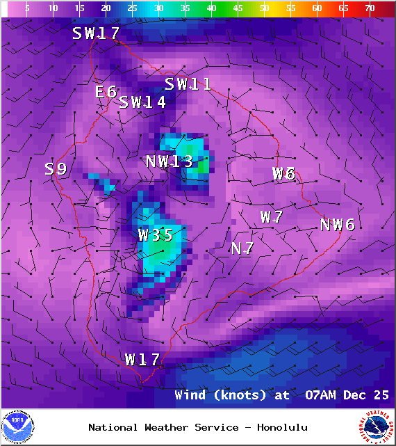
Image: NOAA/NWS

Image: NOAA/NWS
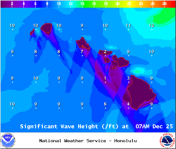
Image: NOAA/NWS
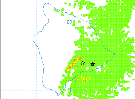
Image: UHSOEST
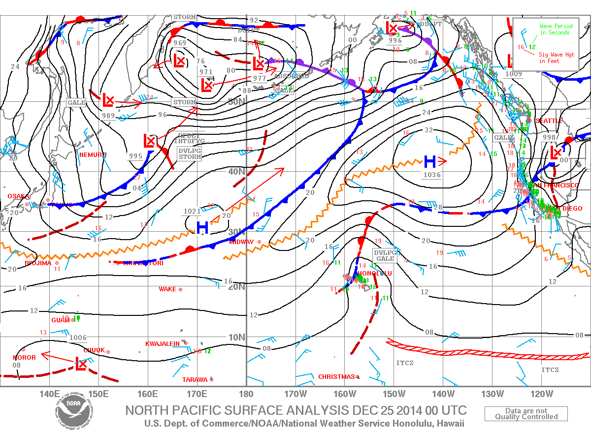
Image: NOAA/NWS
Sponsored Content


