

WNW Slightly Smaller, Messy Conditions
Alerts
Throughout the current weather event, all weather alerts will be posted HERE.
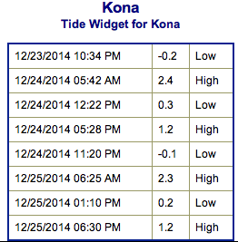
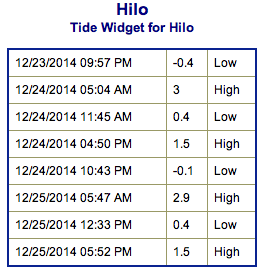
**Click directly on the images below to make them larger. Charts include: Big Island projected winds, tides, swell direction & period and expected wave heights.**
 Big Island Surf Forecast, Wednesday, December 24
Hilo side: Surf heights are expected from chest to head high or overhead at the best breaks along the Hamakua coast. Northerly winds will make conditions messy.
Kona side: West-northwest continues to fade but holds good size early in the day at about chest to head high or more at the best breaks.
South: Surf is waist high or less.
 Our current west-northwest swell is slightly smaller Wednesday. Still showing best for the Kona side where the conditions will also be better. Surf continues to fade today and becomes messy as a front moves through. The Hamakua coast will not see much wrap but instead experiences swell out of the north-northeast created by the frontal passage.
Another shot of surf energy out of the north-northwest is forecasted to combine with northeast wind swell on Christmas Day. A new northwest is forecasted for the weekend as well.
Super small trace amounts of swell expected out of the SPAC. Not much to get excited about.
Keep in mind, surf heights are measured on the face of the wave from trough to crest. Heights vary from beach to beach, and at the same beach, from break to break.
**Click here for your detailed Big Island weather report.**
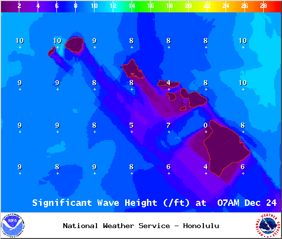
Image: NOAA / NWS
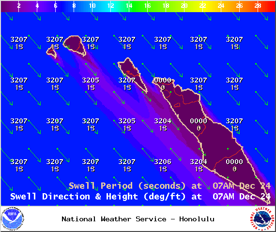
Image: NOAA / NWS
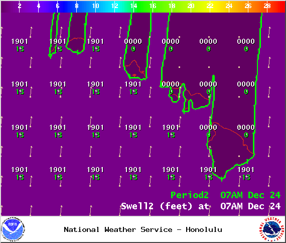
Image: NOAA / NWS
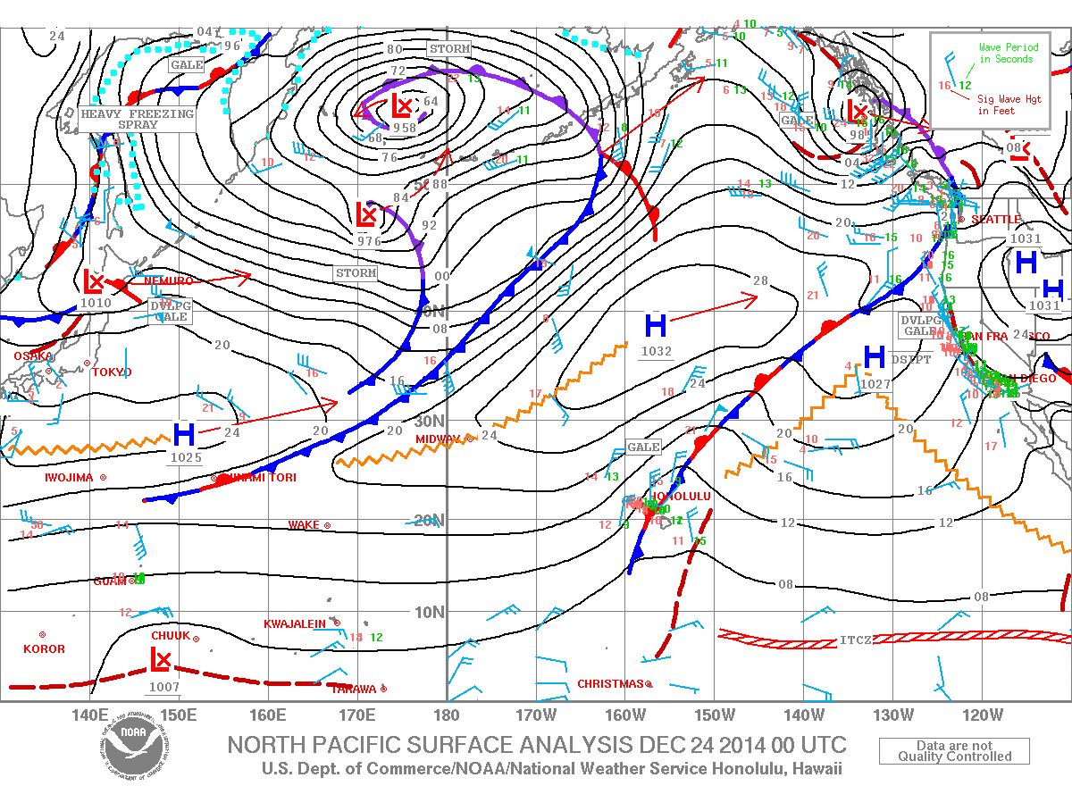
Image: NOAA / NWS
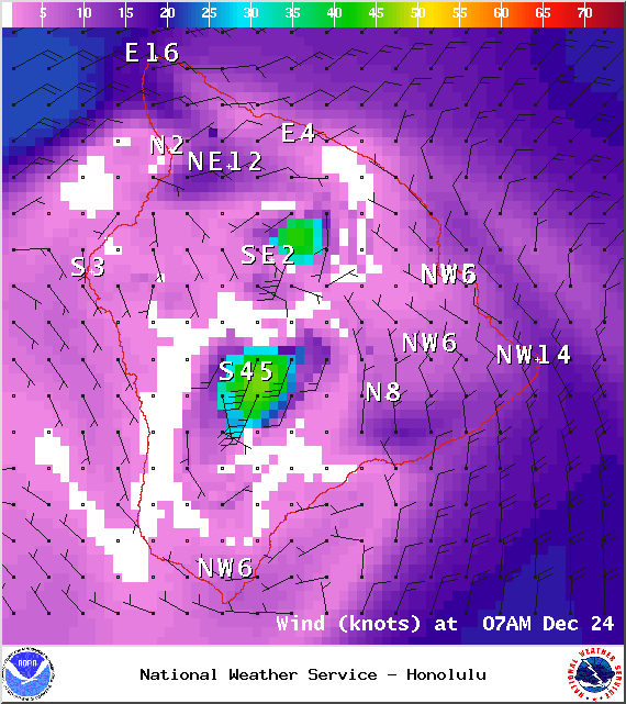
Image: NOAA / NWS
Image: NOAA / NWS
Sponsored Content


