

Gusty Winds, Snow, Possible Thunderstorms Today
Alerts
Throughout the current weather event, all weather alerts will be posted HERE.
**Click directly on the images below to make them larger. Charts include: Big Island high/low forecasted temperatures, projected winds, chance of cloud cover, projected localized weather conditions, vog/SO2 forecast and expected wave heights.**
Today, Wednesday, December 24, 2014
Today, we expect mostly cloudy skies with showers likely and a slight chance of thunderstorms. Locally heavy rainfall is also possible. High temperatures should fall in the range of 75° to 80° with north to northeast winds from 15 to 20 mph. If thunderstorms develop they will be accompanied by gusty winds.
Sunrise: 6:52 a.m.
Sunset: 5:48 p.m.
UV index at 5 (“moderate” exposure level)
Tonight
Partly to mostly cloudy skies are expected tonight for the Big Island with a slight chance of thunderstorms and isolated showers. Heavy rain is possible. Winds will be gusty out of the west around 15 to 30 mph with gusts to 50 mph. Low temperatures from 69° to 74° degrees.
Moonrise: 9:12 a.m.
Moonset: 9:01 p.m.
Next Full Moon: Jan. 4 at 6:54 p.m.
Next New Moon: Jan. 20 at 3:14 a.m.
Looking Ahead
Unstable conditions will continue into Wednesday as a cutoff low high in the atmosphere develops near the islands. The threat for heavy flooding rainfall exists through Wednesday. We are not sure if all of the ingredients will be present for severe weather. The amount of moisture available to fuel unstable weather is not certain. It’s snowing on the summits of Mauna Kea and Mauna Loa but high winds have yet to materialize. Models are forecasting strengthening tomorrow but are also indicating a decrease in chance of snow. The Blizzard Warning may be dropped and replaced with a High Wind Warning for the summits. The disturbance is expected to slowly lift off to the northeast Christmas eve and day, leading to a drier northwest flow at the surface. Friday another disturbance is expected, its effects are not certain at this time. Moderate northerly winds will shift to a typical trade wind direction during the weekend.
Almanac for Hilo Airport
Maximum Temperature for today:
Normal 79°
Record 87° / Set in 1980
Minimum Temperature for today:
Normal 65°
Record 56° / Set in 1978
**Click here for your detailed Big Island surf report.**
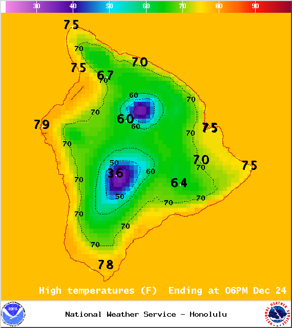
Image: NOAA / NWS
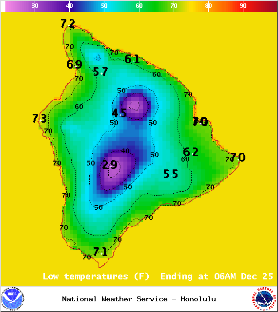
Image: NOAA / NWS
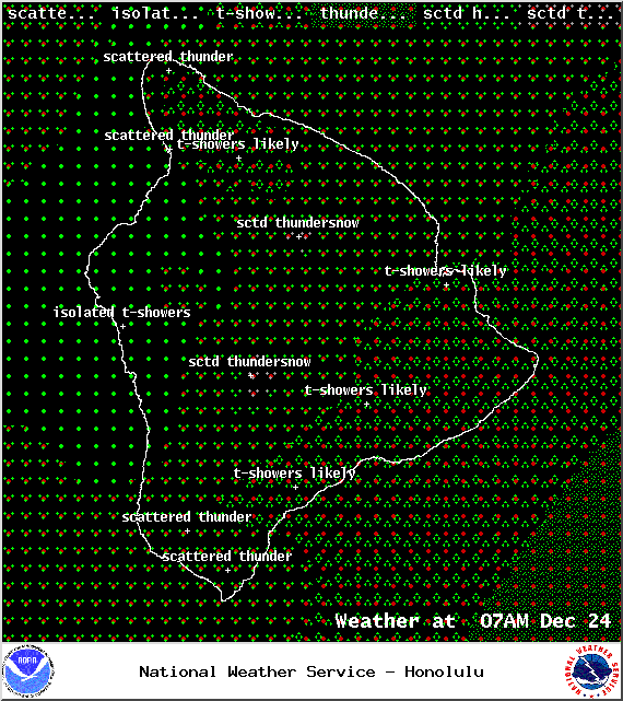
Image: NOAA / NWS
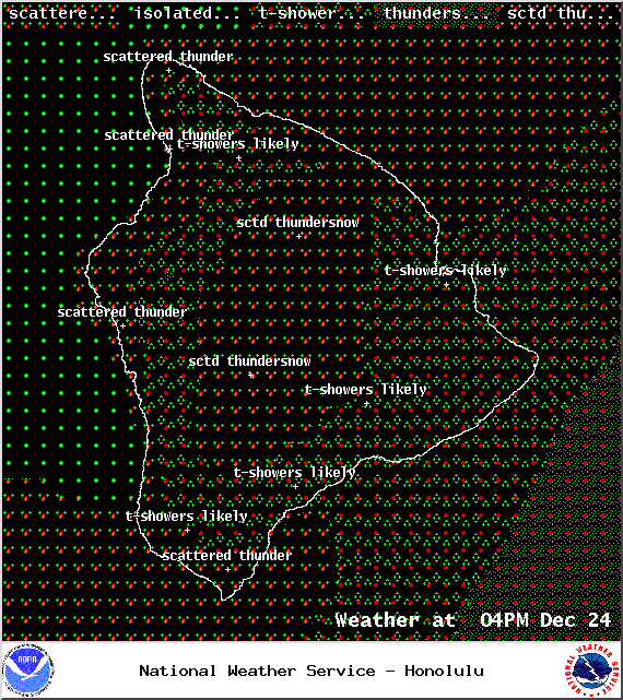
Image: NOAA / NWS
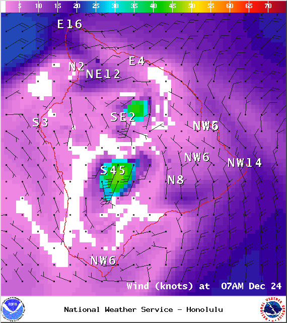
Image: NOAA / NWS
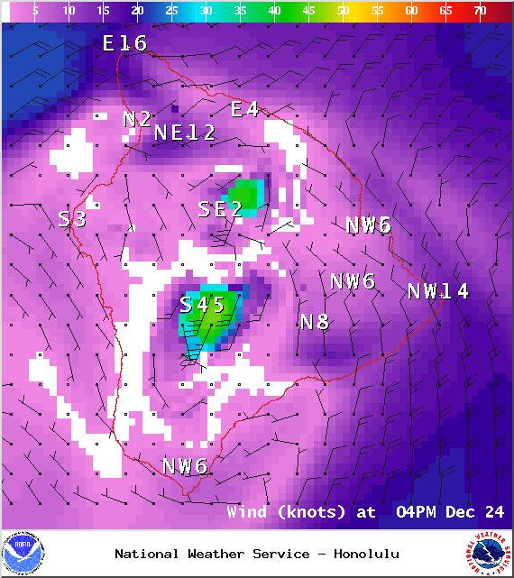
Image: NOAA / NWS
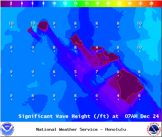
Image: NOAA / NWS
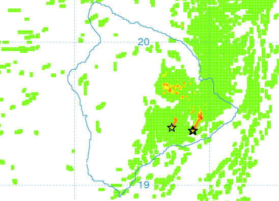
Image: UHSOEST
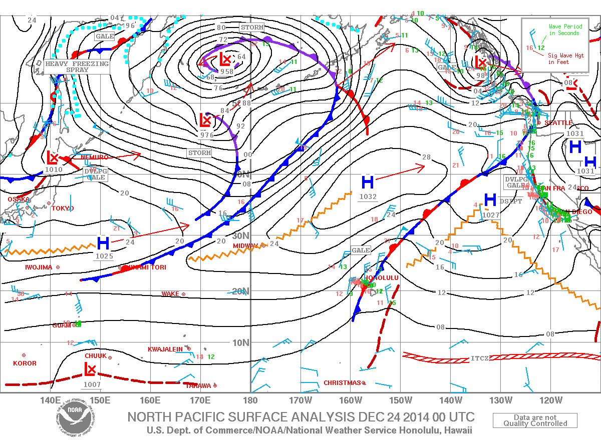
Image: NOAA / NWS
Sponsored Content


