

NW Fades Today, Warning Level Surf Sunday
A High Surf Warning is in effect for the Kona side of the Big Island from 10:00 a.m. this morning through 6:00 a.m. Tuesday for a large west-northwest swell. Warning level surf is expected by late Sunday with wave heights building up to 8 to 12 foot faces by sundown. Early in the day (advisory level) 6 to 10 foot faces are expected.
A High Surf Advisory is in effect for the Hamakua Coast through 6:00 p.m. today for a short period southeast trade swell bringing 6 to 10 foot faces today.
A Small Craft Advisory is in effect for all Big Island waters from 4:00 a.m. Sunday through 6:00 a.m. Tuesday as well.
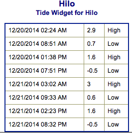
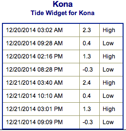
**Click directly on the images below to make them larger. Charts include: Big Island projected winds, tides, swell direction & period and expected wave heights.**
 Big Island Surf Forecast, Sunday – December 21 (Updated at 9:30 a.m. on 12/21/14)
Hilo side: Surf heights are expected from thigh to about chest high at the best breaks along the Hamakua coast. The west-northwest is heavily blocked from the windward side.
Kona side: South-southwest swell peaks at waist to shoulder high. The best breaks may see slightly bigger waves on the sets. By sundown we expect to see some of the west-northwest filling in and it will build quickly overnight.
South: Swell peaks with thigh to shoulder high waves at the best exposures. Some trade swell is also expected for the southeast coastlines in the same wave height range.
A short period southeasterly trade swell will bring advisory level surf to the Hamakua coast.
A west-northwest swell is expected late Sunday and Monday peaking overnight / early Monday morning. This swell is expected to show best for the Kona side at warning levels. The Hamakua coast will still see some wrap, but minimal. Mid-week another solid shot of energy out of the northwest is forecasted to build in as well.
An out of season boost will peak today with about waist to chest high waves with some plusses on the sets at the best exposures. Otherwise, nothing significant is expected out of the SPAC.
Keep in mind, surf heights are measured on the face of the wave from trough to crest. Heights vary from beach to beach, and at the same beach, from break to break.
**Click here for your detailed Big Island weather report.**
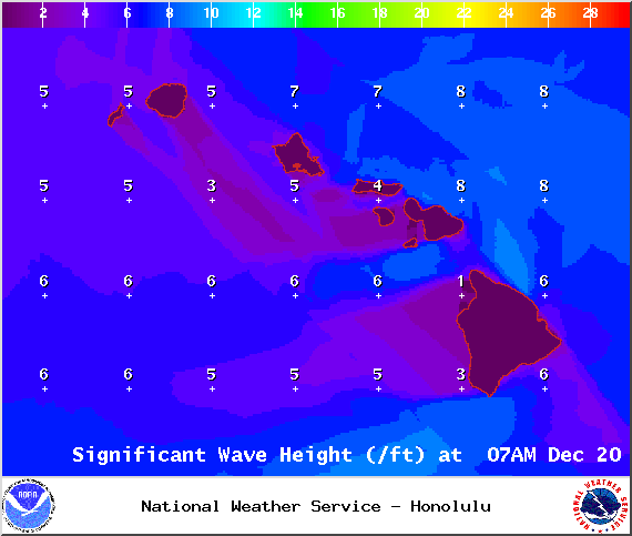
Image: NOAA / NWS
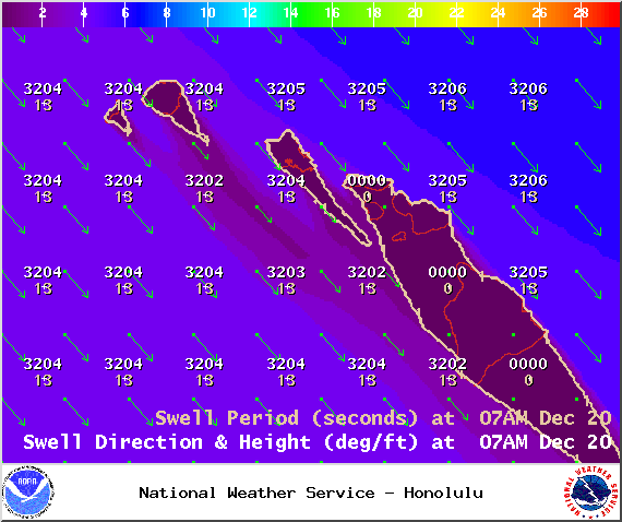
Image: NOAA / NWS

Image: NOAA / NWS
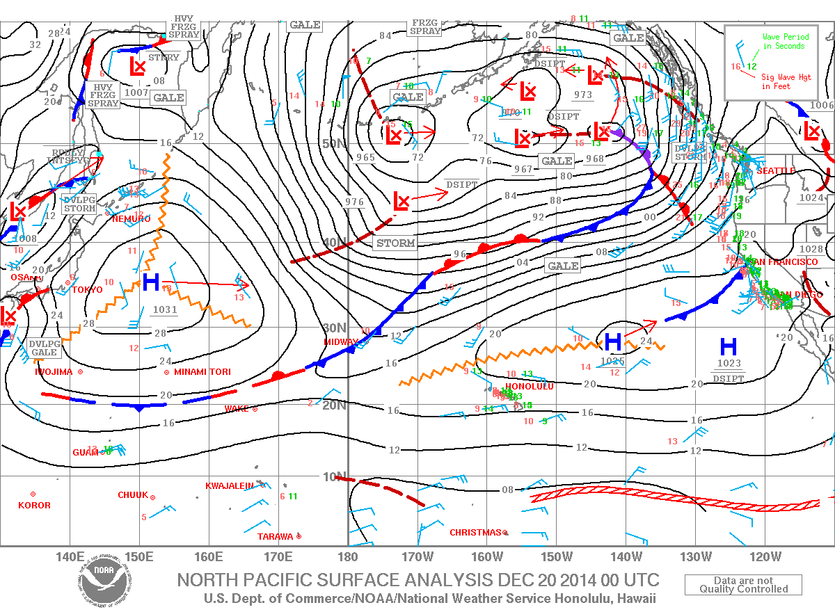
Image: NOAA / NWS
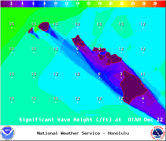
Image: NOAA / NWS
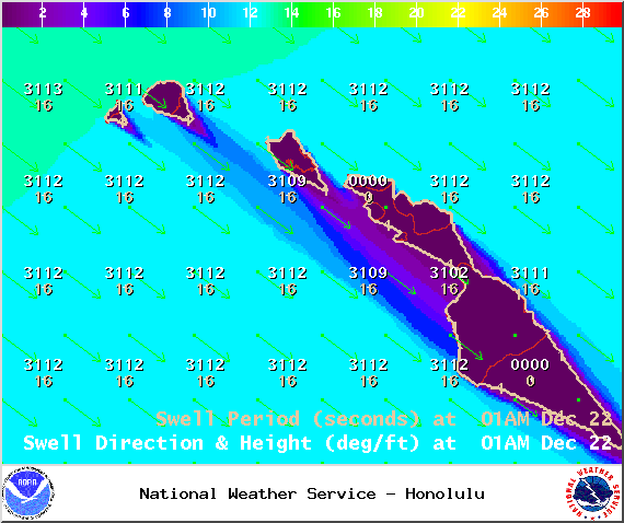
Image: NOAA / NWS

Image: NOAA / NWS
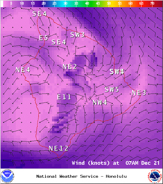
Image: NOAA / NWS
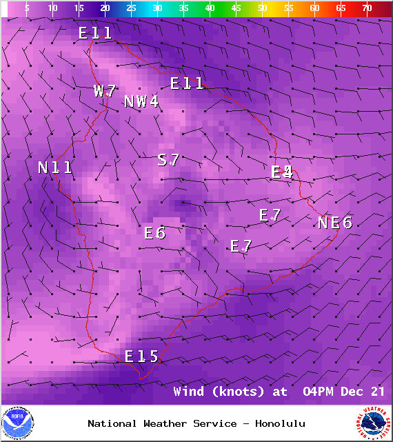
Image: NOAA / NWS
Sponsored Content


