

Trade Wind Weather Today, Cold Front Ahead
Alerts
A Small Craft Advisory is posted through 6 p.m. Friday for all Big Island waters. Rough seas up to 15 feet and winds of 15 to 25 knots. Inexperienced mariners should avoid navigating in these conditions.
**Click directly on the images below to make them larger. Charts include: Big Island high/low forecasted temperatures, projected winds, chance of cloud cover, projected localized weather conditions, vog/SO2 forecast and expected wave heights.**
Today, Friday, December 19, 2014
Today, we expect partly cloudy skies and windward and mauka showers in the morning. The Kona side is forecasted to get mostly clear skies in the morning but as the sea breeze develops due to daytime heating some clouds could move in through the afternoon and evening. Winds are breezy and out of the east from 15 to 20 mph. High temperatures should fall in the range of 79° to 84° and around 69° at 5000 feet.
Sunrise: 6:49 a.m.
Sunset: 5:46 p.m.
UV index at 6 (“high” exposure level)
Tonight
Partly to mostly cloudy skies and breezy conditions are expected tonight for the Big Island. Scattered windward and mauka showers are forecasted. Winds will be around 15 to 20mph. Low temperatures from 67° to 72° degrees.
Moonset: 4:04 p.m.
Moonrise: 5:27 a.m. on Dec 20
Next New Moon: Dec. 21 at 3:36 p.m.
Next Full Moon: Jan. 4 at 6:54 p.m.
The peak nights for the Geminid Meteor Shower have passed but the shower is still active until December 19. Details on timing and viewing tips can be found HERE.
Looking Ahead
Trade winds will push showers into our usual windward and mauka areas and some of that moisture may pass leeward from time to time. Over the weekend, winds are expected to shift and become light as our “natural air conditioner” – high pressure – moves away from the islands and a cold front approaches. The cold front is expected to spread rain, cold air and strong northerly winds across the state from Kauai down to the Big Island starting Sunday night. The rainy conditions are expected to linger into Tuesday. Conditions will gradually return to typical trade wind weather.
Almanac for Hilo Airport
Maximum Temperature for today:
Normal 79°
Record 85° / Set in 1979
Minimum Temperature for today:
Normal 65°
Record 57° / Set in 1969
**Click here for your detailed Big Island surf report.**
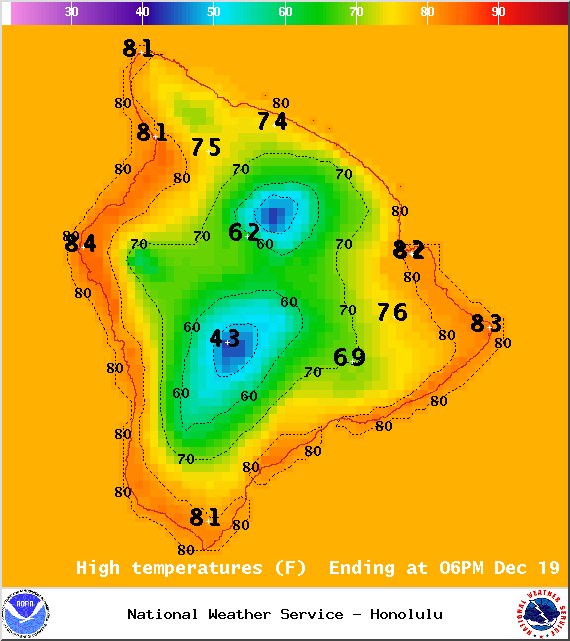
Image: NOAA / NWS
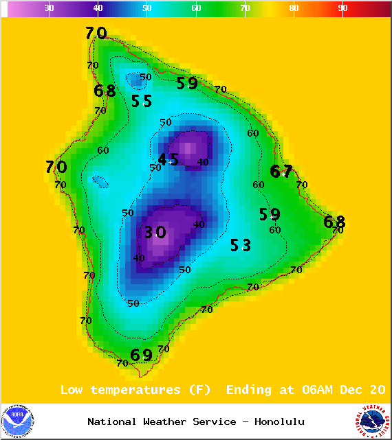
Image: NOAA / NWS
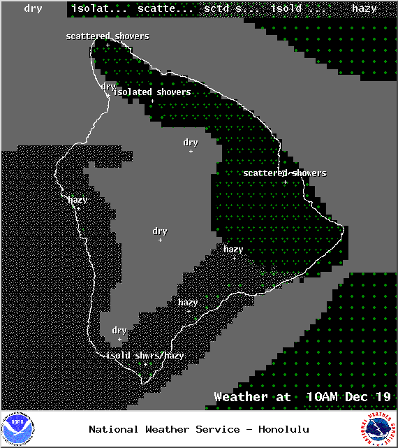
Image: NOAA / NWS
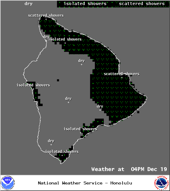
Image: NOAA / NWS
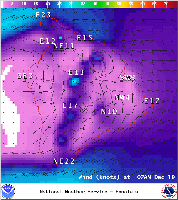
Image: NOAA / NWS
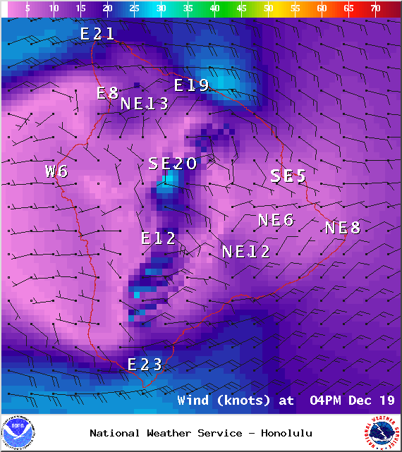
Image: NOAA / NWS
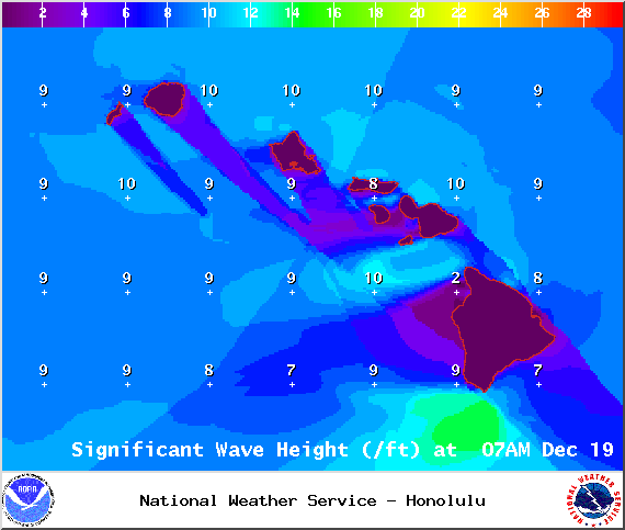
Image: NOAA / NWS
Image: UHSOEST

Image: NOAA / NWS
Sponsored Content


