

Choppy Today, New Swell Builds Overnight
Alerts
A Small Craft Advisory is posted through 6 p.m. Friday for the Alenuihaha channel and Big Island southeast and leeward waters. Rough seas up to 15 feet and winds of 25 to 30 knots. Inexperienced mariners should avoid navigating in these conditions.
**Click directly on the images below to make them larger. Charts include: Big Island projected winds, tides, swell direction & period and expected wave heights.**
 Big Island Surf Forecast, Thursday, December 18
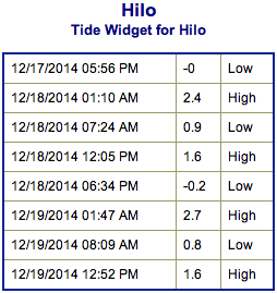
Hilo side: Mix of trade wind swell still holding on leftovers of the northwest. Waist to head high surf expected for the best breaks. Choppy and sloppy conditions are forecasted.
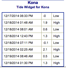
Kona side: Surf is expected ankle to knee high. The best breaks may see waist high waves on the sets.
South: Mix of trade swell and very small fading south-southwest will bring wave heights up to waist high, maybe bigger at the best exposed breaks to the tradeswell. Sloppy and choppy conditions are expected.
 Trade swell will be in the mix for the Hamakua, Puna and Ka’u coastlines through Friday before winds die down and shift out of a more southerly direction over the weekend.
Our current small heavily shadowed northwest swell will continue to fade Thursday.
A new west-northwest is expected to fill in Thursday evening and peak on Friday morning head high to overhead on the sets at the best breaks. The Kona side could see some wrap but it won’t be very notable – maybe knee to waist high.
Another west-northwest swell is expected late Sunday and Monday. This swell is expected to show best for the Kona side, but the Hamakua coast will still see some wrap. Mid-week another shot of energy out of the northwest is forecasted to build in as well.
An out of season south swell that brought a fun little boost the last couple of days will linger but continues to slowly fade through the work week. Another small boost is due in Saturday bringing waist to chest high waves in the afternoon. Otherwise, nothing significant is expected out of the SPAC.
Keep in mind, surf heights are measured on the face of the wave from trough to crest. Heights vary from beach to beach, and at the same beach, from break to break.
**Click here for your detailed Big Island weather report.**

Image: NOAA / NWS
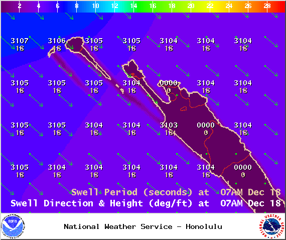
Image: NOAA / NWS
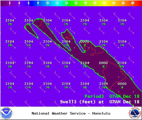
Image: NOAA / NWS
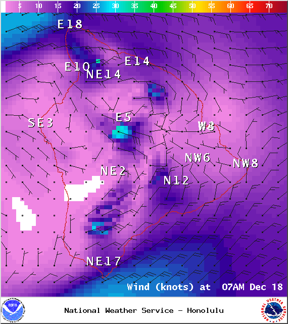
Image: NOAA / NWS
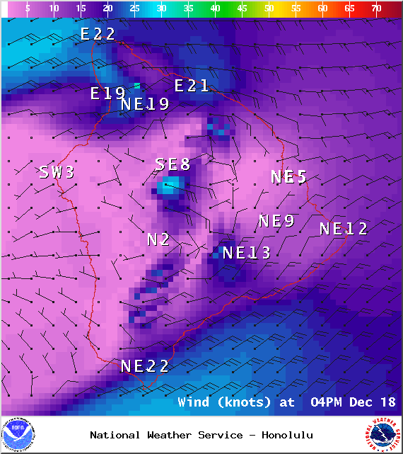
Image: NOAA / NWS
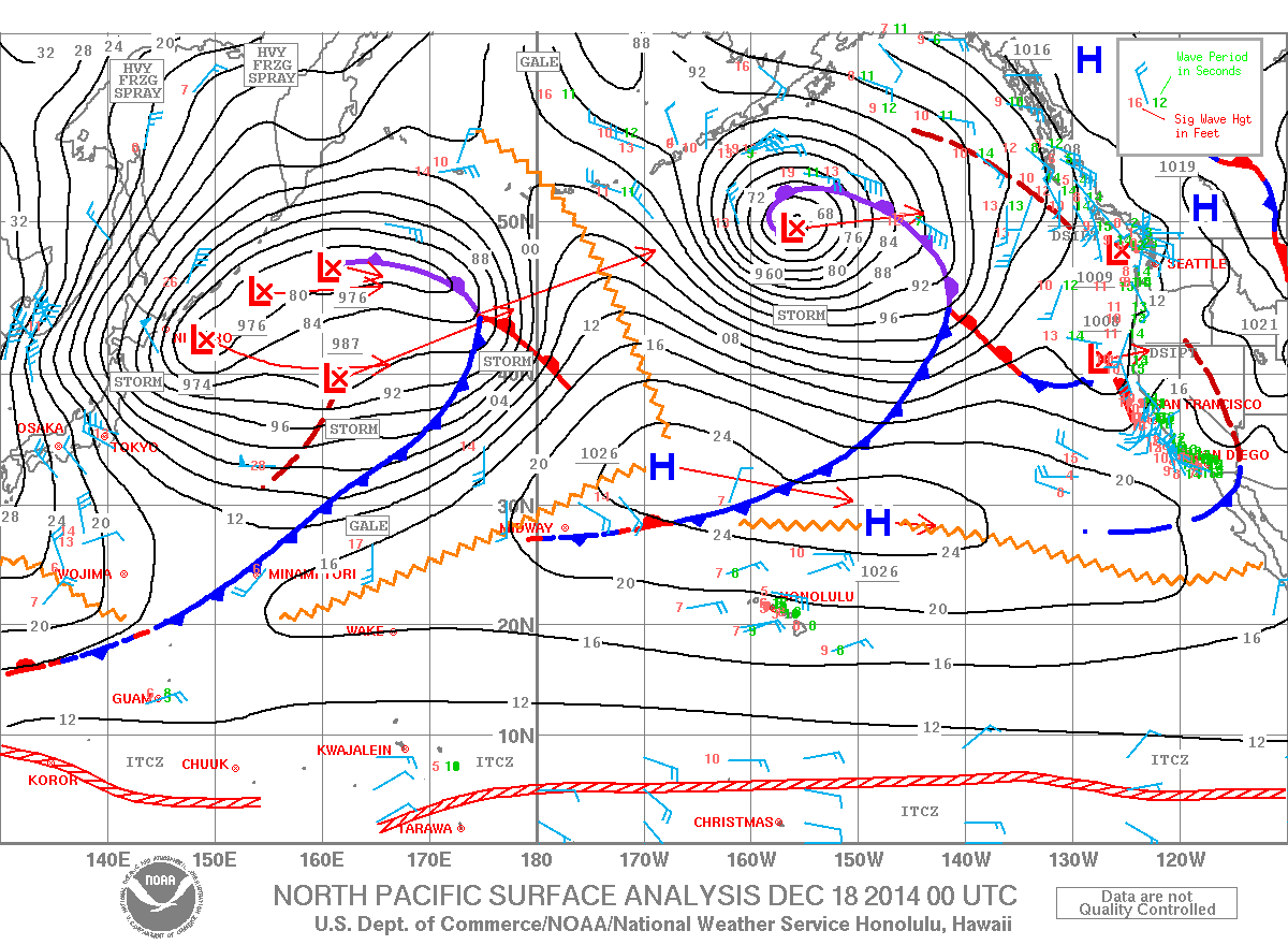
Image: NOAA / NWS
Sponsored Content


