

Breezy Winds Become Light for the Weekend
Alerts
A Small Craft Advisory is posted through 6 p.m. Friday for the Alenuihaha channel and Big Island southeast and leeward waters. Rough seas up to 15 feet and winds of 25 to 30 knots. Inexperienced mariners should avoid navigating in these conditions.
**Click directly on the images below to make them larger. Charts include: Big Island high/low forecasted temperatures, projected winds, chance of cloud cover, projected localized weather conditions, vog/SO2 forecast and expected wave heights.**
Today, Thursday, December 18, 2014
Today is expected to be mostly cloudy for windward and mauka areas with scattered showers mainly in the morning. Some afternoon clearing is forecasted. For the Kona side mostly clear skies are forecasted in the morning before mostly cloudy skies build in the afternoon possibly bringing isolated showers. Winds are out of the northeast from 15 to 25 mph gusting to 35 mph. The UHSOEST vog model is forecasting areas of afternoon vog mainly for the Kona side and down south, the morning looks clear for most spots. High temperatures should fall in the range of 79° to 84° and around 69° at 5000 feet.
Sunrise: 6:49 a.m.
Sunset: 5:45 p.m.
UV index at 6 (“high” exposure level)
Tonight
Mostly cloudy skies and breezy conditions are expected tonight for the Big Island. Scattered windward and mauka showers are forecasted. Winds will be around 15 to 25mph with higher gusts. Low temperatures from 67° to 72° degrees.
Moonset: 3:15 p.m.
Moonrise: 4:29 a.m. on Dec 19
Next New Moon: Dec. 21 at 3:36 p.m.
Next Full Moon: Jan. 4 at 6:54 p.m.
The peak nights for the Geminid Meteor Shower have passed but the shower is still active until December 19. Details on timing and viewing tips can be found HERE.
Looking Ahead
Breezy conditions are expected through the end of the work week. Trade winds will push showers into our usual windward and mauka areas and some of that moisture may pass leeward from time to time. Over the weekend, winds are expected to shift and become light as our “natural air conditioner” – high pressure – moves away from the islands and a cold front approaches. The cold front is expected to move down the island chain from Kauai to the Big Island from Sunday through Tuesday.
Almanac for Hilo Airport
Maximum Temperature for today:
Normal 79°
Record 86° / Set in 1972
Minimum Temperature for today:
Normal 65°
Record 57° / Set in 1975
**Click here for your detailed Big Island surf report.**
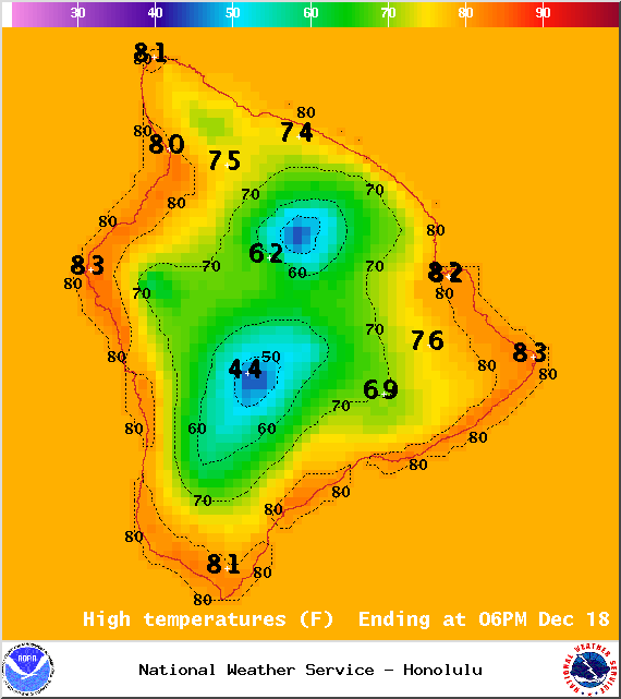
Image: NOAA / NWS
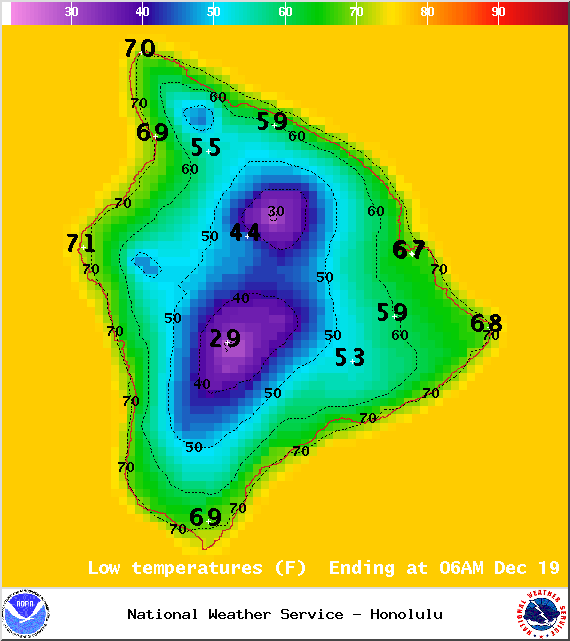
Image: NOAA / NWS
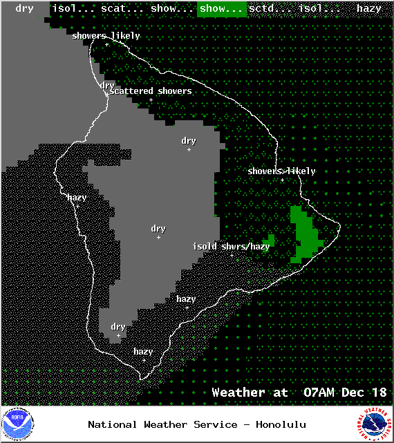
Image: NOAA / NWS
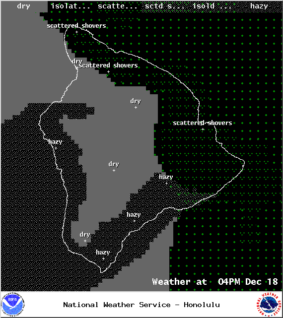
Image: NOAA / NWS
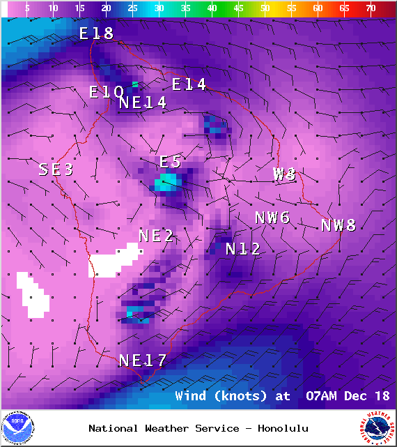
Image: NOAA / NWS
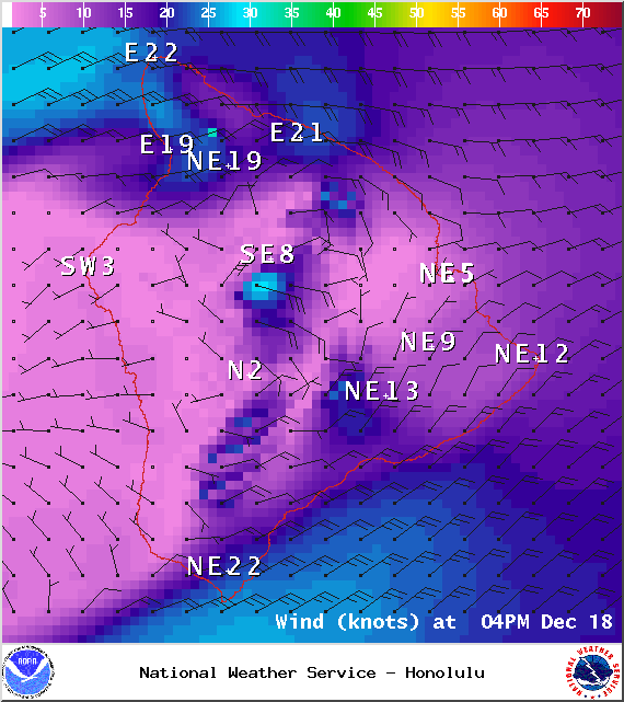
Image: NOAA / NWS

Image: NOAA / NWS
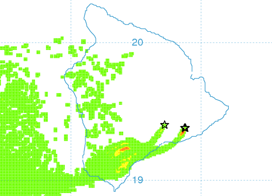
Image: UHSOEST
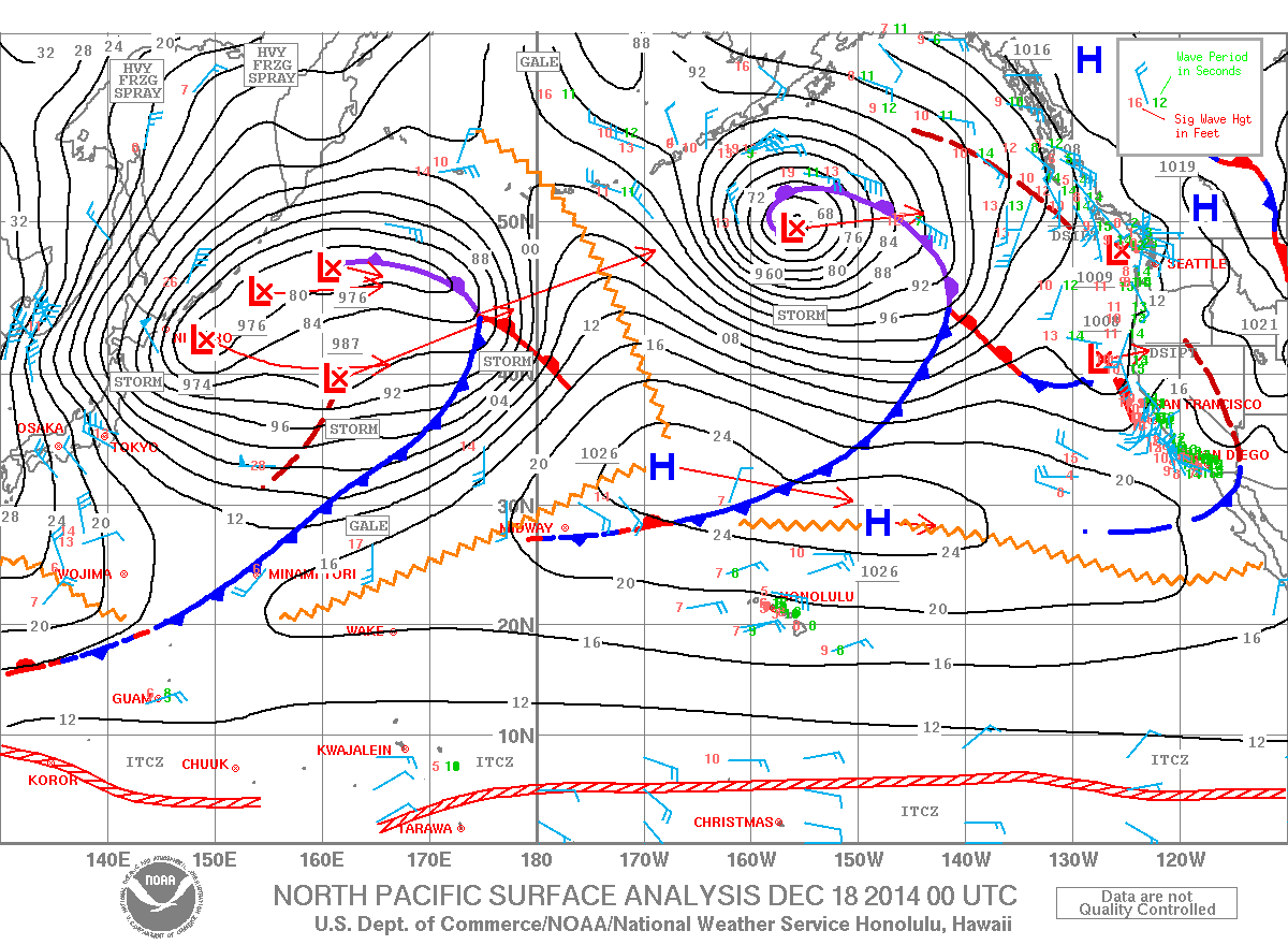
Image: NOAA / NWS
Sponsored Content


