

Large Swell Shifts More North, South Boost Today
Alerts
The National Weather Service has extended the Wind Advisory through Monday at 6 p.m. Northeast winds from 30 to 50 mph with gusts up to 70 mph are expected. The strongest winds on the Big Island are expected on the summits of Mauna Kea and Mauna Loa, in leeward Kohala, the Waimea to Kawaihae corridor and near South Point and Upolu Point. Winds this strong can bring down tree branches and make driving difficult.
A Gale Warning is in effect for Big Island leeward and south waters and the Alenuihaha channel through Monday at 6 p.m. Northeast winds of 30 to 35 knots are expected with higher gusts. Rough seas of 12 to 18 feet are also forecasted. A Gale Warning means that these winds are imminent or occurring. Operating a vessel in gale conditions requires proper experience and equipment. Mariners without these things should remain in port until gale conditions end.
All areas not under the Gale Watch are under a Small Craft Advisory through 6 p.m. Monday. Rough seas of 10 to 17 feet are forecasted along with winds of 30 to 35 knots or more. Inexperienced mariners should avoid navigating in these conditions.
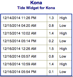
**Click directly on the images below to make them larger. Charts include: Big Island projected winds, tides, swell direction & period and expected wave heights.**
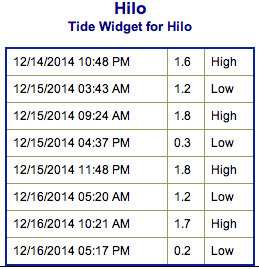 Big Island Surf Forecast, Monday, December 15
Hilo side: Choppy trade wind swell expected. Swell is shifting direction and becoming more north. This should bring wave heights a few feet overhead to possibly double overhead at the best exposures.
Kona side: Surf is expected chest to head high for the best exposures early in the day before the swell begins to shift out of a more northerly direction. Wave heights of waist to chest high are expected later in the day but some south will wrap into exposures as well.
South: An out of season south swell continues with waist to chest high waves expected for the best exposures. Some trade swell will trickle in to select spots as well at about head high but very choppy.
 Our current swell started out as a west-northwest and is shifting more north. The Kona side will get bigger waves early on as the swell continues to swing more north today. Tomorrow the swell will fade further but still at decent size for best exposures at a little overhead on the sets.
Another set of northwest swells are expected for the second half of next week with yet another large northwest swell due for next weekend. All dependent on how the storms actually end up developing. Will keep an eye on it.
An out of season south swell is expected to continue into Monday and Tuesday. We could see a fun little boost up to head high at the best breaks on Monday. This swell should linger into Wednesday. Another pulse out of the south is expected for the weekend.
Keep in mind, surf heights are measured on the face of the wave from trough to crest. Heights vary from beach to beach, and at the same beach, from break to break.
**Click here for your detailed Big Island weather report.**
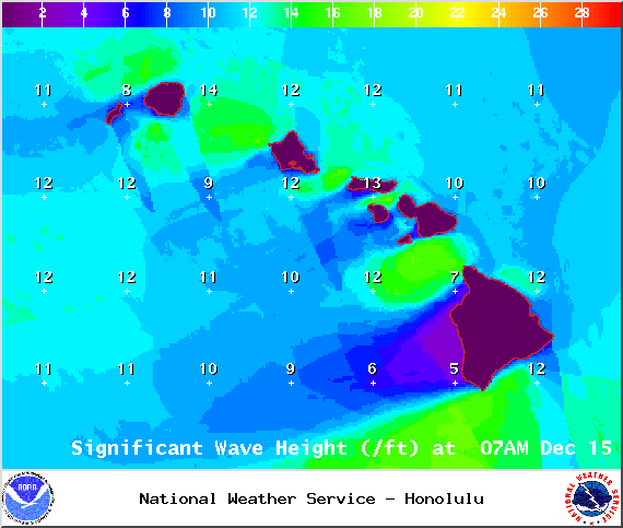
Image: NOAA / NWS
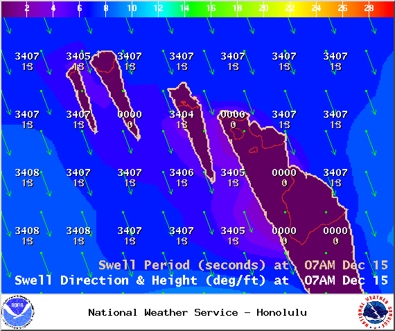
Image: NOAA / NWS
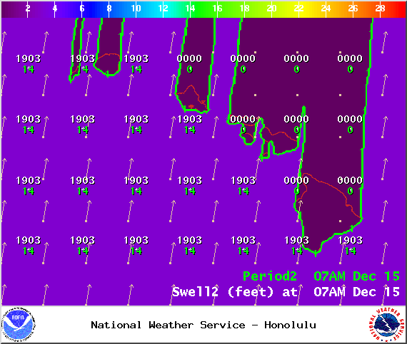
Image: NOAA / NWS
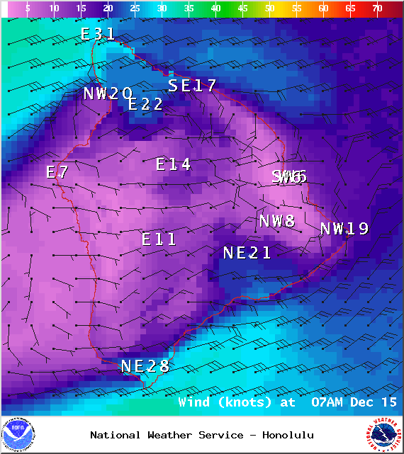
Image: NOAA / NWS
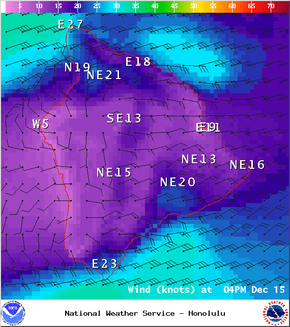
Image: NOAA / NWS
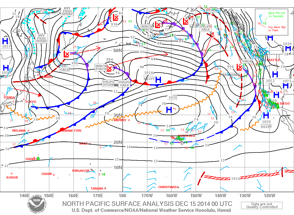
Image: NOAA / NWS
Sponsored Content


