

Weekend Weather Brings Lighter Winds
Alerts
There are no ocean alerts posted at this time.
**Weather charts for both Saturday and Sunday are presented below. Click directly on the images below to make them larger. Charts include: Big Island high/low forecasted temperatures, projected winds, chance of cloud cover, projected localized weather conditions, vog/SO2 forecast and expected wave heights.**
Today, Saturday December 6, 2014
Partly cloudy skies are expected today. Windward and mauka areas are forecasted to get scattered showers. The Kona side will have a mostly dry morning with afternoon clouds building and isolated showers. Areas of haze will linger on that side as well. Trade winds are expected around 15 mph. High temperatures should fall in the range of 80° to 85° and around 70° at 5000 feet.
Sunrise: 6:42 a.m.
Sunset: 5:41 p.m.
UV index at 6 (“high” exposure level)
Tonight
Mostly cloudy skies are expected in windward and mauka areas tonight with likely showers in the forecast. Leeward areas should be mostly cloudy becoming mostly clear as the land breeze kicks in and pushes our clouds out to sea. Winds are out of the northeast around 15 mph. Low temperatures are expected in the range of 68° to 73° with a low of about 50° at 5000 feet.
Moonrise: 6:20 p.m.
Moonset: 7:42 a.m. on Dec 7
Next New Moon: Dec. 21 at 3:36 p.m.
Next Full Moon: Jan. 4 at 6:54 p.m.
Almanac for Hilo Airport
Maximum Temperature for today:
Normal 80°
Record 91° / Set in 1977
Minimum Temperature for today:
Normal 66°
Record 60° / Set in 1962 and tied in 2010
Sunday, December 7, 2014
Partly cloudy skies are expected today with hazy conditions on the leeward side in the afternoon and isolated windward showers during the day, then scattered windward and mauka showers at night. Highs from 80 to 85 degrees with winds out of the northeast around 15 mph.
Sunrise: 6:42 a.m.
Sunset: 5:41 p.m.
UV index at 6 (“high” exposure level)
Looking Ahead
The trade winds will gradually weaken Saturday through Sunday, then winds become light and variable by early next week. This will allow for local land and sea breezes to develop from Sunday night through Tuesday. Afternoon interior and leeward showers are possible with the sea breezes, but rainfall accumulations should remain light. Wednesday a return to more typical trade wind weather is expected.
**Click here for your detailed Big Island surf report.**

Image: NOAA / NWS

Image: NOAA / NWS

Image: NOAA / NWS

Image: NOAA / NWS
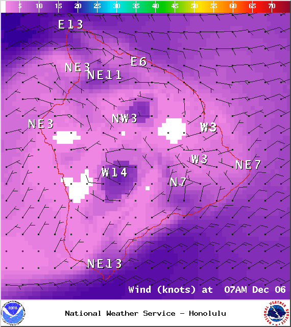
Image: NOAA / NWS
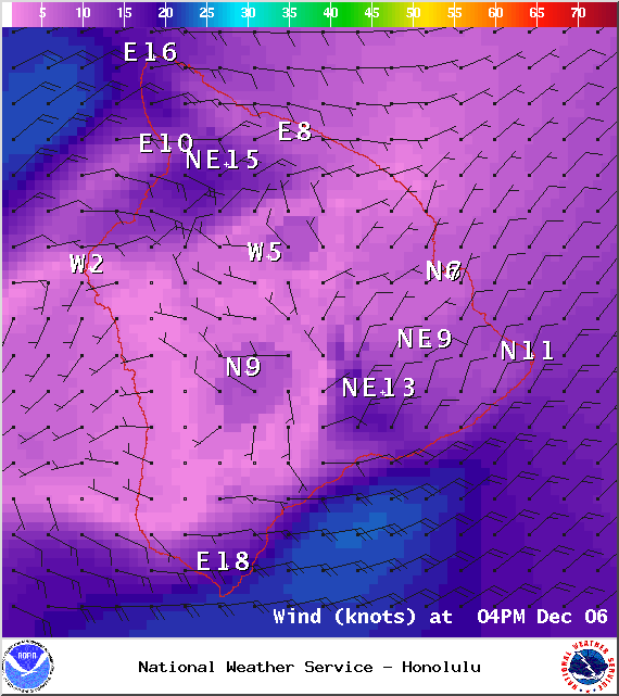
Image: NOAA / NWS
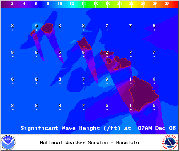
Image: NOAA / NWS

Saturday Vog Forecast – Image: UHSOEST
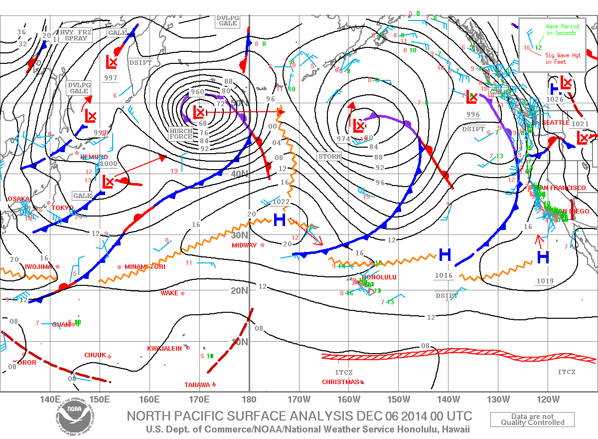
Image: NOAA / NWS

Image: NOAA / NWS

Image: NOAA / NWS

Image: NOAA / NWS

Image: NOAA / NWS
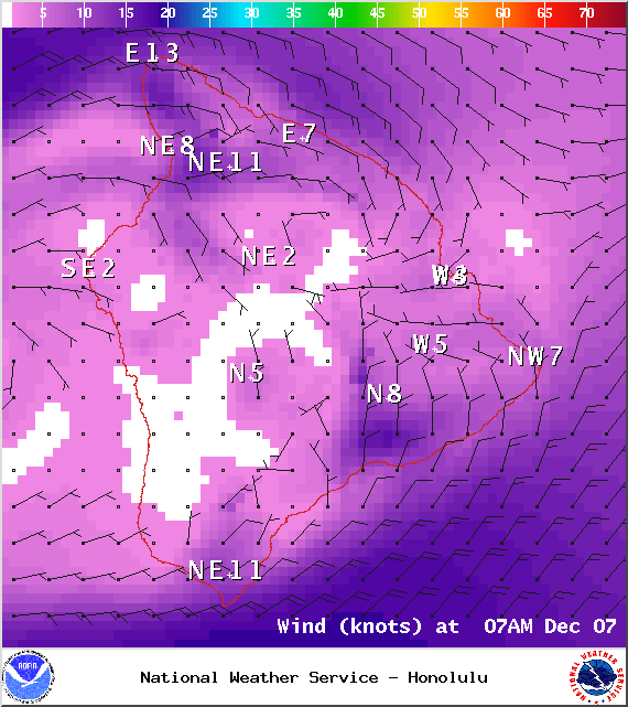
Image: NOAA / NWS
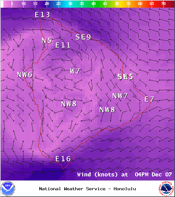
Image: NOAA / NWS
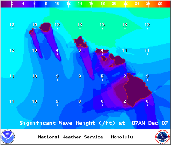
Image: NOAA / NWS

Sunday Vog Forecast – Image: UHSOEST
Sponsored Content


