

NNW Fades, Series of Swells on The Way
Alerts
There are no ocean alerts posted at this time.
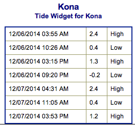
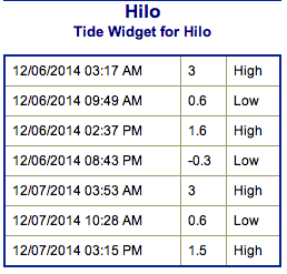
**Click directly on the images below to make them larger. Charts include: Big Island projected winds, tides, swell direction & period and expected wave heights.**
 Big Island Surf Forecast, Saturday and Sunday December 6 / 7
Hilo side: Surf is expected overhead to well overhead early on at the best breaks. Swell fades through the day.
Kona side: Surf is expected ankle to knee high for the best exposures.
South: Southeast shores open to the trade swell could see waves knee to shoulder high, though sloppy and choppy conditions are expected. Minimal surf out of the southern hemisphere – knee high or less.
 Our current north-northwest swell is expected to continue into Saturday. Surf expected from overhead to well overhead, maybe even bigger at the best exposures early in the day today on the Hilo side. Swell will fade throughout the day.
A new north-northwest swell is expected to build late Saturday, peaking on Sunday. The Kona side will be heavily shadowed from both of these swells.
A series of overlapping swells are expected next week as well.
Super small trace amounts of swell expected out of the SPAC. Not much to get excited about.
Keep in mind, surf heights are measured on the face of the wave from trough to crest. Heights vary from beach to beach, and at the same beach, from break to break.
**Click here for your detailed Big Island weather report.**
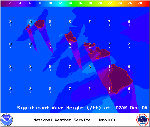
Image: NOAA / NWS
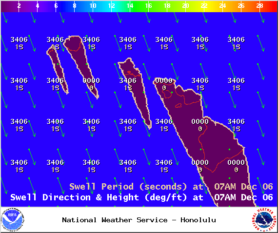
Image: NOAA / NWS
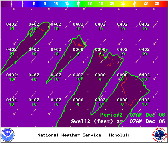
Image: NOAA / NWS
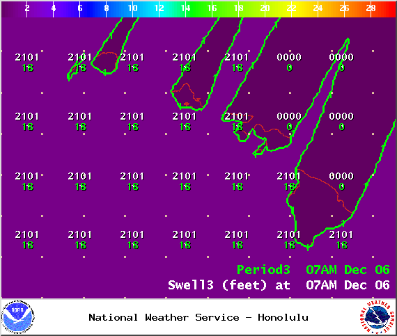
Image: NOAA / NWS
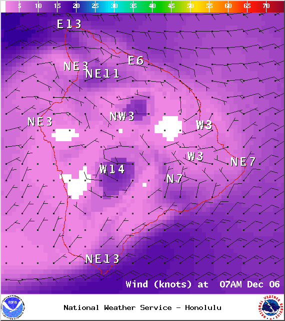
Image: NOAA / NWS
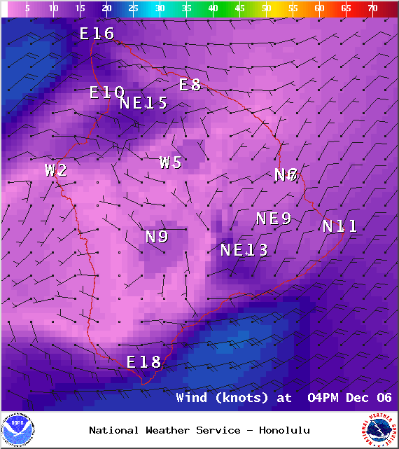
Image: NOAA / NWS
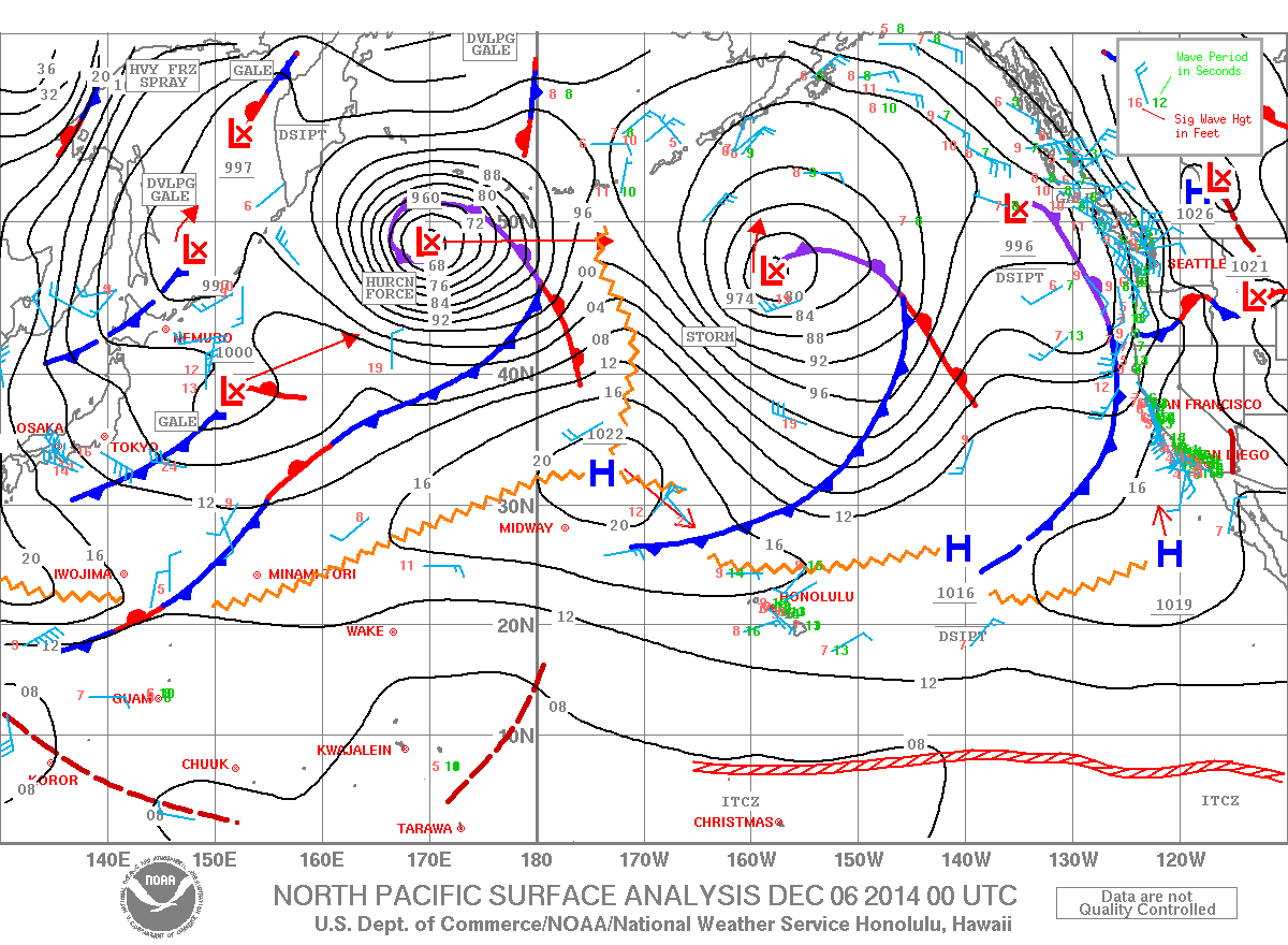
Image: NOAA / NWS
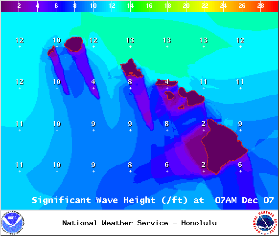
Image: NOAA / NWS
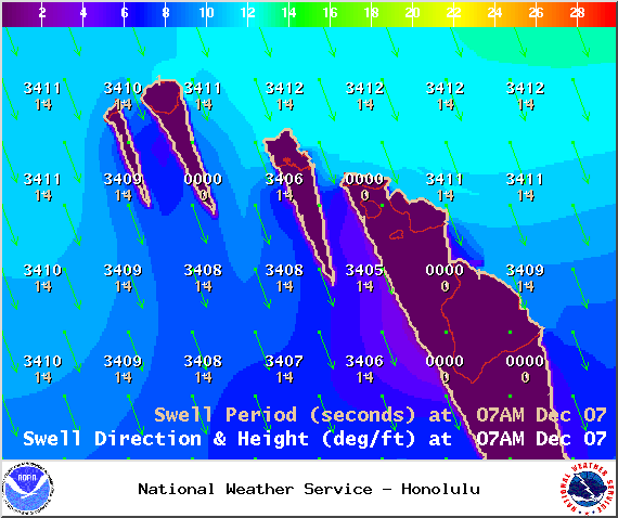
Image: NOAA / NWS
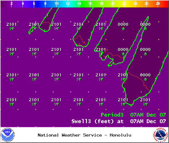
Image: NOAA / NWS
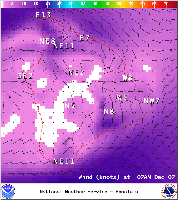
Image: NOAA / NWS
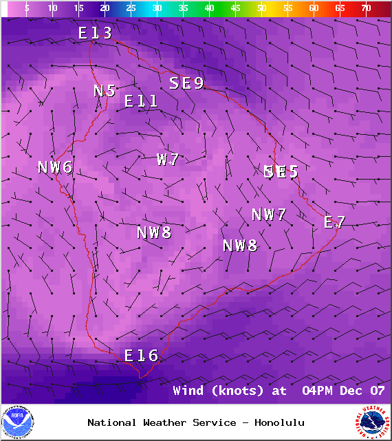
Image: NOAA / NWS
Sponsored Content


