

New NNW Builds, Series of N Swells on Horizon
Alerts
The High Surf Advisory has been extended by the National Weather Service for east-facing shores of the Big Island through 6 p.m. Friday. Surf is expected from 5 to 7 foot faces.
Expect strong breaking waves, shore break and strong longshore and rip currents making swimming difficult and dangerous.
**Click directly on the images below to make them larger. Charts include: Big Island projected winds, tides, swell direction & period and expected wave heights.**
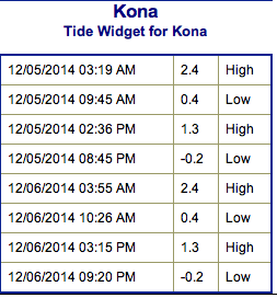
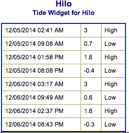 Big Island Surf Forecast, Friday December 5
Hilo side: Surf is expected head high to a few feet overhead early on at the best breaks. Late in the day a new swell is expected to bring overhead to well overhead wave heights at best exposures.
Kona side: Surf is expected ankle to thigh high for the best exposures.
South: Southeast shores open to the trade swell could see waves knee to waist high, though sloppy and choppy conditions are expected. Minimal surf out of the southern hemisphere – knee high or less. Some wrap from the northeast swell as well.
 Trade winds are generating swell for windward spots on the Big Island. Conditions will be choppy and sloppy.
Our current northeast swell is expected to continue to gradually ease today.
A new north-northwest swell is expected to build Friday into Saturday, peaking near advisory levels. Surf expected from overhead to well overhead, maybe even bigger at the best exposures.
A new north-northwest swell is also expected for the weekend peaking on Sunday.
A series of overlapping swells are expected next week as well.
Super small trace amounts of swell expected out of the SPAC. Not much to get excited about.
Keep in mind, surf heights are measured on the face of the wave from trough to crest. Heights vary from beach to beach, and at the same beach, from break to break.
**Click here for your detailed Big Island weather report.**
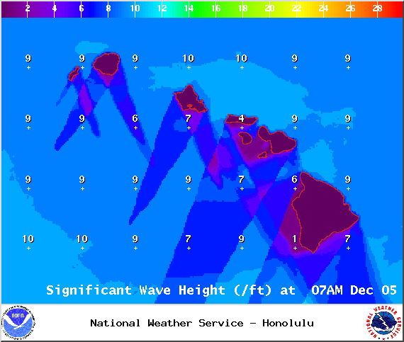
Image: NOAA / NWS
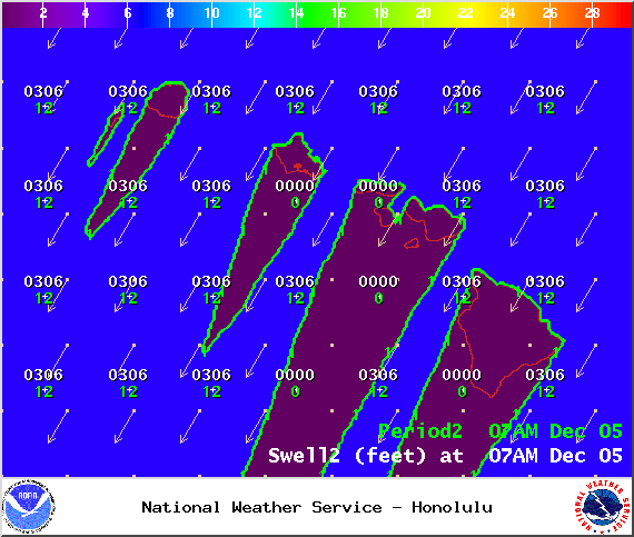
Image: NOAA / NWS
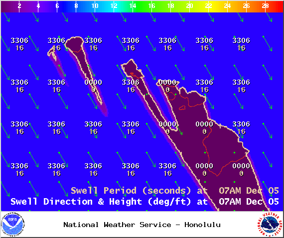
Image: NOAA / NWS
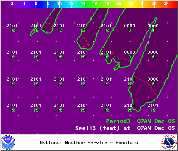
Image: NOAA / NWS
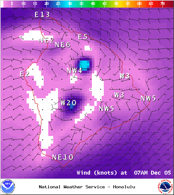
Image: NOAA / NWS
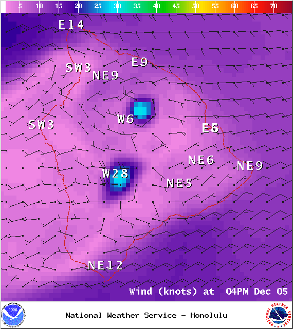
Image: NOAA / NWS
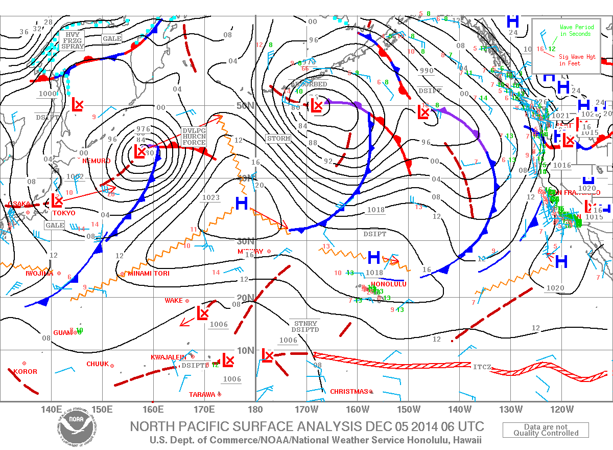
Image: NOAA / NWS
Sponsored Content


