

Weekend Surf Forecast
Alerts
The High Surf Advisory has been extended for the north-east facing shores of the Big Island until 6 p.m. Sunday. Surf along east facing shores could reach heights of 6 to 8 feet. Expect strong breaking waves, shore break and dangerous currents that make getting into the water hazardous and swimming difficult.
A Small Craft Advisory is posted for all Big Island waters through 6 p.m. Saturday. The advisory will last until Sunday at 6 p.m. for the ʻAlenuihāhā channel and Big Island leeward and southeast waters. Winds of 20 to 30 knots are expected and rough seas from 10 to 15 feet. Inexperienced mariners should avoid navigating in these conditions.
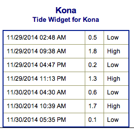
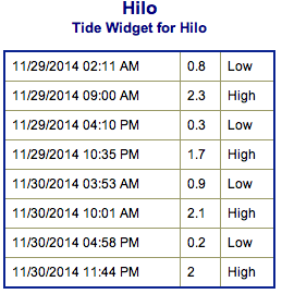
**Click directly on the images below to make them larger. Charts include: Big Island projected winds, tides, swell direction & period and expected wave heights.**
 Big Island Surf Forecast, Saturday & Sunday November 29 & 30
Hilo side: Surf is expected overhead to possibly double overhead at the best breaks.
Kona side: Spots that catch some of the wrap could see a slight bump in wave heights from ankle to possibly waist high or more. Breaks not exposed to the swell will be flat today.
South: Southeast shores open to the trade swell could see waves head high to overhead or more, though sloppy and choppy conditions are expected. Minimal surf out of the southern hemisphere.
 Trade winds are generating swell for windward spots on the Big Island. Conditions will be choppy and sloppy.
Another swell out of the northeast is expected to bring another round of overhead waves over the weekend starting this afternoon. New northwest swell could start building over the weekend on top of our old swell. Wave heights expected in the overhead range to double overhead at the best breaks.
If models are right, a series of swells will affect our northerly exposures the first week of December.
Super small trace amounts of swell expected out of the SPAC. Some small SW to S swells could fill in Friday/Saturday of next week if storms in the SPAC behave as forecasted.
Keep in mind, surf heights are measured on the face of the wave from trough to crest. Heights vary from beach to beach, and at the same beach, from break to break.
**Click here for your detailed Big Island weather report.**

Image: NOAA / NWS
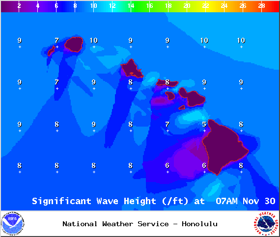
Image: NOAA / NWS
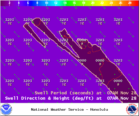
Image: NOAA / NWS
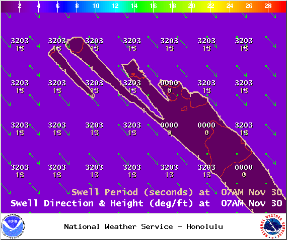
Image: NOAA / NWS
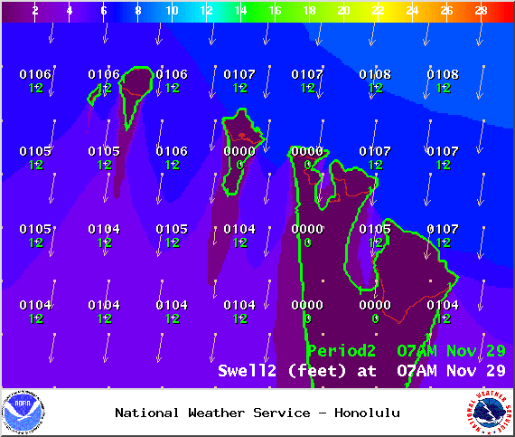
Image: NOAA / NWS
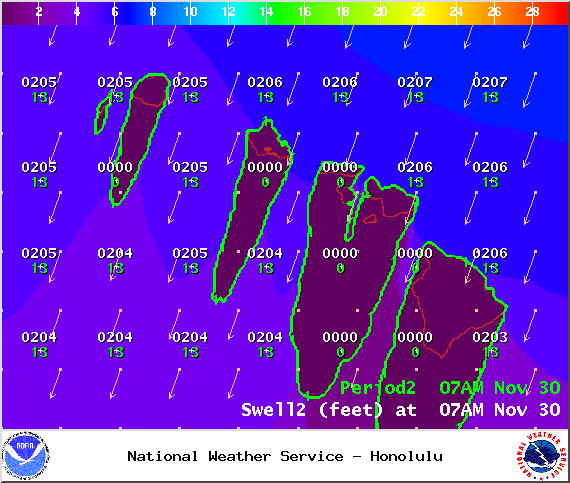
Image: NOAA / NWS

Image: NOAA / NWS
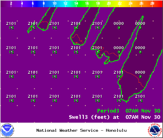
Image: NOAA / NWS
Image: NOAA / NWS
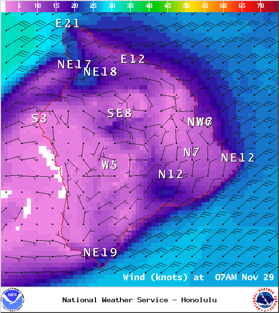
Image: NOAA / NWS

Image: NOAA / NWS
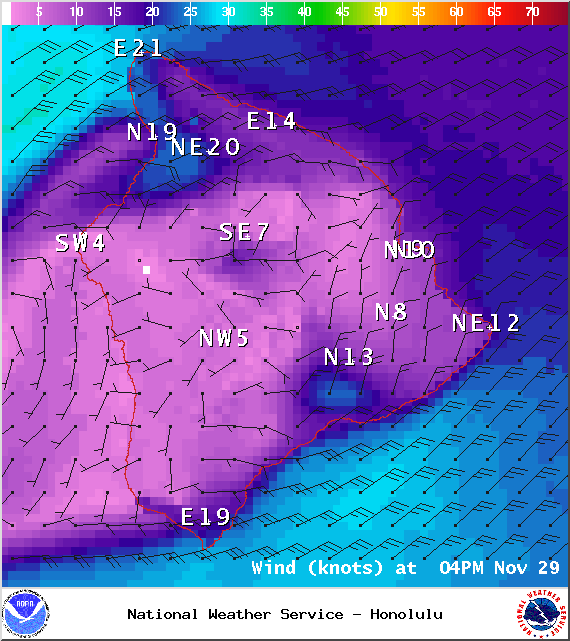
Image: NOAA / NWS
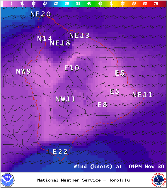
Image: NOAA / NWS
Sponsored Content


