

Frontal Remnants Expected Tuesday
Alerts
A Small Craft Advisory is posted for the ʻAlenuihāhā channel until 6 p.m. Winds up to 25 knots are expected out of the east and rough seas up to 10 feet. Inexperienced mariners should avoid navigating in these conditions.
**Click directly on the images below to make them larger. Charts include: Big Island high/low forecasted temperatures, projected winds, chance of cloud cover, projected localized weather conditions, vog/SO2 forecast and expected wave heights.**
Today, Saturday November 22, 2014
Today windward and mauka areas can expect scattered showers. Meanwhile, the leeward side and coastline can expect a mostly clear morning before clouds begin to build in the afternoon as the sea breeze develops due to daytime heating. High temperatures should fall in the range of 81° to 86° and around 71° at 5000 feet. Winds are expected our of the east winds from 15 to 20 mph.
Sunrise: 6:33 a.m.
Sunset: 5:40 p.m.
UV index at 6 (“high” exposure level)
Tonight
We expect mostly cloudy skies tonight with scattered windward and mauka showers and mostly clear skies in leeward spots but haze is expected to stick around. We could see some isolated showers after midnight in lee areas. Variable winds are expected up to 15 mph. Low temperatures should fall in the range of 70° to 75° with a low of about 56° at 5000 feet.
Moonrise: 6:45 a.m.
Moonset: 6:17 p.m.
Next Full Moon: Dec. 6 at 2:27 a.m.
Next New Moon: Dec. 21 at 3:36 p.m.
Looking Ahead
Trade winds are on the decline as a front approaches and will shift out of the southeast. Moderate rainfall and stiff north winds are expected as the front pushes down the island chain. Expected arrival time for the Big Island is Tuesday and Tuesday night. By the time the front reaches Hawaii County it will likely be disorganized and mainly composed of frontal remnants. Ahead of the front winds will weaken and a diurnal land / sea breeze weather pattern will set up. Behind the front, cool and dry conditions are forecasted.
Almanac for Hilo Airport
Maximum Temperature for today:
Normal 80°
Record 86° / Set in 1977
Minimum Temperature for today:
Normal 67°
Record 59° / Set in 1956
**Click here for your detailed Big Island surf report.**
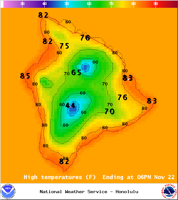
Image: NOAA / NWS
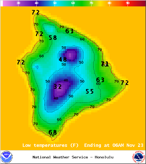
Image: NOAA / NWS
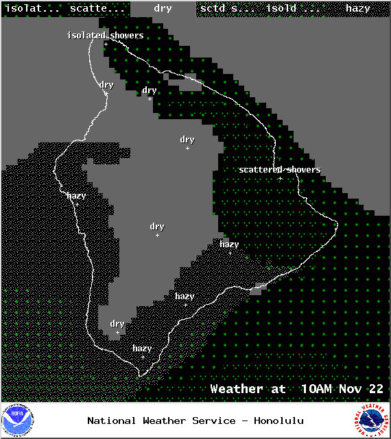
Image: NOAA / NWS
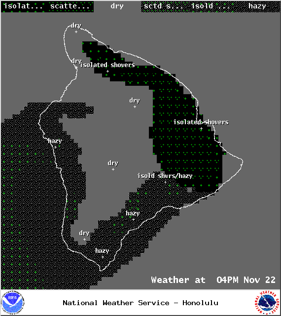
Image: NOAA / NWS
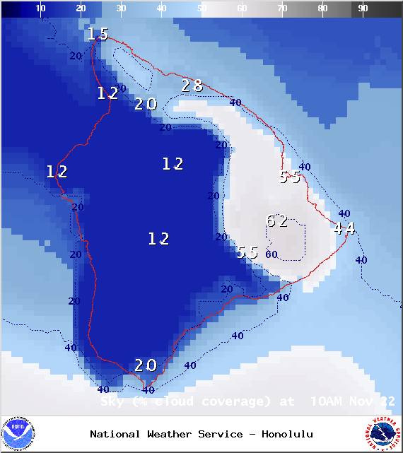
Image: NOAA / NWS
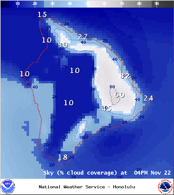
Image: NOAA / NWS
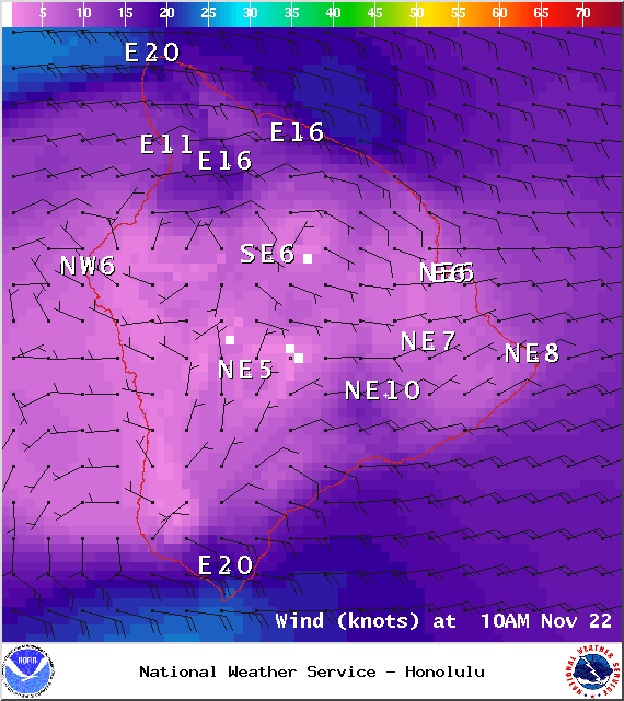
Image: NOAA / NWS
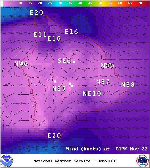
Image: NOAA / NWS
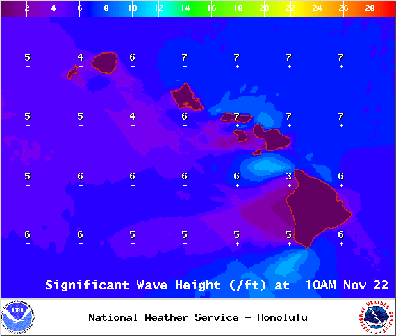
Image: NOAA / NWS
Image: UHSOEST
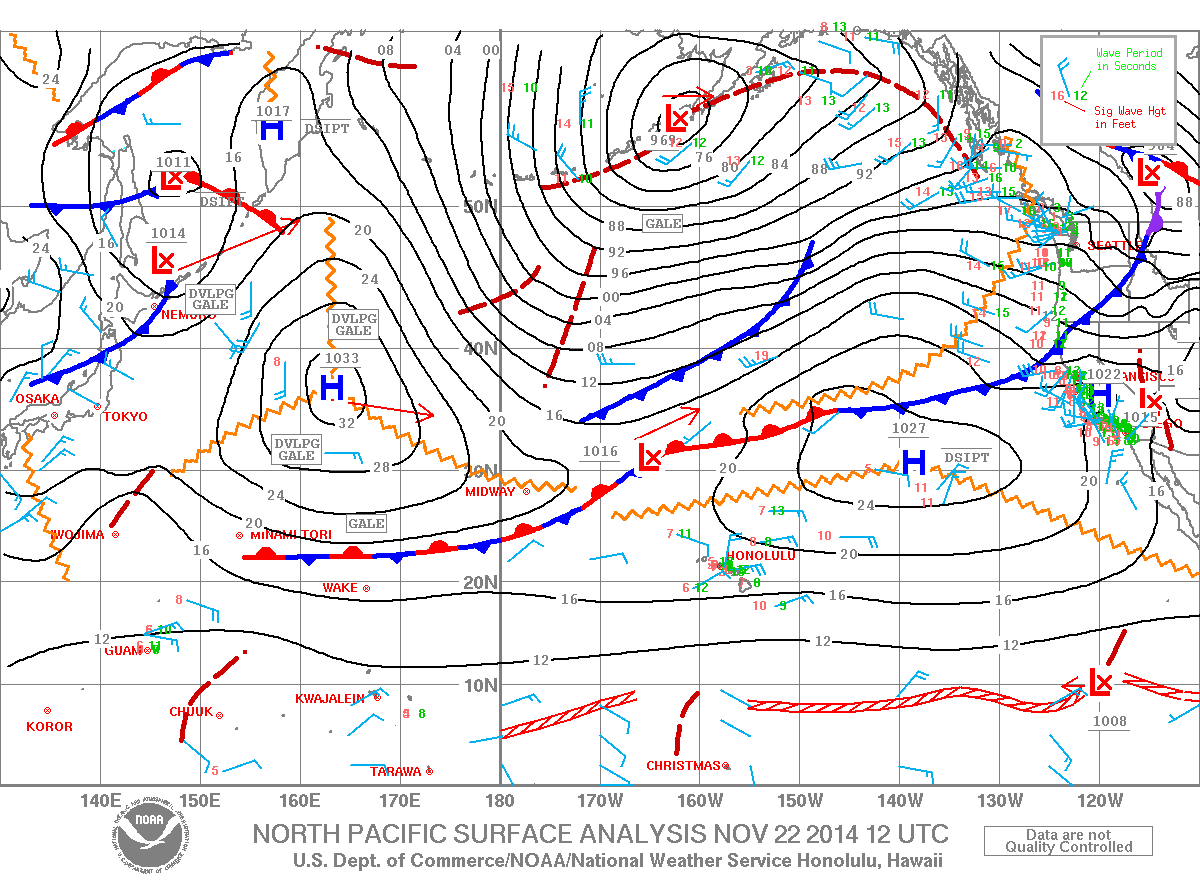
Image: NOAA / NWS
Sponsored Content


