

Vog for Windward Spots as Front Approaches
Alerts
A Wind Advisory is posted for the summits of Mauna Kea and Mauna Loa until 6 p.m. Saturday for elevations above 12000 feet. Westerly winds of 35 to 55 mph are forecasted with gusts up to 65 mph possible.
The National Weather Service advises that winds this strong can make walking and driving difficult. Use extra caution when driving and be careful when opening and closing doors. If camping in the area, be sure your tent is well anchored.
**Click directly on the images below to make them larger. Charts include: Big Island high/low forecasted temperatures, projected winds, chance of cloud cover, projected localized weather conditions, vog/SO2 forecast and expected wave heights.**
Today, Saturday November 15, 2014
We expect partly sunny skies today and scattered showers. The UHSOEST vog model is predicting voggy conditions along the windward coast (see image above). High temperatures should fall in the range of 82° to 87° and around 70° at 5000 feet. In general, variable winds from 5 to 15 mph are expected.
Sunrise: 6:29 a.m.
Sunset: 5:41 p.m.
UV index at 7 (“high” exposure level)
Tonight
We expect partly cloudy skies tonight with isolated showers and areas of haze. Variable winds from 5 to 15 mph are forecasted. Low temperatures should fall in the range of 69° to 74° with a low of about 57° at 5000 feet.
Moonset: 1:21 p.m.
Moonrise: 1:30 a.m. on Nov. 16
Next New Moon: Nov. 22 at 2:33 a.m.
Next Full Moon: Dec. 6 at 2:27 a.m.
The Leonid meteor shower is currently active. For details on the show in the sky click here.
Looking Ahead
Southwest winds are expected to spread over Hawaii County late in the day as a weak cold front pushes toward us out of the northwest. The front is expected to reach Kauaʻi Saturday and move down the island chain Saturday night through Sunday. Isolated thunderstorms are possible ahead of the front. Cooler, drier conditions and breezy winds are expected to fill in behind the front.
Almanac for Hilo Airport
Maximum Temperature for today:
Normal 81°
Record 85° / Set in 1970 and tied in 1995 and 2006
Minimum Temperature for today:
Normal 67°
Record 61° / Set in 1956 and tied in 1974 and 1980
**Click here for your detailed Big Island surf report.**
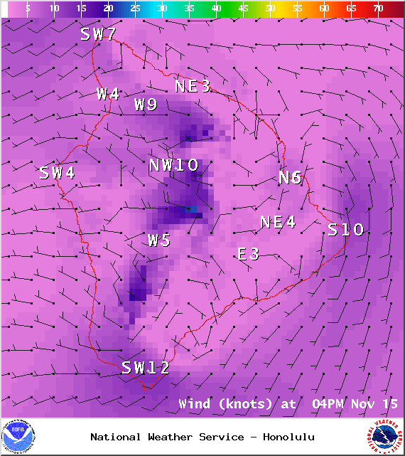
Image: NOAA / NWS
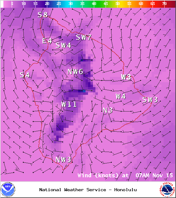
Image: NOAA / NWS
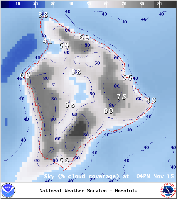
Image: NOAA / NWS
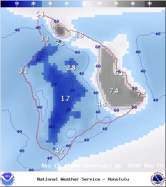
Image: NOAA / NWS
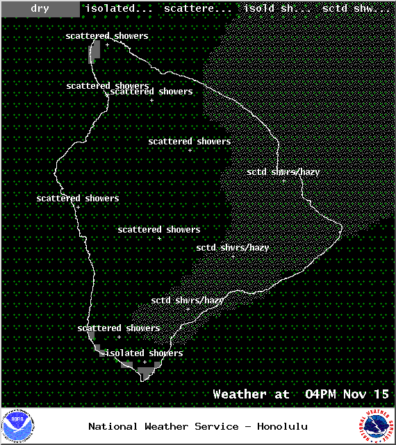
Image: NOAA / NWS

Image: NOAA / NWS
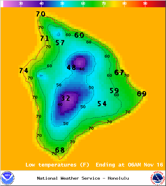
Image: NOAA / NWS
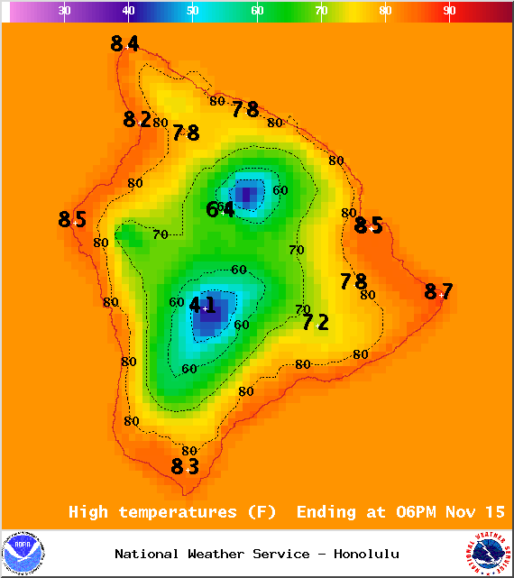
Image: NOAA / NWS
Image: UHSOEST
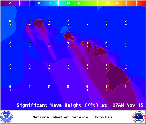
Image: NOAA / NWS
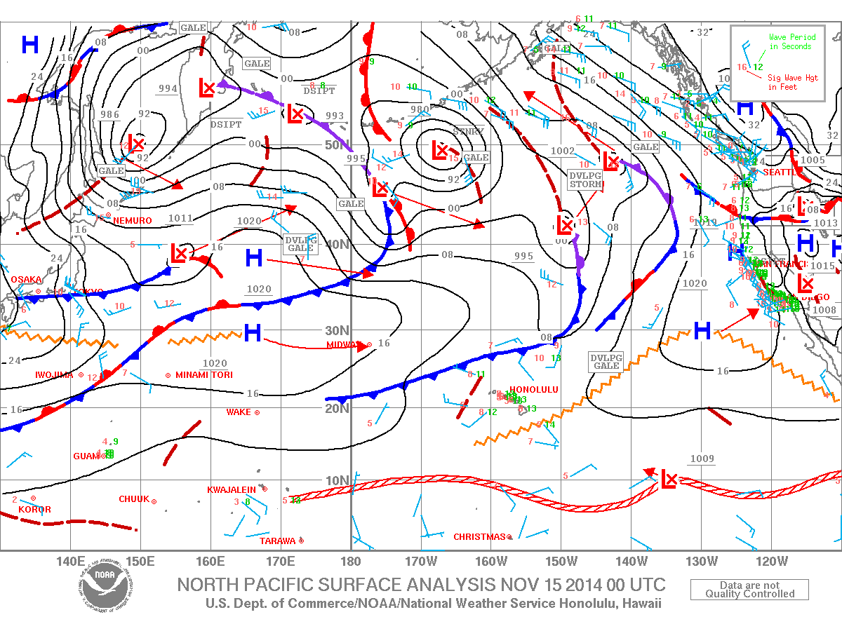
Image: NOAA / NWS
Sponsored Content


