

Haze, Scattered Heavy Showers Possible Today
Alerts
A Wind Advisory is posted for the summits of Mauna Kea and Mauna Loa until 6 a.m. Saturday for elevations above 12000 feet. Westerly winds of 35 to 55 mph are forecasted with gusts up to 65 mph possible.
The National Weather Service advises that winds this strong can make walking and driving difficult. Use extra caution when driving and be careful when opening and closing doors. If camping in the area, be sure your tent is well anchored.
**Click directly on the images below to make them larger. Charts include: Big Island high/low forecasted temperatures, projected winds, chance of cloud cover, projected localized weather conditions, vog/SO2 forecast and expected wave heights.**
Today, Friday November 14, 2014
We expect areas of haze across the Big Island today. The UHSOEST vog model is forecasting it mostly for the north side of the island. The weather is expected to be mostly cloudy and showery through the day. That may help to clean out some of the vog. Heavy rain is possible. There is a 30% chance of rain for Kona, Waikoloa, Waimea and the Kohala coast. Down south and from Volcano all the way up along the Hamakua coast the chance of rain is 40% today. High temperatures should fall in the range of 80° to 85° and around 70° at 5000 feet. In general, southwest winds around 15 mph are expected with higher winds for the summits of Mauna Kea and Mauna Loa.
Sunrise: 6:28 a.m.
Sunset: 5:41 p.m.
UV index at 6 (“high” exposure level)
Tonight
We expect mostly cloudy skies tonight with scattered showers and areas of haze. Southwest winds around 15 mph are forecasted. Low temperatures should fall in the range of 69° to 74° with a low of about 57° at 5000 feet. The moon is 53.3% full.
Moonset: 12:44 p.m.
Moonrise: 12:42 a.m. on Nov. 15
Next New Moon: Nov. 22 at 2:33 a.m.
Next Full Moon: Dec. 6 at 2:27 a.m.
The Leonid meteor shower is currently active. For details on the show in the sky click here.
Looking Ahead
An area of instability near Maui is forecasted to move away from the islands and weaken as a front northwest of Kauai continues to approach. The surface trough that has been making our weather wet is expected to keep conditions damp through Saturday. Winds ahead of the front are expected to shift out of the south and bring scattered showers. These showers will be quite disorganized in nature and could be heavy at times.
The front northwest of Kauai is expected to push down the island chain Saturday evening through Sunday. Conditions are expected to be more stable as the surface trough leaves our area, therefore not expecting heavy rain from this feature at this time. Cooler, drier conditions are expected early next week with breezy winds filling in behind the front.
Almanac for Hilo Airport
Maximum Temperature for today:
Normal 81°
Record 87° / Set in 1996
Minimum Temperature for today:
Normal 68°
Record 62° / Set in 1974
**Click here for your detailed Big Island surf report.**
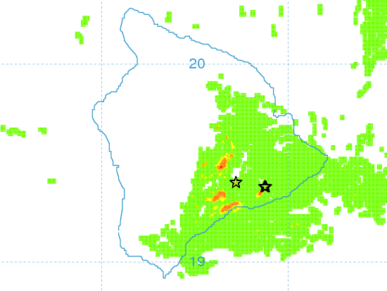
Vog Model / Image: UHSOEST
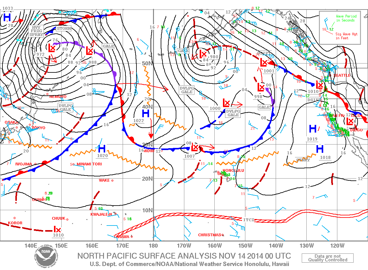
Image: NOAA / NWS
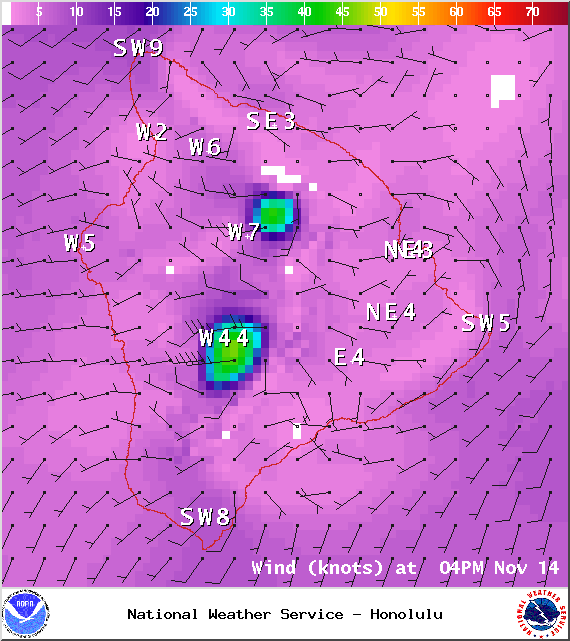
Image: NOAA / NWS
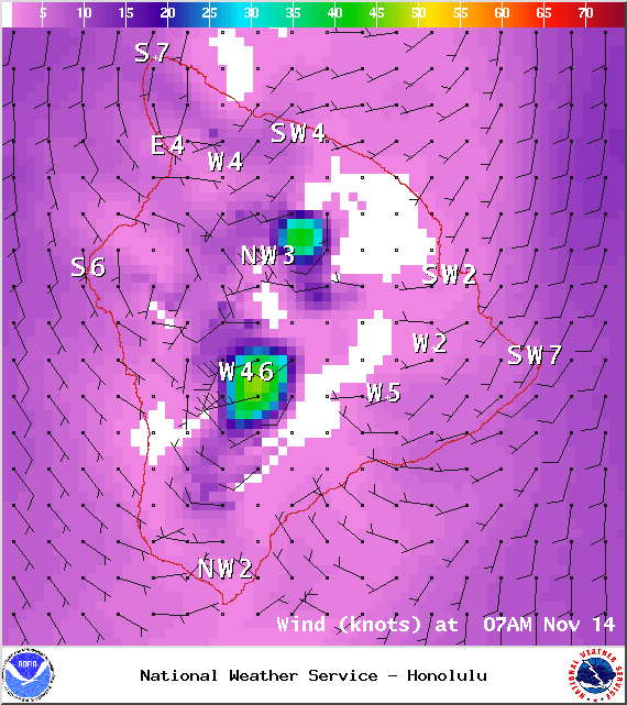
Image: NOAA / NWS
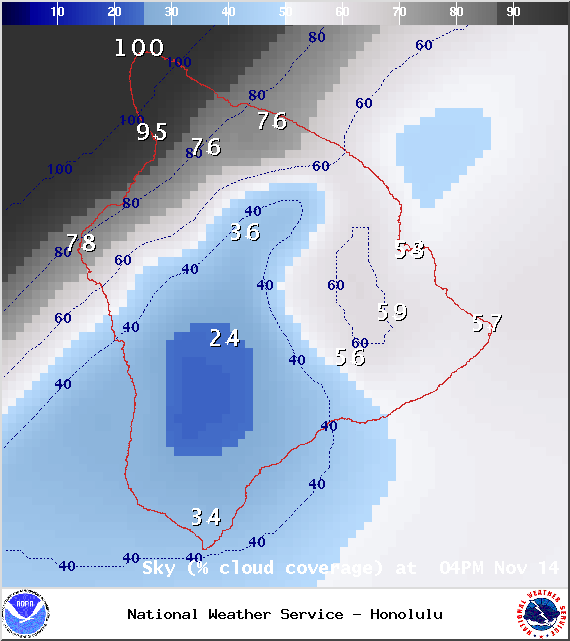
Image: NOAA / NWS
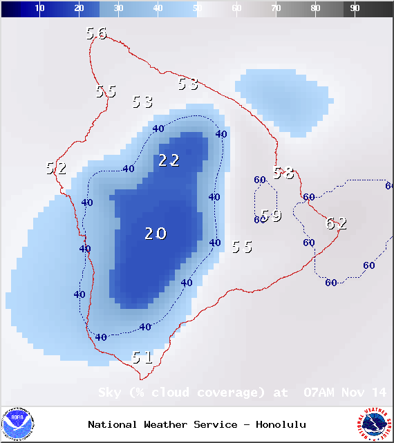
Image: NOAA / NWS
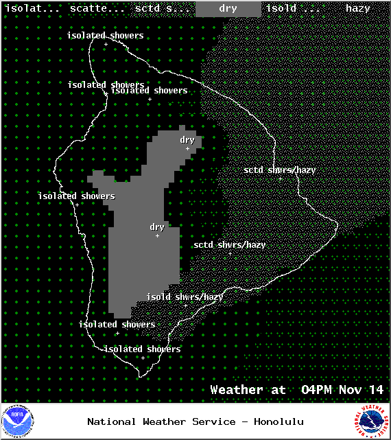
Image: NOAA / NWS
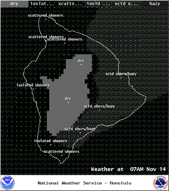
Image: NOAA / NWS
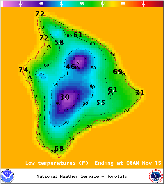
Image: NOAA / NWS
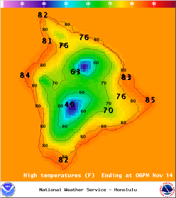
Image: NOAA / NWS
Sponsored Content


