

Malika Dudley’s Big Island Forecast – 11/7/14
**A breakdown of expected conditions specific to the Big Island is presented below. Click directly on the image to make it larger.**
Today
Partly sunny skies are expected today throughout Hawaii County. Leeward and interior spots could see afternoon cloud cover as daytime heating kicks up the sea breeze and spawns late day clouds with the possibility of scattered showers. Hazy in the afternoon on the Kona side. High temperatures should fall in the range of 82° to 87° and around 72° at 5000 feet. In general, variable winds up to 15 mph are expected.
Sunrise: 6:24 a.m.
Sunset: 5:43 p.m.
UV index at 7 (“high” exposure level)
Tonight
Tonight we should get variable winds up to 15 mph. Scattered showers are possible in the early evening for leeward and interior areas. Skies will clear as the evening goes on and the land breeze takes hold pushing any clouds and showers we may get out to sea. Low temperatures should fall in the range of 69° to 74° with a low of about 58° at 5000 feet. Variable winds are expected up to 15 mph.
Moonrise: 6:48 p.m.
Moonset: 8:07 a.m.
Next New Moon: Nov 22 at 2:33 a.m.
Next Full Moon: Dec 6 at 2:27 a.m.
Looking Ahead
At this point the front is expected to impact Hawaii County on Sunday. However, recent model runs are suggesting that the front could stall over Maui County instead. Will keep an eye on this feature and bring you the latest. Briefly strong northerly winds are expected to follow the front but become lighter and more easterly into next week as frontal showers diminish.
 Surf & Seas
Hilo: Surf is expected in the thigh to chest high range with some plusses for spots best exposed to the mix of trade swell and north-northwest.
Kona: Surf is expected to be thigh high or less. Breaks not exposed to the swell will be flat today.
South: Best breaks could see waist to chest high waves for spots exposed to the trade swell along the southeast coast. South breaks that are not exposed to the trade swell should see waves thigh high or less.
 Our current north-northwest swell (325-355°) is fading today. An even bigger swell (320-345°) is expected to build tomorrow and peak Sunday morning, possibly peaking with waves double overhead on the sets at the best breaks. Typhoon Nuri is expected to bring us a solid swell starting late Monday and peaking on Veteran’s day in the afternoon with overhead to double overhead sets at the best exposures despite being heavily shadowed from the swell. The Kona side will be significantly smaller but may still catch waves in the waist to head high range at the best breaks.
Small swells generated in the South Pacific are expected to bring us waves in the thigh high or less range. You might see possible plusses at the best tides and exposures but they will be inconsistent at best and most Kona spots will remain flat. There isn’t much on the horizon out of the South Pacific.
Keep in mind, surf heights are measured on the face of the wave from trough to crest. Heights vary from beach to beach, and at the same beach, from break to break.
Almanac for Hilo Airport
Maximum Temperature for today:
Normal 81°
Record 92° / Set in 1996
Minimum Temperature for today:
Normal 68°
Record 61° / Set in 1979
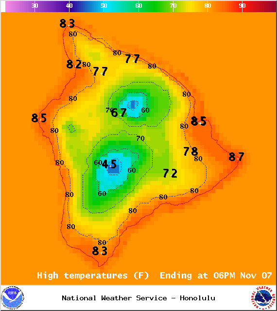
Image: NOAA / NWS
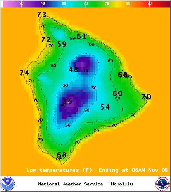
Image: NOAA / NWS
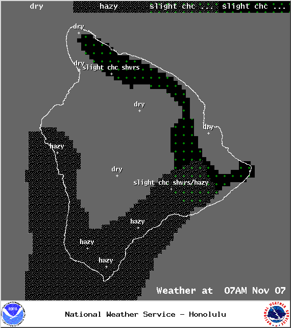
Image: NOAA / NWS
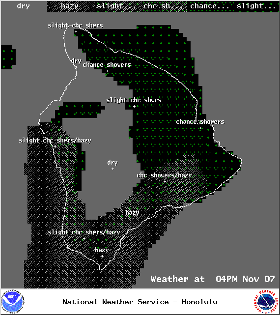
Image: NOAA / NWS
Image: NOAA / NWS
Image: NOAA / NWS
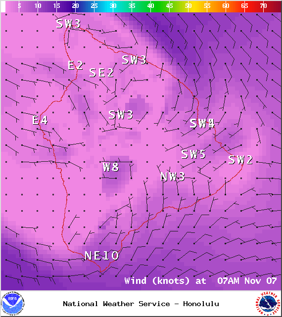
Image: NOAA / NWS
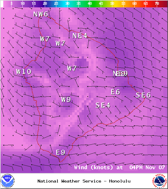
Image: NOAA / NWS
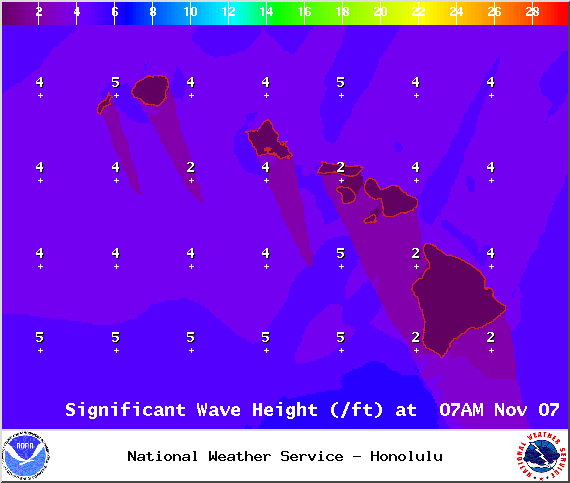
Image: NOAA / NWS
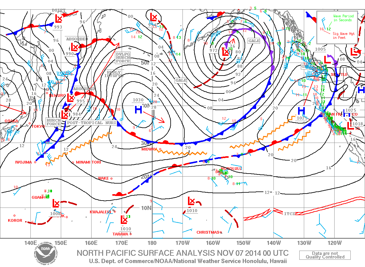
Image: NOAA / NWS
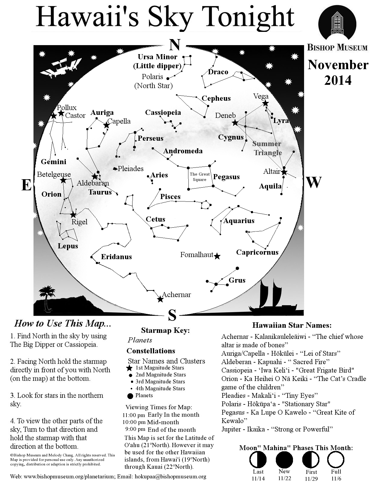
Image: Bishop Museum Planetarium
Sponsored Content


