

Flood Advisory for Kona Until 12:15am
**A breakdown of expected conditions specific to the Big Island is presented below. All graphics are provided by the National Weather Service in Honolulu. Click directly on the image to make it larger.**
Alerts (Updated at 9:12 pm)
A FLOOD ADVISORY has been issued by the National Weather Service for heavy rain near Keahole point, about 9 miles north of Kailua-Kona. The area of heavy rain was nearly stationary. Other locations in the advisory include but are not limited to Puuanahulu and Kona Village Resort. The advisory is set to expire at 12:15am but could be extended if conditions persist.
Previous post (7:30 pm):
The Flood Advisory was allowed to expire.
Previous post (5:30 pm):
The FLOOD ADVISORY has been extended to 7:30pm. Radar showed heavy rain near Puuanahulu at 5:30pm.
A SHORT TERM FORECAST has been issued by the National Weather Service for the possibility of localized downpours for interior, western and southern areas this afternoon. Showers are expected to be brief but rainfall rates could exceed an inch per hour in the heaviest cells once they develop. Motorists could encounter significantly reduced visibility, localized ponding, and possibly traffic slowdowns in some areas.
Previous post (2:30 pm):
The National Weather Service has extended the FLOOD ADVISORY to 5:30pm for areas of the Big Island. Locally heavy downpours were observed about 13 miles north of Kailua-Kona. Other heavy showers are expected over the slopes during the afternoon as well. Other locations included in the advisory are Waipio Valley, Waikoloa Village, Waikoloa Beach Resort, Waikii, Saddle Road, Puuanahulu, Kamuela, Puako, Upolu airport, Paauilo, Mahukona, Hawi, Honokaa and Kawaihae. Will update if it gets upgraded to a warning, expires or gets extended.
Previous post (11:45 am):
A FLOOD ADVISORY is posted for the Kona Village area of the island until 2:45pm this afternoon for locally heavy downpours in the area. Other heavy showers are expected over the slopes during the afternoon as well. Other locations included in the advisory are Waikoloa Village, Waikoloa Beach Resort, Waikii, Kawaihae, Puako, Kamuela, Puuanahulu and the Saddle Road. Will update if it gets upgraded to a warning, expires or gets extended.
Full Weather Forecast >>
Today
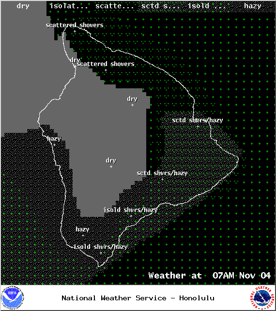
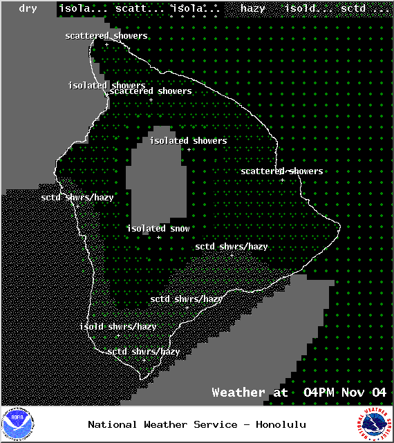
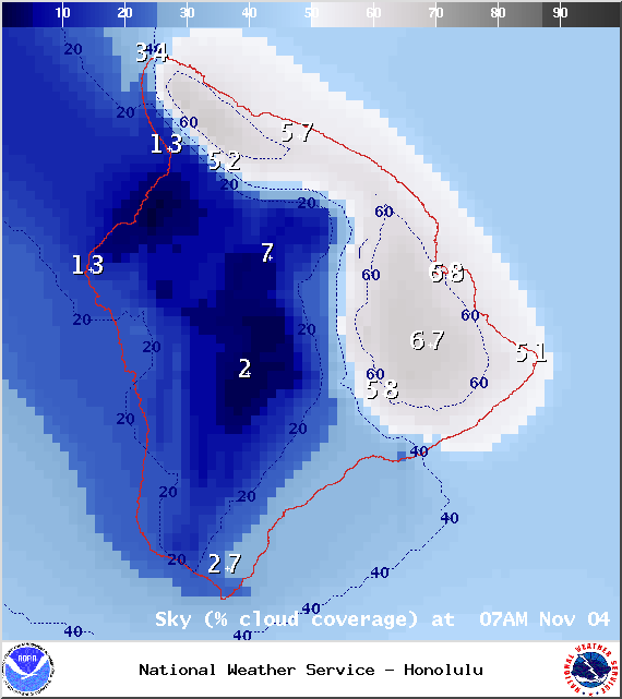
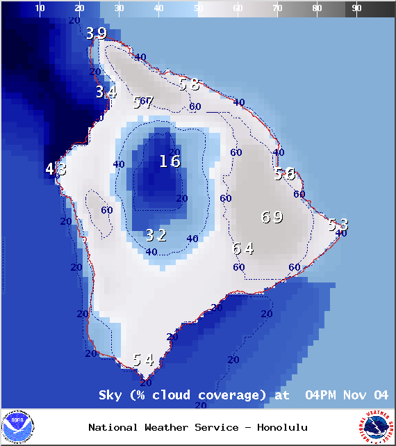
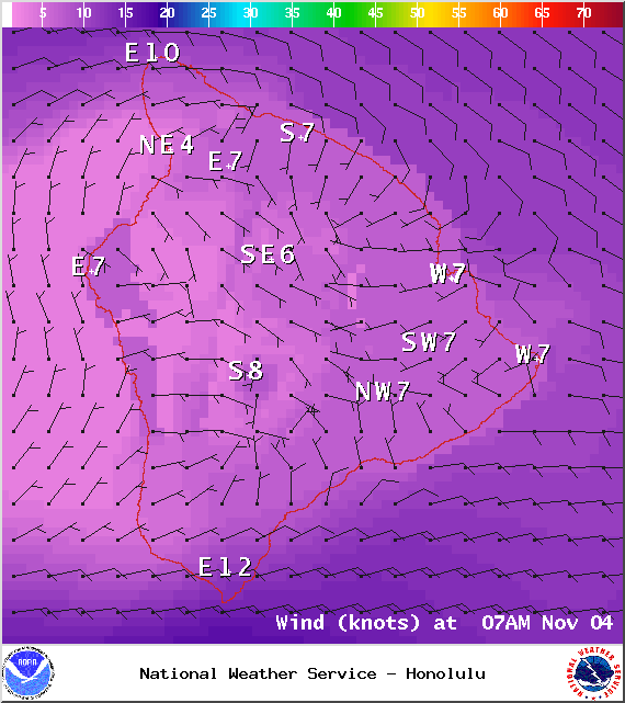
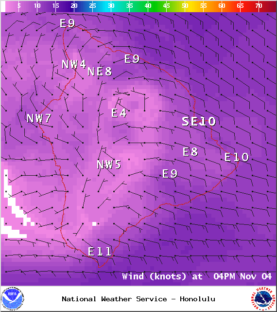
Today we expect a hybrid weather pattern with trade wind weather expected for the windward side and a diurnal weather pattern for the leeward side. What that means for you is windward spots will see the usual scattered morning showers but the sunshine is expected to peak through with partly sunny skies in the forecast. The Kona side will have mostly sunny skies in the morning and mostly cloudy skies in the afternoon as daytime heating brings on the sea breeze and cloud cover starts to build. Afternoon downpours are likely and some could be locally heavy. High temperatures should fall in the range of 82° to 87° and around 67° – 73° at 5000 feet. In general, variable winds should fall in the 5 – 15 mph range.
Sunrise: 6:23 a.m.
Sunset: 5:45 p.m.
UV index at 8 (“very high” exposure level)
 Tonight
We expect mostly cloudy skies tonight with showers likely for windward and mauka areas. The Kona side will be mostly cloudy in the evening but gradually clearing as the night goes on. Haze is expected all night. Low temperatures should fall in the range of 69° to 74° with a low of about 56° at 5000 feet. Variable winds are expected up to 15 mph.
Moonrise: 4:22 p.m.
Moonset: 5:13 a.m.
Next Full Moon: Nov 6, 2014 at 12:23 p.m.
Next New Moon: Nov 22 at 2:33 a.m.
Looking Ahead
Moderate trades are expected to start filling back in late Tuesday into Wednesday. Another front is expected to approach the island chain starting Thursday, this will cut our trade winds off again. It’s still too far out to say for sure, but at this point the front is expected to impact the Big Island on Sunday.
 Surf & Seas
Hilo: Surf is expected in the waist high range. Spots best exposed to the swell could see head high to overhead sized waves. Catching trade swell and a small north as it builds in.
Kona: Surf is expected to be thigh high or less. Breaks not exposed to the swell may not see any surf today.
South: Best breaks could see waist to head high waves with overhead sets from time to time.
A new northwest swell (315-335°) is expected to peak in the knee to waist high range overnight with a reinforcement on tap out of the north-northwest swell (330-360°) building Wednesday and peaking early Thursday in the waist to head high range. Maybe an even bigger swell on the horizon for next weekend. Super Typhoon Nuri could possibly bring us a solid swell around 11/11.
 Our current south-southwest swell continues to slowly fade out through the first half of this week. After that swell subsides, surf goes quiet with not much on the horizon out of the South Pacific.
Keep in mind, surf heights are measured on the face of the wave from trough to crest. Heights vary from beach to beach, and at the same beach, from break to break.
Almanac for Hilo Airport
Maximum Temperature for today:
Normal 82°
Record 86° / Set in 1968 and tied in 1988
Minimum Temperature for today:
Normal 68°
Record 64° / Set in 1962 and tied in 1985

Sponsored Content


