

Malika Dudley’s Big Island Forecast (11/02/14)
**A breakdown of expected conditions specific to the Big Island is presented below. All charts are by the National Weather Service in Honolulu.**
Alerts
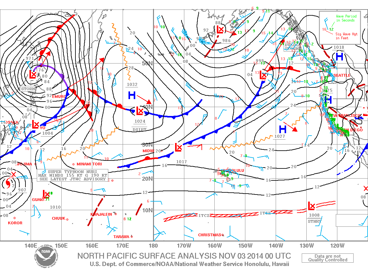
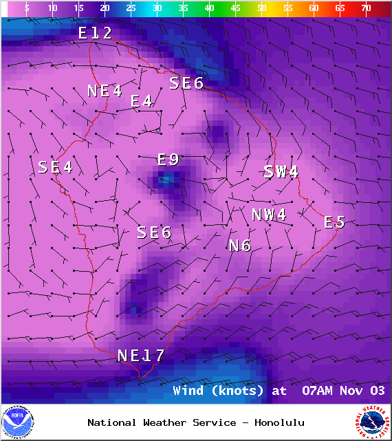
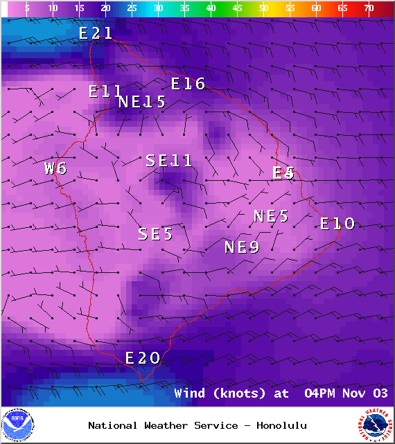
The SMALL CRAFT ADVISORY is still posted for waters near South Point, Big Island leeward waters and the Alenuihaha channel until 6 p.m. Monday, Nov. 3, 2014. Rough seas are expected up to 10 feet. Winds are forecasted out of the east around 25 knots, with higher gusts. Inexperienced mariners are cautioned to avoid navigating in these conditions.
 Today
Today
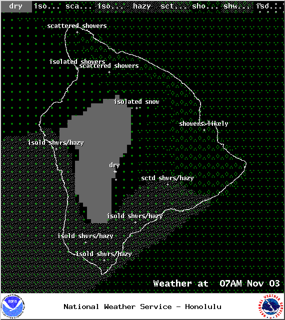
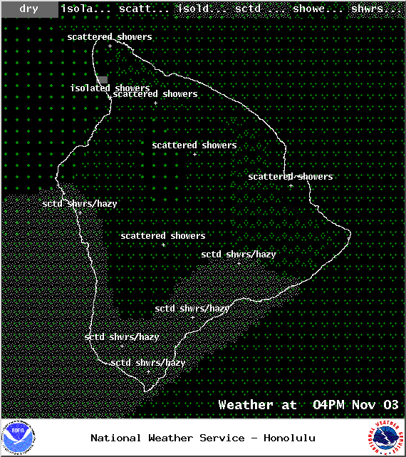
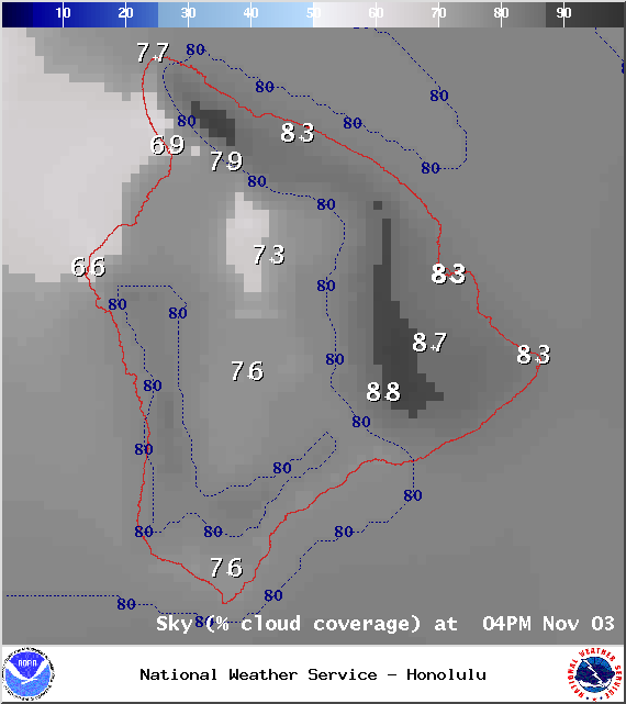
Today mostly cloudy skies are expected with showers likely for windward and mauka areas. The Kona side can expect hazy conditions with isolated morning showers and scattered afternoon showers. High temperatures should fall in the range of 82° to 87° and around 68° – 74° at 5000 feet. In general, east winds should fall in the 15 – 20 mph range with higher gusts. Along the Hamakua coast and at South Point winds could gust up to 35 mph. In the Waikoloa and Kohala areas gusts could reach 30 mph.
Sunrise: 6:22 a.m.
Sunset: 5:45 p.m.
UV index at 8 (“very high” exposure level)
 Tonight
We expect mostly cloudy skies tonight with showers likely for windward and mauka areas. The Kona side will be mostly cloudy in the evening but gradually clearing as the night goes on. Haze is expected all night. Low temperatures should fall in the range of 70° to 75° with a low of about 56° at 5000 feet. Variable winds are expected up to 15 mph.
Moonrise: 3:36 p.m.
Moonset: 4:13 a.m.
Next Full Moon: Nov 6, 2014 at 12:23 p.m.
Next New Moon: Nov 22 at 2:33 a.m.
Looking Ahead
Trade winds are expected to gradually weaken over the next couple of days. The upper low that has been making our weather unstable should shift northward and weaken on Tuesday. By midweek trades should start filling back in. Another front is expected to affect us next week as well.
 Surf & Seas
Hilo: Surf is expected in the chest high range. Spots best exposed to the swell could see overhead sized waves. Mainly catching trade swell as the north fades in the afternoon.
Kona: Surf is expected to be waist high or less. Breaks not exposed to the swell may not see any surf today.
South: Ankle to waist high waves are expected. Best breaks could see chest high waves from time to time. The southeast coast will also catch the trade swell bringing waves heights up to waist or even head high at the best exposures.
Our north swell (350-360°) is fading through today. A new northwest swell (315-335°) is expected to peak in the knee to waist high range overnight Tuesday. This swell is expected to hold through the end of the work week. Another north-northwest swell (330-360°) is possible late Wednesday, peaking early Thursday. Maybe an even bigger swell on the horizon for next weekend. Typhoon Nuri could possibly bring us a swell around 11/11.
 Our trade wind swell is expected to drop out over the next few days.
Our current south-southwest swell (200-180°) is expected to slowly fade out through the first half of this week. After that swell subsides, surf goes quiet with not much on the horizon out of the South Pacific.
Keep in mind, surf heights are measured on the face of the wave from trough to crest. Heights vary from beach to beach, and at the same beach, from break to break.
Almanac for Hilo Airport
Maximum Temperature for today:
Normal 82°
Record 87° / Set in 1993
Minimum Temperature for today:
Normal 68°
Record 61° / Set in 1970 and tied in 1980
Sponsored Content


