

Malika Dudley’s Big Island Forecast (10/29/14)
Updated at 3:30pm
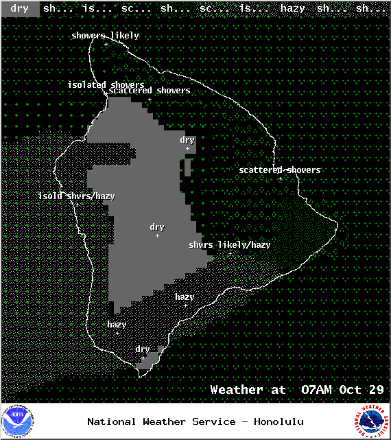
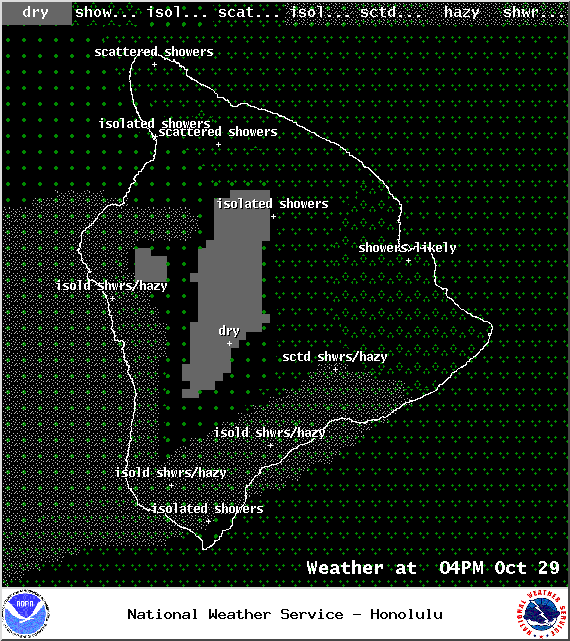
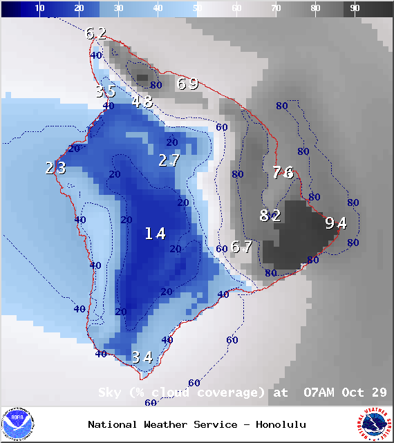
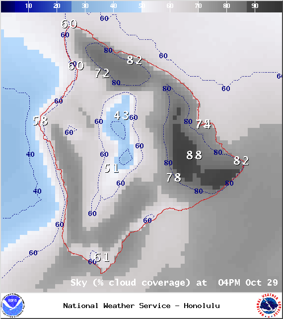
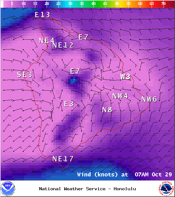
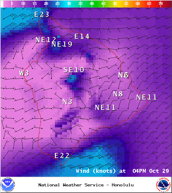
**A breakdown of expected conditions specific to the Big Island is presented below in graphical form. All graphics are provided by the National Weather Service in Honolulu.**
Alerts
A SMALL CRAFT ADVISORY is posted for waters near South Point, Big Island leeward waters and the Alenuihaha channel until 6:00 a.m. Saturday. Winds of 20 to 25 knots are expected with rough seas from 8 to 11 feet. Inexperienced mariners are cautioned to avoid navigating these conditions.
The National Weather Service has issued a HIGH SURF ADVISORY for east shores until 6 a.m. Saturday, Nov. 1, 2014. Hazardous ocean conditions are expected due to a combo of north swell and increasing winds. Watch out for rip currents, dangerous shore break conditions and strong breaking waves from 7 to 9 foot faces.
A GALE WARNING has also been issued for all Hawaiian offshore waters for tonight.
 Today
Today
Today the Kona side should see partly sunny skies early on and light winds, giving way to mostly cloudy skies as daytime heating kicks up the sea breeze in the afternoon. Hazy skies are again in the forecast for leeward spots with scattered showers expected in the afternoon. Windward and mauka areas are forecasted to get mostly cloudy skies and showers throughout the day. High temperatures should fall in the range of 82° to 87° with cooler temperatures expected at higher elevations. In general, trade winds should be fall in the 10 – 20 mph range for Hawaii County. Along the windward coast gusts are expected up to 25 mph increasing to 45 mph in the late morning and afternoon. Sustained winds from 15 to 25 mph are expected in Waikoloa. At South Point gusts could reach 30 mph early on and 40 mph as the day progresses.
Sunrise: 6:20 a.m.
Sunset: 5:48 p.m.
UV index at 8 (“very high” exposure level)
 Tonight
We expect mostly cloudy skies tonight with showers likely in windward and mauka areas. The Kona side will be mostly cloudy to start then partly cloudy as some clouds get pushed out to sea by the land breeze. Low temperatures should fall in the range of 70° to 75° with lower temperatures expected at higher elevations. Trade winds are expected from 10 – 20 mph.
Moonrise: 11:39 a.m.
Moonset: 11:16 p.m.
Looking Ahead
Okay… so it’s not great news for Halloween. Right now, models are showing a front dipping to the south, toward the islands, affecting our weather later today and through the end of the work week. Left over moisture from this front is expected to hang around through the weekend bringing soggy conditions to windward and mauka areas. During this same time, winds are expected to pick up in strength so some of those showers could pass into leeward areas from time to time as well. For now, instability expected in our area late in the week is not expected to spawn any severe weather but we’ll keep an eye on it just in case things change. Another front may also affect us by the middle of next week.
 Surf & Seas
Hilo: Surf is expected in the waist to shoulder high range today, possibly head high at best exposures.
Kona: Only spots that catch a south will see notable surf today. Those breaks could get waist to chest high surf, possibly shoulder high at the best spots exposed to the swell.
South: Swell peaking at about waist to chest high today, possibly reaching shoulder high at the best breaks. The southeast coast will also catch some of the trade swell.
As expected, former hurricane ANA merged with a storm south of the Aleutians. This north-northwest swell (340-360°) should build today and peak tomorrow afternoon. Another shot of surf energy is expected to possibly fill in on Friday, peak Friday night and slowly fade out through the weekend.
 A modest trade swell is expected to be in the mix late in the week as our trade winds ramp up.
Our current south-southwest swell (200-180°) is expected to peak today and tomorrow before fading out. A reinforcing swell (200-185°) is expected over the weekend. After that swell subsides, surf goes quiet with not much on the horizon out of the South Pacific.
Keep in mind, surf heights are measured on the face of the wave from trough to crest. Heights vary from beach to beach, and at the same beach, from break to break.
Almanac for Hilo Airport
Maximum Temperature for today:
Normal 82°
Record 88° / Set in 1967
Minimum Temperature for today:
Normal 68°
Record 62° / Set in 1970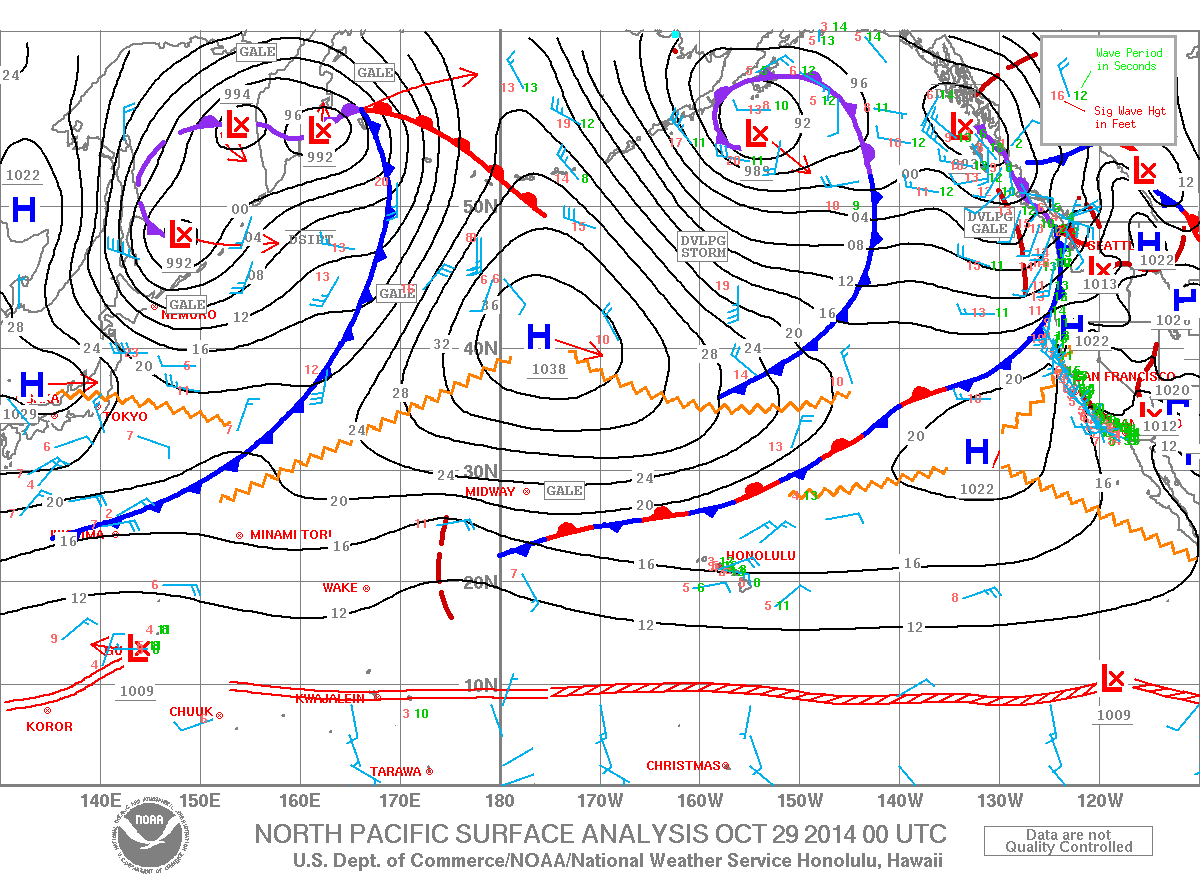
Sponsored Content


