

Malika Dudley’s Big Island Forecast (10/27/14)
**A breakdown of expected conditions specific to the Big Island is presented below in graphical form. High and low temperatures, swell, percent chance of clouds / rain and wind conditions are each depicted. All graphics are provided by the National Weather Service in Honolulu.**
Alerts
There are no alerts posted for Hawai’i County at this time.
 Today
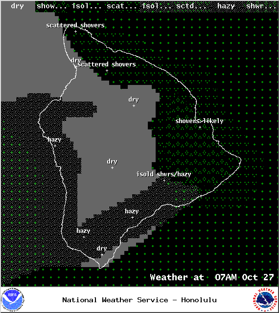
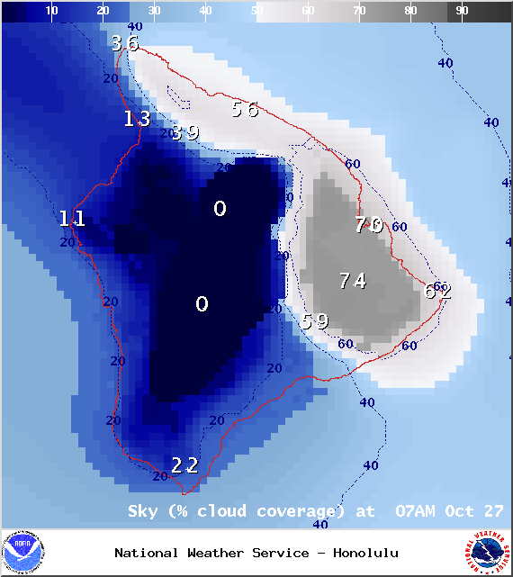
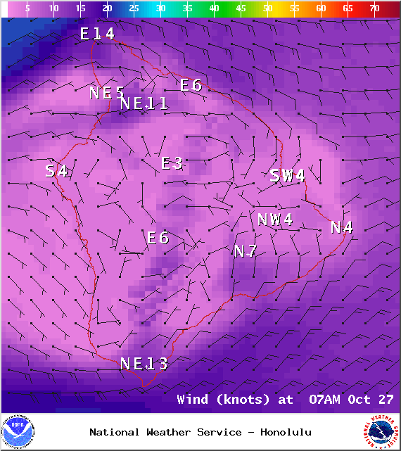
Today
High temperatures should fall in the range of 82° to 87° with cooler temperatures at higher elevations. East winds should be around 15 mph with a sea breeze developing each afternoon for the Kona side of the island, therefore, the general weather pattern will be for scattered windward and mauka showers with partly cloudy skies on the east side throughout the day. Some of those showers could be enhanced due to the remnants of an old front moving in from the east. For the west side, especially in the Hualalai area, lighter winds and hazy skies are expected with lots of morning sunshine and partly cloudy skies in the afternoon as the sea breeze kicks in. At South Point and along the Hamakua coast, winds could gust up to 30 mph in the afternoon.
Sunrise: 6:19 a.m.
Sunset: 5:49 p.m.
UV index at 8 (“very high” exposure level)
 Tonight
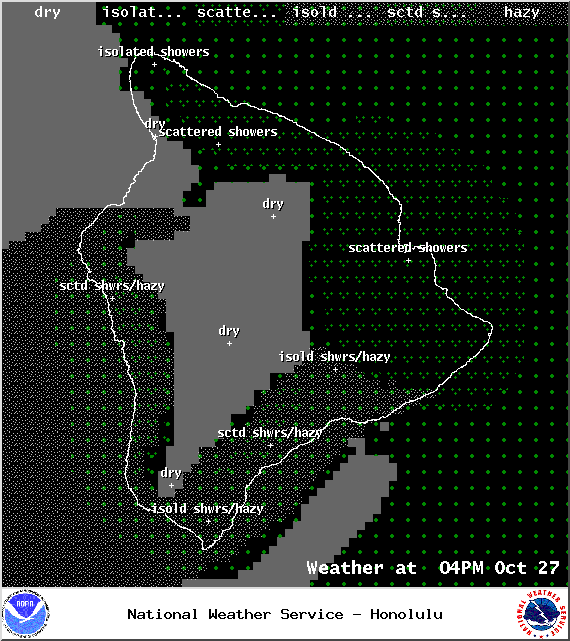
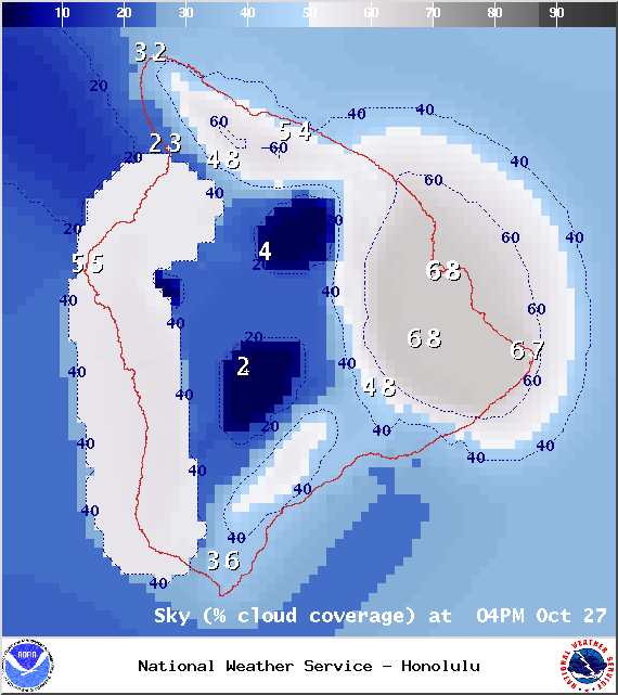
We expect mostly cloudy skies tonight with showers likely in windward and mauka areas. The Kona side will be mostly cloudy to start, then gradually clear as the land breeze takes hold. Low temperatures should fall in the range of 72° to 77° with lower temperatures expected at higher elevations.
Moonrise: 9:50 a.m.
Moonset: 9:19 p.m.
Looking Ahead
Light to moderate trades early in the week should allow local land and sea breeze conditions to develop. Later in the week, trade winds are forecasted to become breezy. Models are also showing enhanced windward and mauka showers Tuesday and Wednesday. A weak, spread out front is also expected to enhance showers Thursday night into Friday (Halloween). I’ll keep an eye on this feature and bring you the latest if anything changes. We don’t want our trick-or-treaters to get rained out! Following the front, we expect stronger winds, cooler air, and lower humidity.
 Surf & Seas
Hilo: Surf is expected to be knee to possibly shoulder high at the best breaks. A small short-period east-northeast trade swell will also start to show.
Kona: Breaks along the west side will be flat today. You could see ankle-slappers to possibly knee high waves from time to time.
South: Ankle to knee high waves early on, dropping even further in the afternoon to trace amounts.
Our current north swell (350-10°) continues to slowly fade as ANA generates a reinforcement of short-period north swell (355-15°). This one is pretty small with only knee to waist high waves expected. A slightly larger north swell is expected to slowly start building late Wednesday bringing overhead waves by Friday. Larger short period easterly swells area expected late in the week as trade winds strengthen.
 Our small south-southwest (200-190°) swell has dropped down to trace amounts. Another small boost is expected by mid-week offering knee to waist high surf, possibly bigger at the best exposures on Wednesday. After that swell fades out, surf goes quiet with not much on the horizon out of the South Pacific.
ANA is now an extratropical storm and has begun to merge with a storm south of the Aleutians. This will help to boost surf heights for north exposures late Wednesday into Thursday.
Keep in mind, surf heights are measured on the face of the wave from trough to crest. Heights vary from beach to beach, and at the same beach, from break to break.
Almanac for Hilo Airport
Maximum Temperature for today:
Normal 82°
Record 86° / Set in 1957
Minimum Temperature for today:
Normal 68°
Record 64° / Set in 1963 and tied in 2005


Sponsored Content


