The National Weather Service (NWS) briefed Hawai‘i Emergency Management Agency (HI-EMA), local emergency management and civil defense agencies, and federal and state partners Monday morning, Aug. 6, 2018, about Hurricane Hector, which has reached Category 4 strength.
Hurricane Hector. Times reported in PDT not Hawai‘i Standard Time.
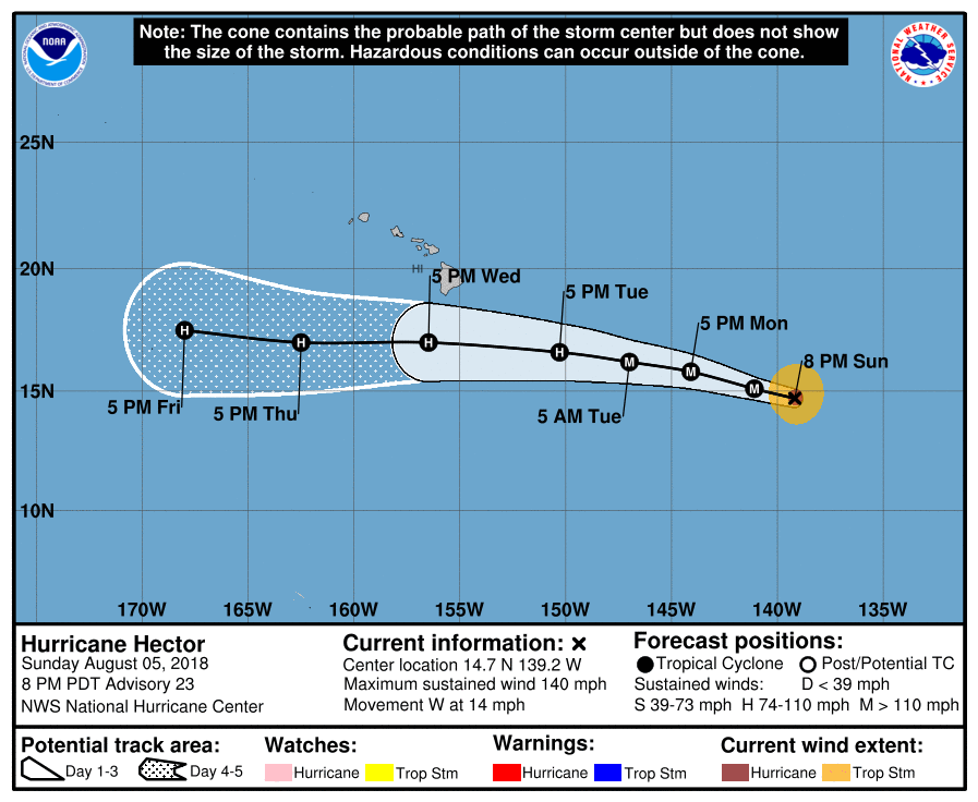
The center of the system is currently located approximately 850 miles east-southeast of Hilo and moving west at 15 mph. Forecasters expect Hector to move west-northwest for the next two days. However, the exact timing of the anticipated turn is somewhat uncertain at this stage.
High surf is expected to impact east-facing shores of Hawai‘i Island and East Maui, with heights building today through Tuesday and peaking Tuesday night. Surf may reach 15 to 20 feet.
HI-EMA and its partners continue to closely monitor the storm, and recommend the following precautions to the public as Hector remains in the Central Pacific:
ARTICLE CONTINUES BELOW AD
ARTICLE CONTINUES BELOW AD
Listen to ocean safety officials and exercise caution if entering the water as high surf messages are issued.
This comments section is a public community forum for the purpose of free expression. Although Big Island Now encourages respectful communication only, some content may be considered offensive. Please view at your own discretion. View Comments