


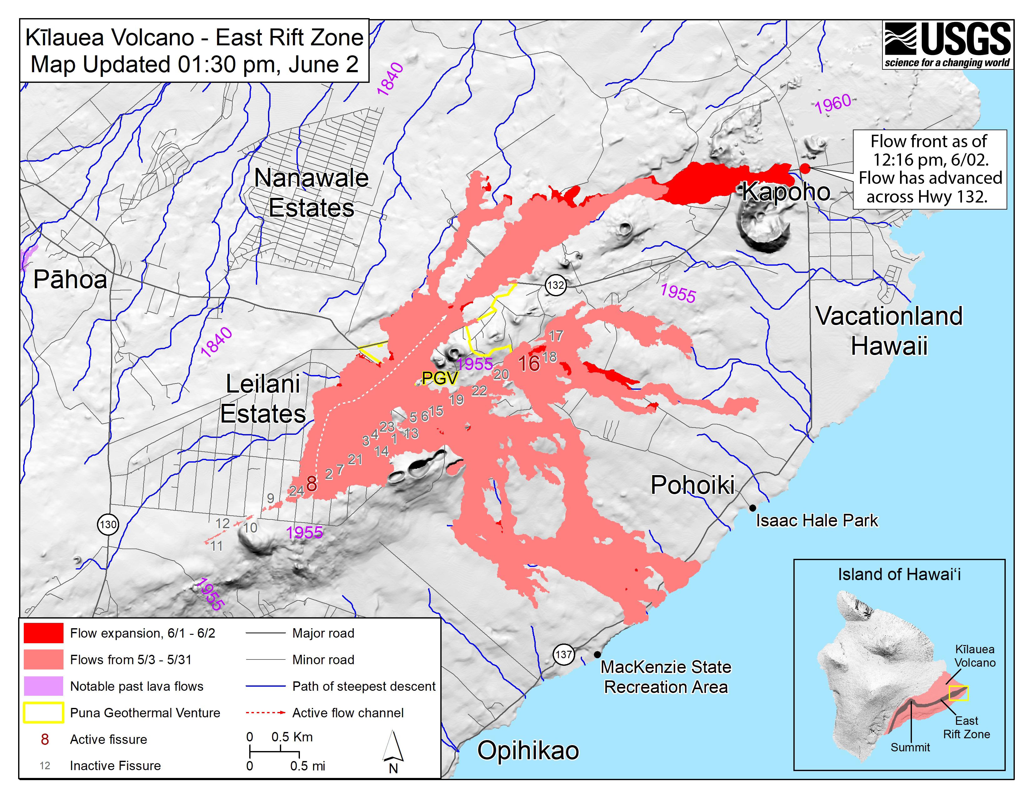
New Map Released Shows Where Lava Crossed Hwy 132
The U.S. Geological Survey released this map and these pictures of the East Rift Zone of the Big Island on Saturday, May 2, 2018.
Map as of 1:30 p.m., June 2, 2018.
Click to enlarge
Given the dynamic nature of Kīlauea’s lower East Rift Zone eruption, with changing vent locations, fissures starting and stopping, and varying rates of lava effusion, map details shown here are accurate as of the date/time noted. Shaded purple areas indicate lava flows erupted in 1840, 1955, 1960 and 2014-2015.
USGS scientists on HVO’s overflight Saturday, June 2, 2018, captured this image of the fissure 8 flow front as it advanced west along Highway 132.

Click to enlarge
Around the time of this photo, 7:15 a.m, the flow front was approximately 100 yards west of the Hwy 132/137 intersection and advancing along a broad front over 300 yards in width extending both north and south of Highway 132.
Overnight, June 1-2, fissure 8 lava fountains decreased to heights of about 164 feet.
Click to enlarge
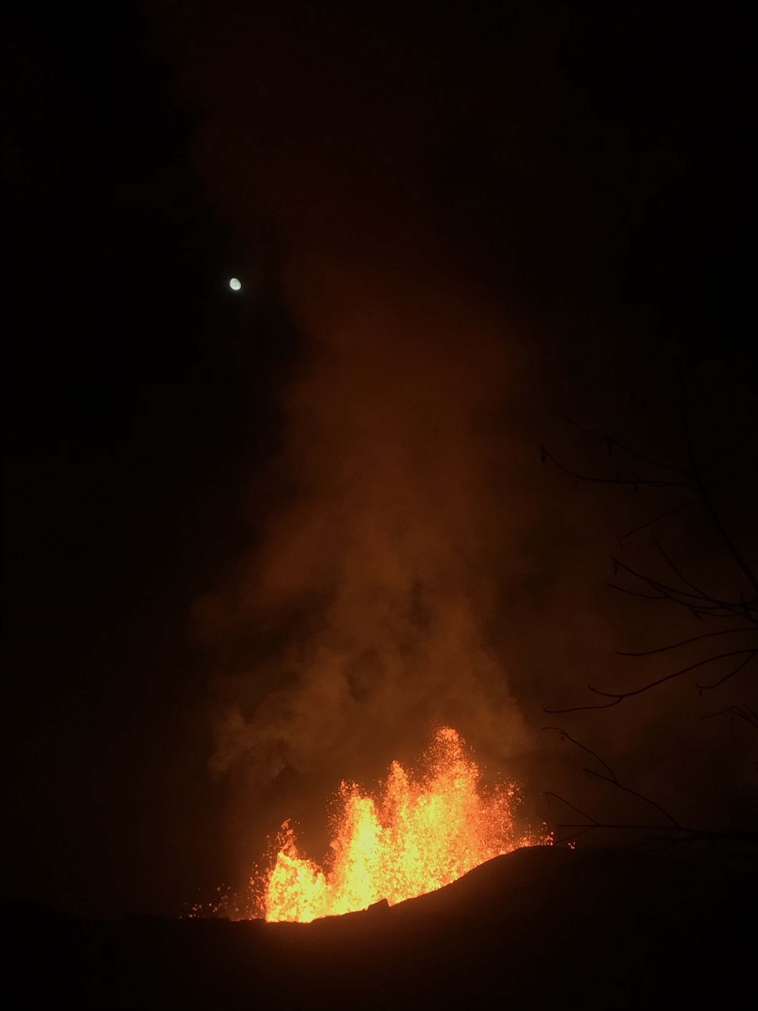
The moon can be seen in the upper left.
Northern edge of the fissure 8 flow front on the night of Friday, June 1, as it approached the intersection of Highways 132 and 137, known as “Four Corners.”
Click to enlarge
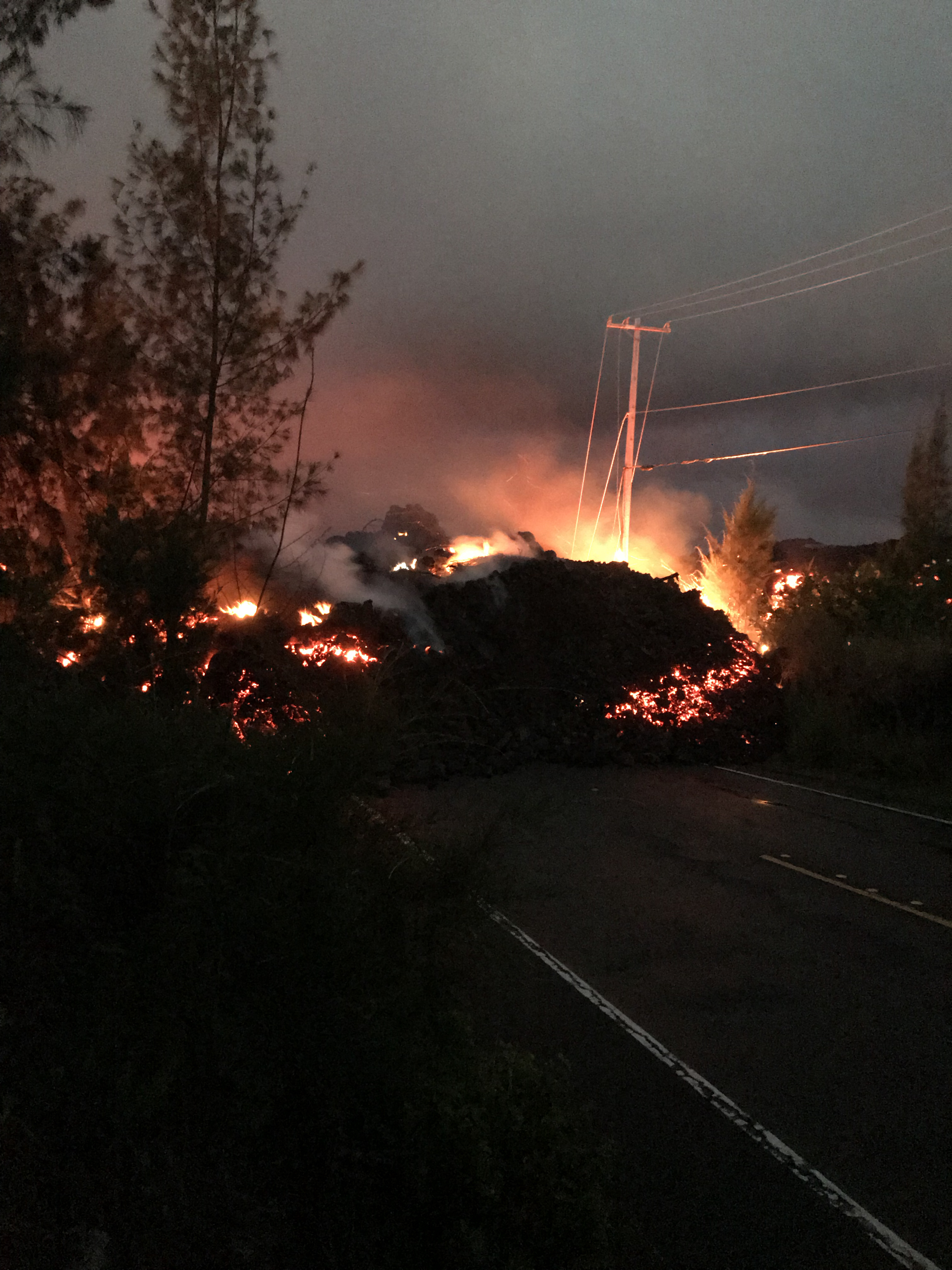
East side of the fissure 8 flow on the “lighthouse road” (east of the Four Corners intersection).

Click to enlarge
The ‘a‘ā flow was about 16 feet thick when this photo was taken around 2 p.m Saturday, June 2, 2018.
An HVO geologist documents the fissure 8 flow southeast of Four Corners (the intersection of Highways 132 and 137).
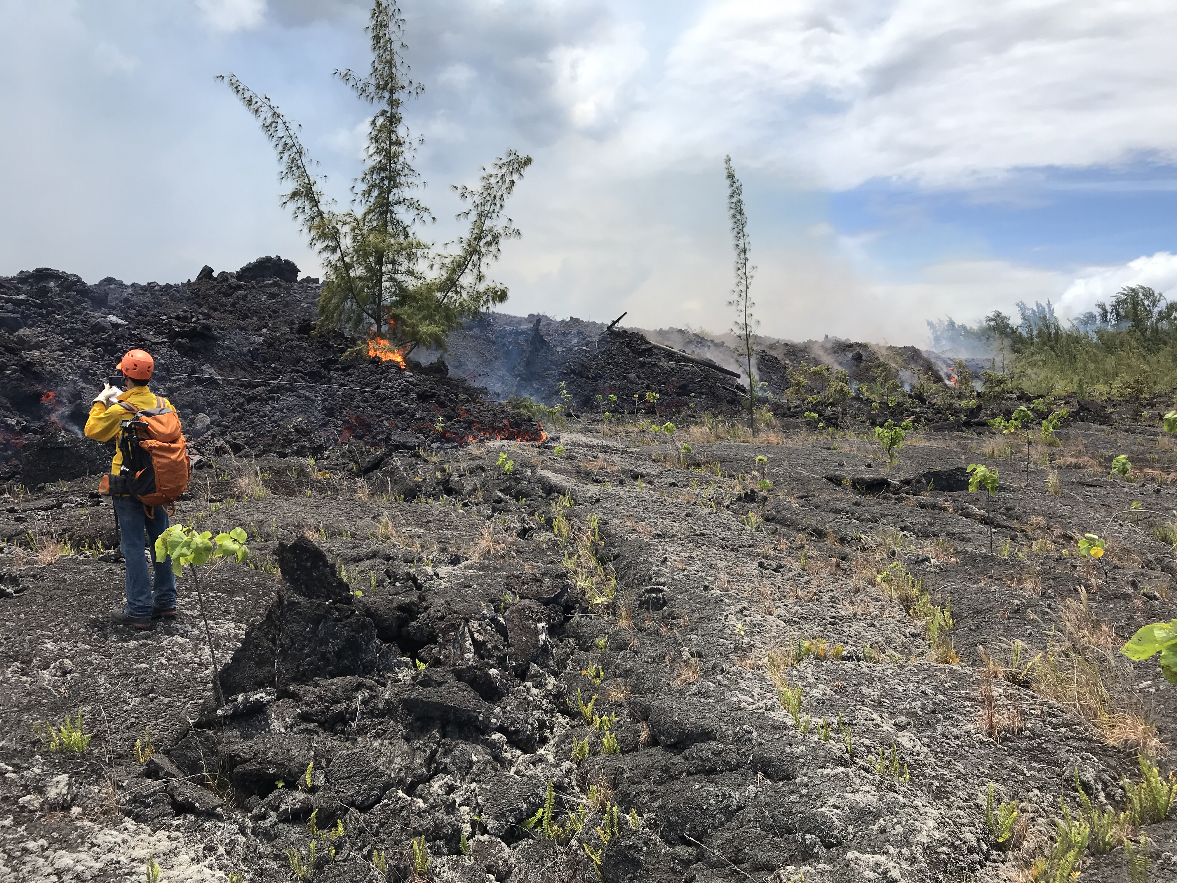
Click to enlarge
As fissure 8 lava flowed into Green Lake, the lake water boiled away, sending a white plume high into the sky—visible from afar between around 11:30 a.m. and 1:30 p.m.
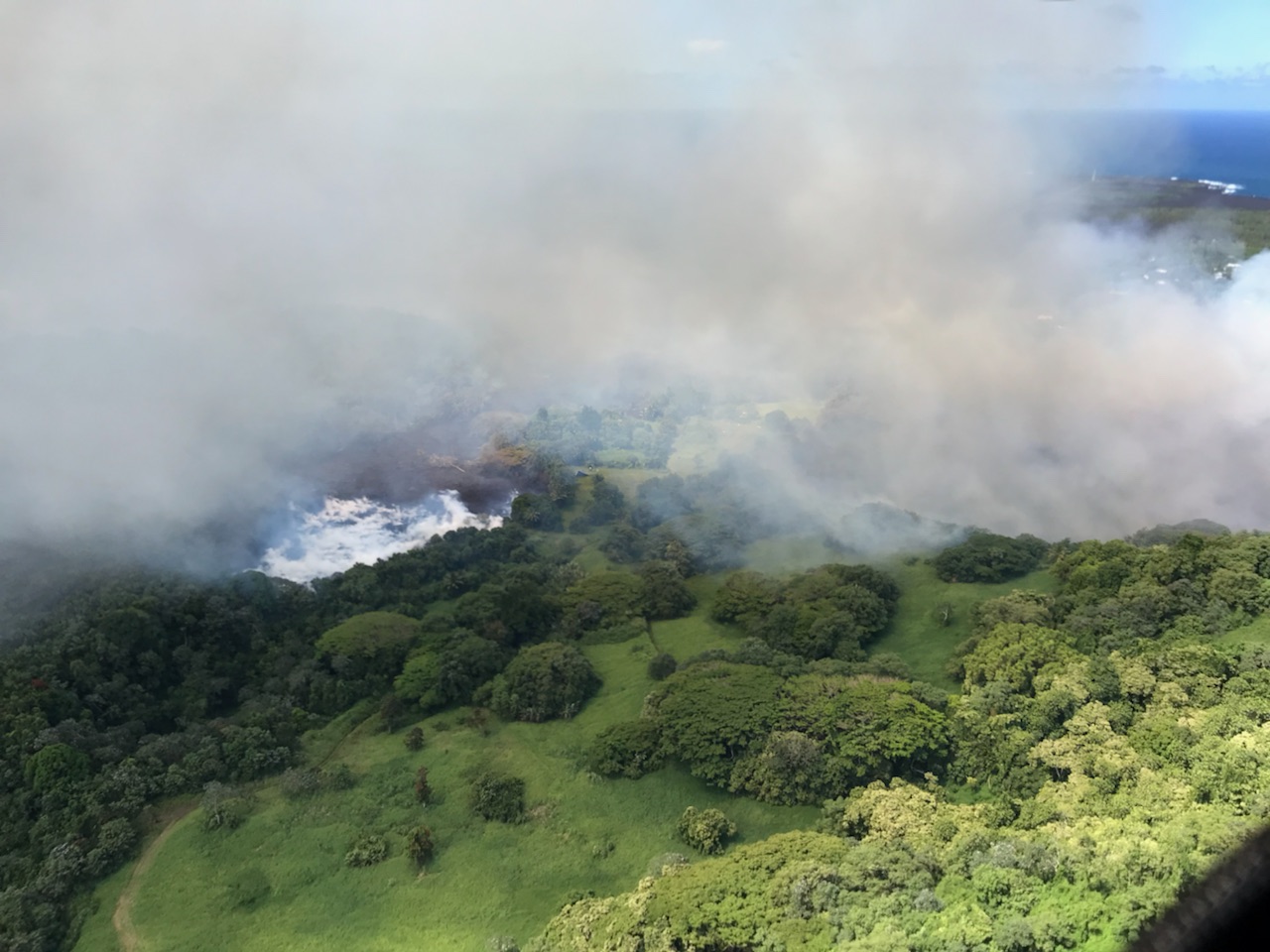
Click to enlarge
This aerial photo, taken a couple of hours later by the Hawai‘i County Fire Department, shows still-steaming lava within Green Lake, located near the intersection of Highways 132 and 137.
Sponsored Content


