Current Swell Eases, New Swell Expected
Alerts (as of 1:00 a.m.)
High Surf Advisory: North shores of Big Island through noon Tuesday.
Small Craft Advisory: Until noon Tuesday for seas 6 to 11 feet.
Wind Advisory: Until noon Tuesday for 35 to 55 mph winds gusting to 65 mph on the summits of Mauna Kea and Mauna Loa.
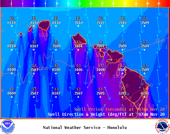
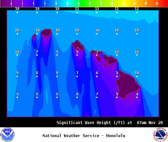
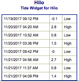
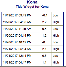
**Click directly on the images below to make them larger. Charts include: Big Island projected winds, tides, swell direction & period and expected wave heights.**
Big Island Surf Forecast
Hilo: Wave heights are expected to be overhead to double overhead today.
Kona: Wave heights are expected to be knee high or less today.
South: Wave heights are expected to be knee high or less today.
Our current northerly swell is forecast to slowly continue easing. Overlapping swells are forecast over the next week. The next swell is forecast to be a few feet larger than the current fading one and arrive Wednesday. This swell is likely going to be at warning levels for north facing shores of all exposed islands.
Small southerly swells will continue with small background swell for south facing shores.
Keep in mind, surf heights are measured on the face of the wave from trough to crest. Heights vary from beach to beach, and at the same beach, from break to break.


