

Afternoon Downpours Possible Today, Light Winds

Image: James Grenz
Alerts (as of 1:00 a.m.)
There are no weather alerts posted at this time.
**Click directly on the images below to make them larger. Charts include: Big Island high/low forecasted temperatures, projected winds, chance of cloud cover, projected localized weather conditions, vog/SO2 forecast and expected wave heights.**
Looking Ahead
Afternoon sea breeze conditions are forecast to bring pop up scattered showers over interior and leeward areas into the evening. Some could be locally heavy from time to time through Wednesday. At night, land breezes will clear out most clouds and showers. The trade winds aren’t expected back until about Thursday.
Today
We expect light and variable winds up to 10 mph with afternoon sea breezes developing. Mostly sunny skies in the morning with clouds building in the afternoon for lee and interior areas and scattered showers with the possibility of heavy downpours. Mostly cloudy skies for windward spots with scattered showers. Temperatures up to 84° to 89° and feeling warmer due to the higher heat index. Hazy skies are expected.
UV index at 9 (“very high” exposure level)
Tonight
Light and variable winds up to 10 mph with a land breeze developing at night. Clouds and showers in the evening are expected to clear as the night goes on. Low temperatures from 69° to 74°.
Our Big Island Now Weather homepage always includes daily: Sunrise | Sunset | Moonrise | Moonset | Moon Phase | Live Weather Cams | 5-day Forecast | Current Temperature & Conditions
**Click here for your detailed Big Island surf report.**
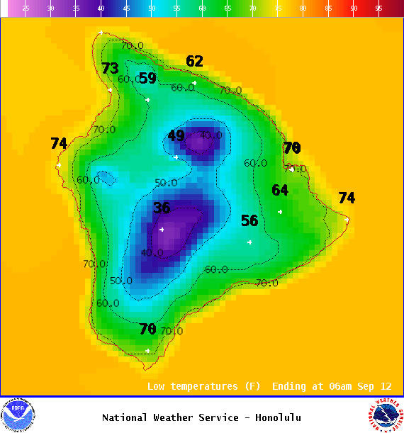
Image: NOAA
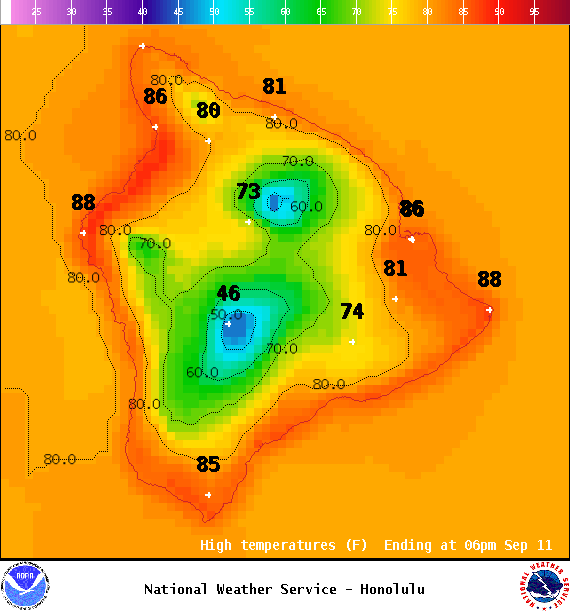
Image: NOAA
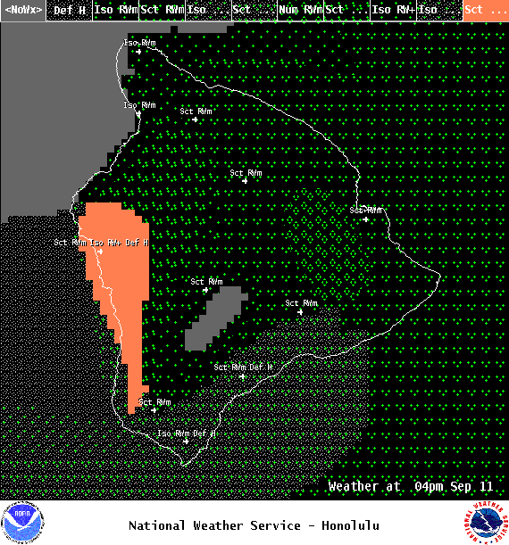
Image: NOAA
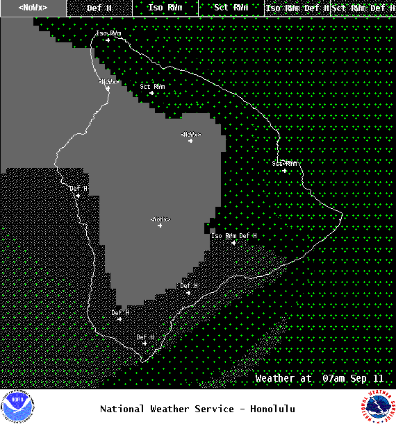
Image: NOAA

Image: NOAA
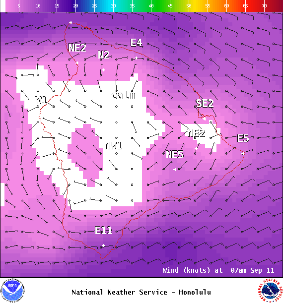
Image: NOAA
Image: NOAA

Image: NOAA
Sponsored Content


