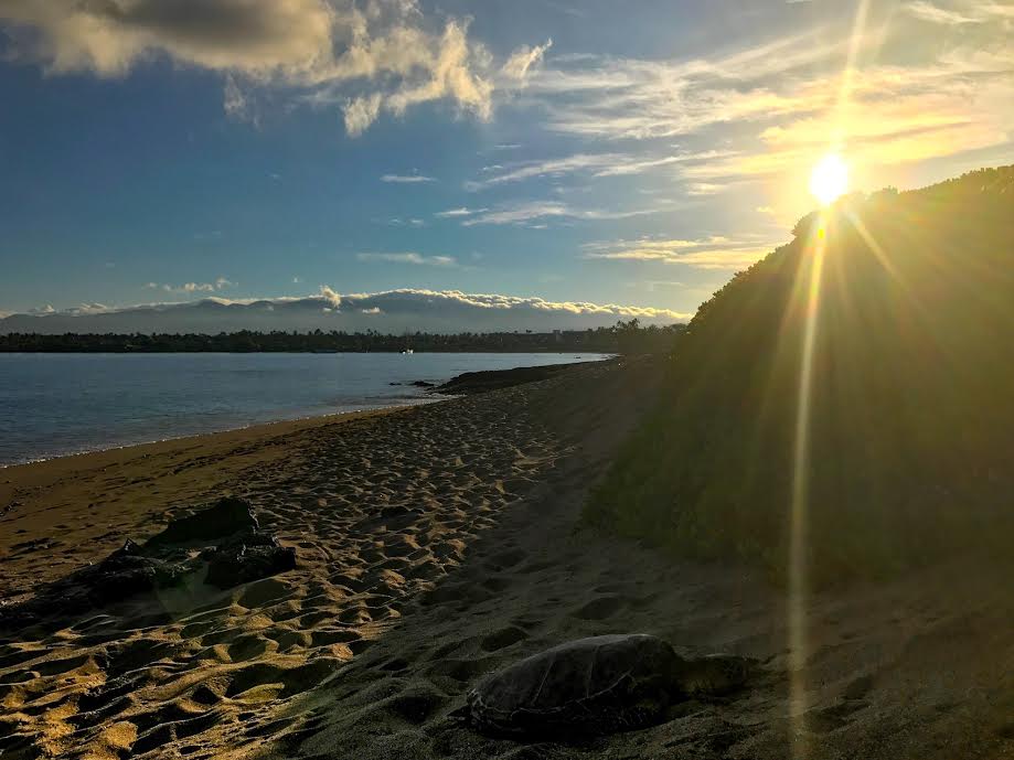
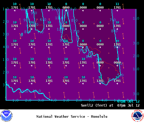
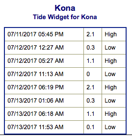
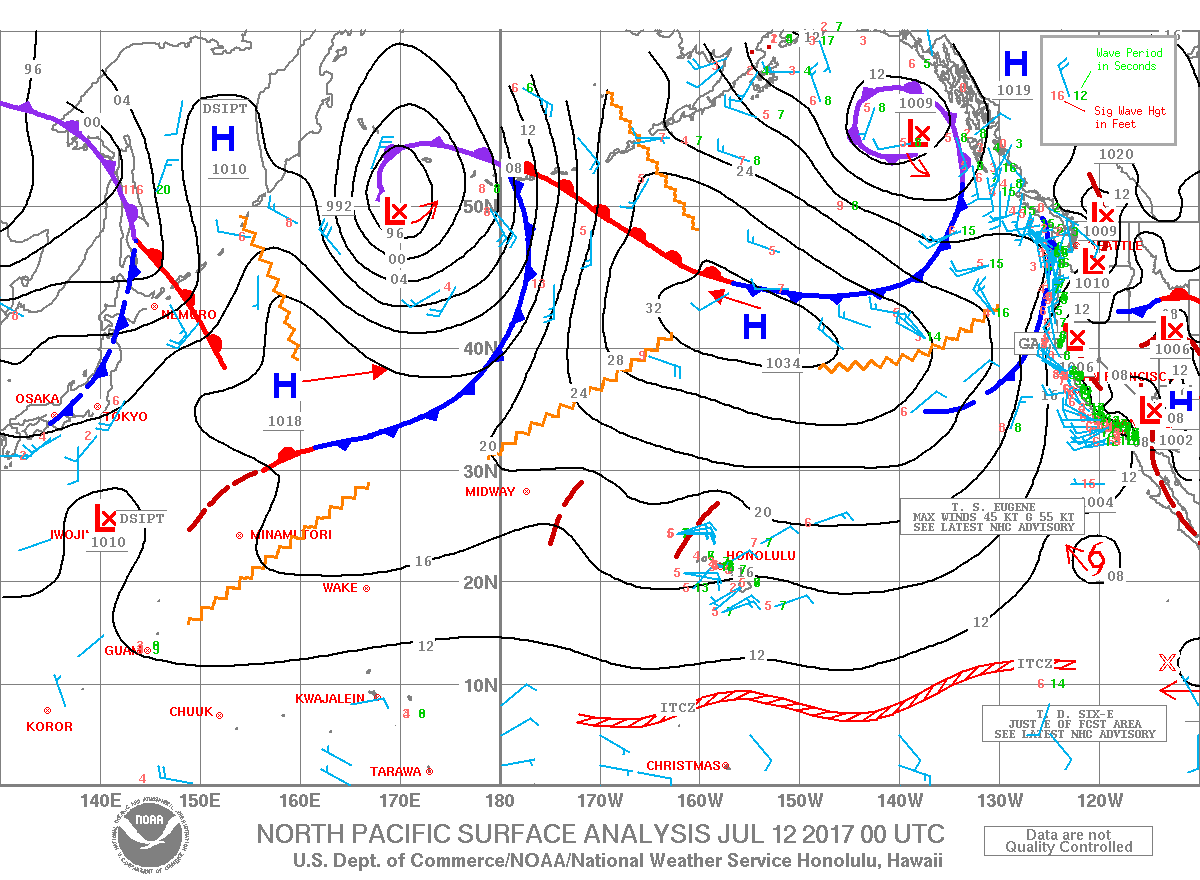
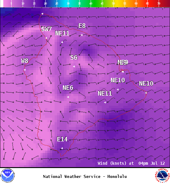
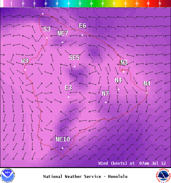
**Click directly on the images below to make them larger. Charts include: Big Island projected winds, tides, swell direction & period and expected wave heights.**
ARTICLE CONTINUES BELOW AD
ARTICLE CONTINUES BELOW AD
+
SWIPE LEFT OR RIGHT
Big Island Surf Forecast
Hilo side: Surf heights are expected to be ankle/waist high today.
ARTICLE CONTINUES BELOW AD
Kona side: Wave heights are expected to be knee/thigh high today. Flat for many Kona breaks not catching the swell.
South: Wave heights are expected to be knee/thigh high today. Best bet is South Point.
No significant swells are expected through the rest of this week. A series of minimal south swells is expected to keep wave heights near 2-4 foot faces along southern exposures. We could see a slightly bigger run of swell starting around the 19th of this month.
Small trade wind swells will continue to produce small choppy surf along east facing shores.
ARTICLE CONTINUES BELOW AD
Models are showing a small long period east swell maybe reaching the state late Wednesday night into the weekend. Produced by distant tropical system “Eugene”… Will keep an eye on it.
Keep in mind, surf heights are measured on the face of the wave from trough to crest. Heights vary from beach to beach, and at the same beach, from break to break.
This comments section is a public community forum for the purpose of free expression. Although Big Island Now encourages respectful communication only, some content may be considered offensive. Please view at your own discretion. View Comments