

NW Swell Peaks Today, SSW Swell Holds

Image: James Grenz
Alerts (as of 1:00 a.m.)
There are no weather alerts posted at this time.
**Click directly on the images below to make them larger. Charts include: Big Island projected winds, tides, swell direction & period and expected wave heights.**
Big Island Surf Forecast
Hilo side: Wave heights are forecast to be shoulder/head high today.
Kona side: Wave heights are expected to be thigh/chest high today with the best breaks getting up to shoulder high on the sets. Many Kona spots that face west or northwest won’t catch much of this energy.
South: Wave heights are expected to be waist/chest high today with the best breaks getting up to shoulder high on the sets.
Our current south-southwest is expected to hold through Friday. Yet another swell is forecast for around the 27th.
Our current northwest swell is peaking Friday before easing over the weekend. The Big Island will be heavily shadowed from this swell. Only minimal swell expected out of the NPAC for next week at this point but will keep an eye on it.
Keep in mind, surf heights are measured on the face of the wave from trough to crest. Heights vary from beach to beach, and at the same beach, from break to break.
**Click here for your detailed Big Island weather report.**
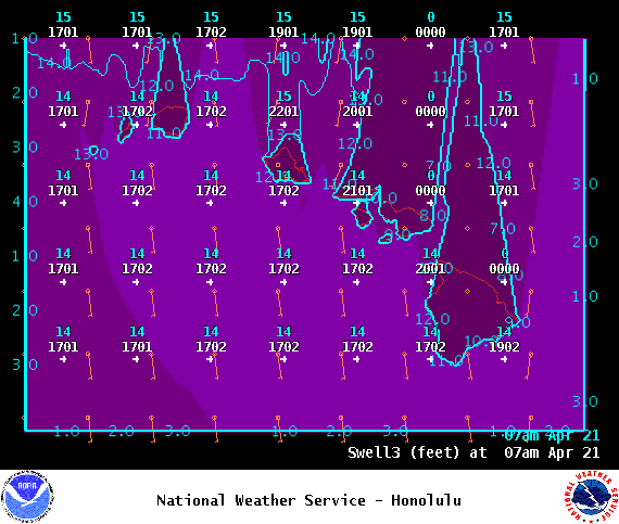
Image: NOAA
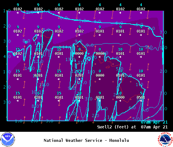
Image: NOAA
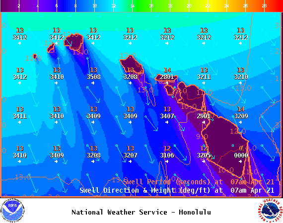
Image: NOAA

Image: NOAA
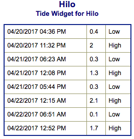
Image: NOAA
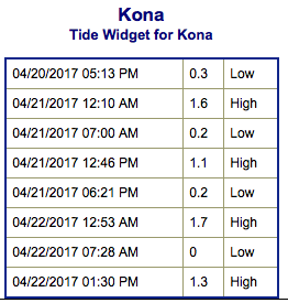
Image: NOAA

Image: NOAA
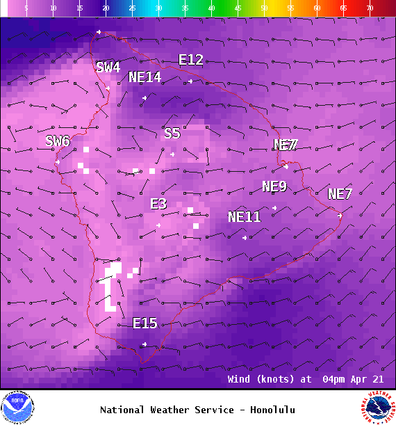
Image: NOAA
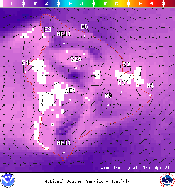
Image: NOAA
Sponsored Content


