

SSW Holds This Weekend, NW Peaks Saturday

Image: James Grenz
Alerts (as of 1:00 a.m.)
There are no weather alerts posted at this time.
**Click directly on the images below to make them larger. Charts include: Big Island projected winds, tides, swell direction & period and expected wave heights.**
Big Island Surf Forecast
Hilo side: Wave heights are forecast to be knee/shoulder high today.
Kona side: Wave heights are expected to be waist/chest high today.
South: Wave heights are expected to be waist/chest high today.
A fun south-southwest should hold through the weekend. This swell will begin to ease Sunday into early next week. Another south-southwest is forecast from the 19th to the 21st with yet another swell expected around the 27th.
A northwest swell peaks Saturday and eases Sunday into Monday. Another small northwest is forecast to fill in Tuesday.
Keep in mind, surf heights are measured on the face of the wave from trough to crest. Heights vary from beach to beach, and at the same beach, from break to break.
**Click here for your detailed Big Island weather report.**
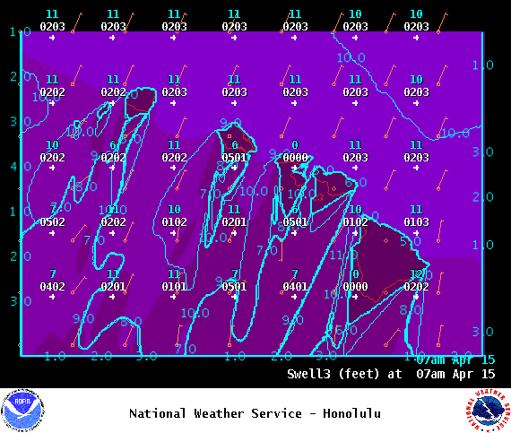
Image: NOAA
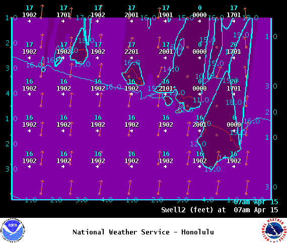
Image: NOAA
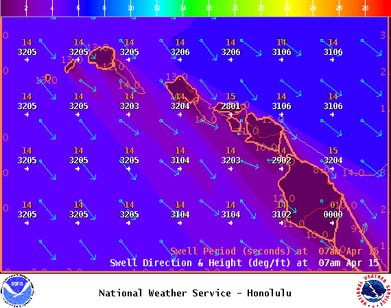
Image: NOAA

Image: NOAA
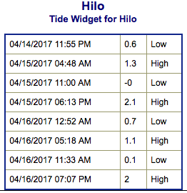
Image: NOAA
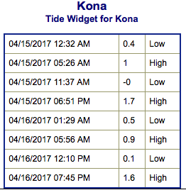
Image: NOAA
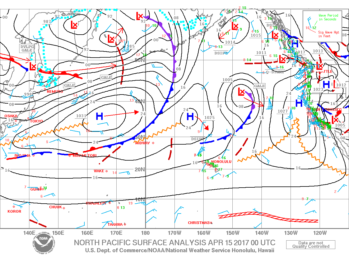
Image: NOAA
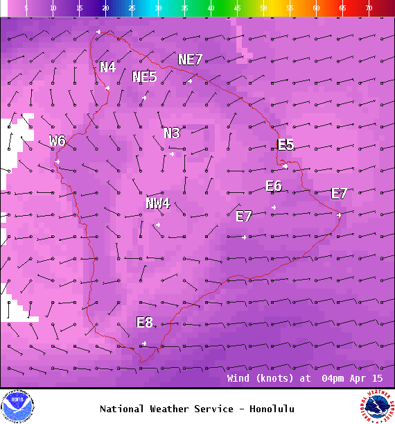
Image: NOAA
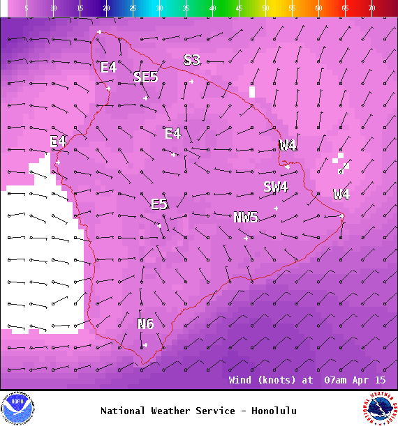
Image: NOAA
Sponsored Content


