

Morning Sunshine, Afternoon Clouds / Showers

Image: James Grenz
Alerts (as of 1:00 a.m.)
There are no weather alerts posted at this time.
**Click directly on the images below to make them larger. Charts include: Big Island high/low forecasted temperatures, projected winds, chance of cloud cover, projected localized weather conditions, vog/SO2 forecast and expected wave heights.**
Looking Ahead
A land and sea breeze weather pattern is expected during the next couple of days. Interior clouds and showers, some briefly heavy on Saturday, will develop on most islands each afternoon followed by partial clearing at night. Trade winds will rebuild late Sunday and Monday.
Today & Sunday
We expect partly cloudy skies with isolated showers in the morning and mostly cloudy skies with showers likely in the afternoon. Winds are variable around 15 mph with local sea breezes developing. High temperatures from 81° to 86°.
UV index at 12 (“extreme” exposure level)
Tonight & Sunday Night
Variable winds tonight around 15 mph with local land breezes. Showers in the evening with clearing skies as the land cools off and a land breeze develops. Low temperatures from 65° to 70°.
Our Big Island Now Weather homepage always includes daily: Sunrise | Sunset | Moonrise | Moonset | Moon Phase | Live Weather Cams | 5-day Forecast | Current Temperature & Conditions
**Click here for your detailed Big Island surf report.**
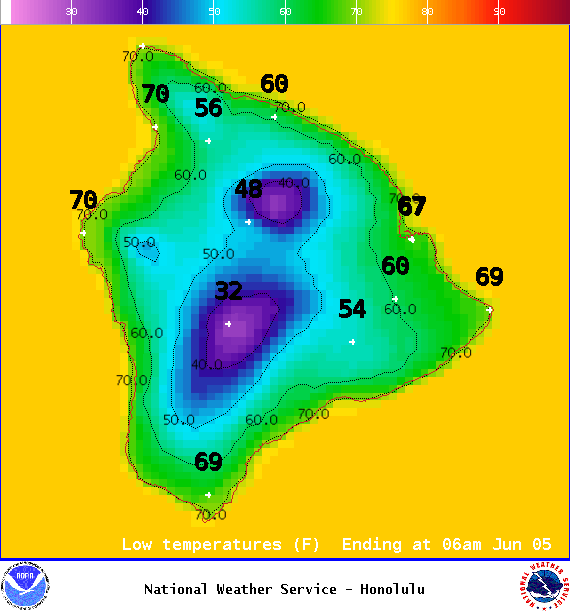
Image: NOAA / NWS
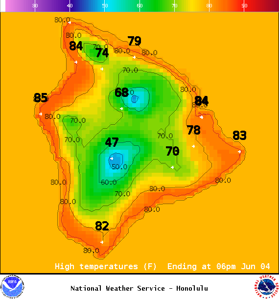
Image: NOAA / NWS
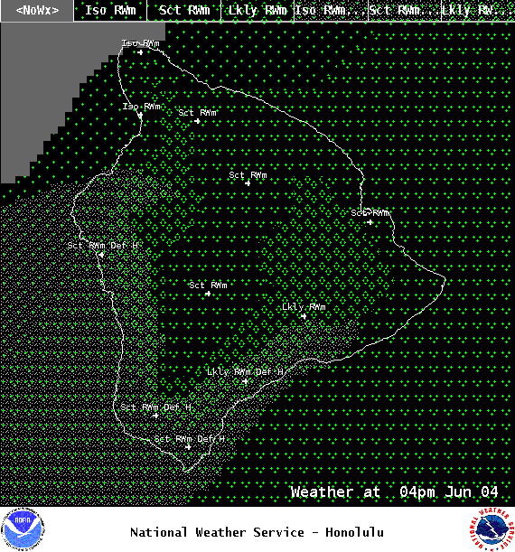
Image: NOAA / NWS
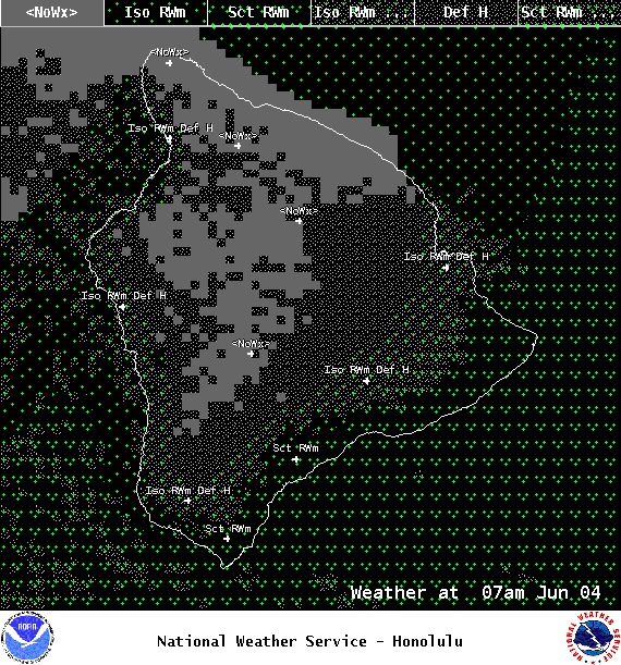
Image: NOAA / NWS
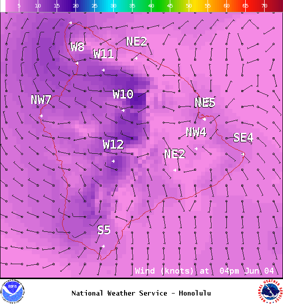
Image: NOAA / NWS
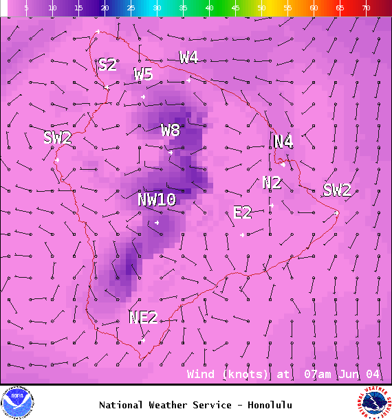
Image: NOAA / NWS
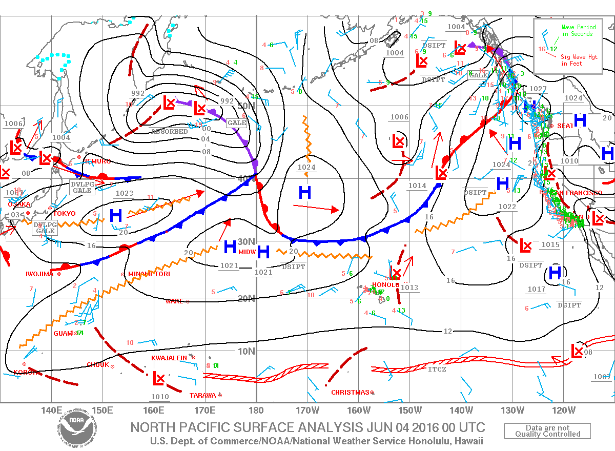
Image: NOAA / NWS
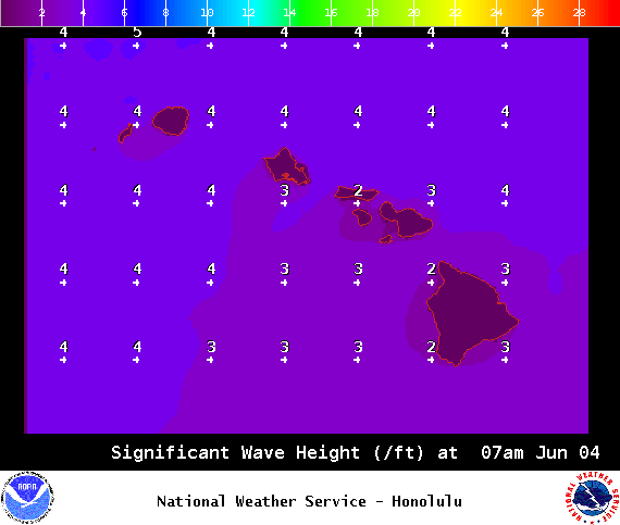
Image: NOAA / NWS
Sponsored Content


