New Swell Fills in Tomorrow
Alerts (as of 1:00 a.m.)
There are no weather alerts posted at this time.
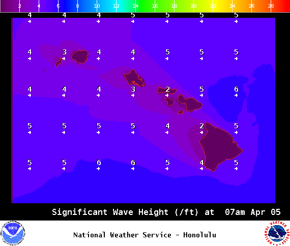
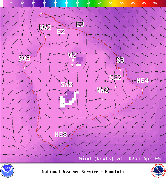
**Click directly on the images below to make them larger. Charts include: Big Island projected winds, tides, swell direction & period and expected wave heights.**
Hilo side: Wave heights for spots exposed to the swell are expected to be shoulder high today. Smaller for spots without direct exposure to the swell.
Kona side: Wave heights are expected to be knee/thigh high today.
South: Wave heights are expected to be waist high or less today. Spots with exposure to the wind generated waves could be bigger.
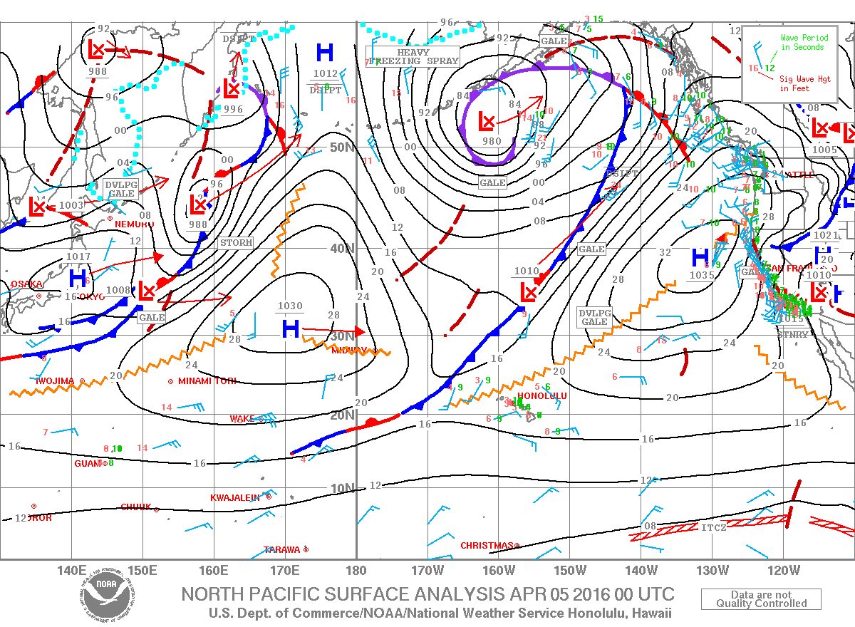
 Not much expected out of the SPAC anytime soon. Maybe some rideable waves around April 9th.
Our current northwest swell is down to leftovers today. Models are showing another northwest swell moving in Wednesday and holding steady through Thursday. Friday the swell should start to ease and shift. Another swell is possible around April 10th.
Keep in mind, surf heights are measured on the face of the wave from trough to crest. Heights vary from beach to beach, and at the same beach, from break to break.
Sponsored Content
Comments


