A Small Craft Advisory is posted for all Big Island coastal waters and the ʻAlenuihāhā channel through 7 p.m. Monday for northeast winds up to 25 knots and seas up to 13 feet.
A High Surf Advisory is posted through 7 p.m. Monday morning for 12 to 16 foot faces for north facing shores of the Big Island.
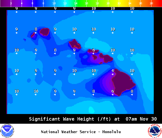
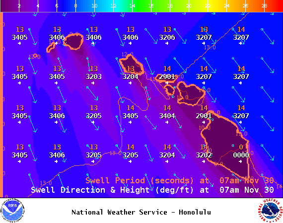
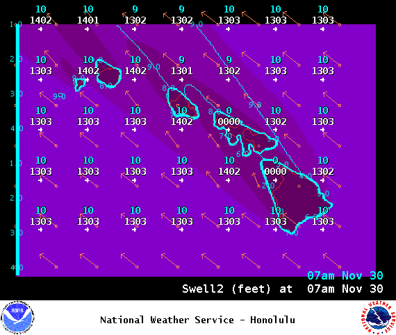
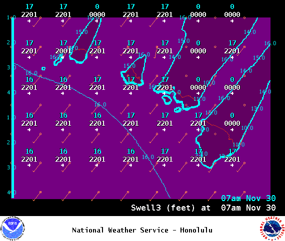
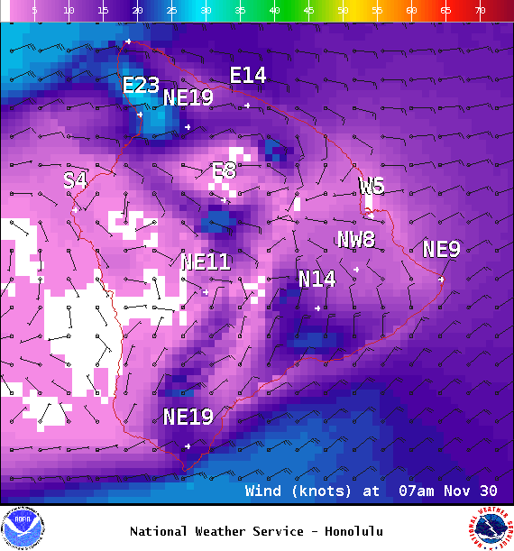
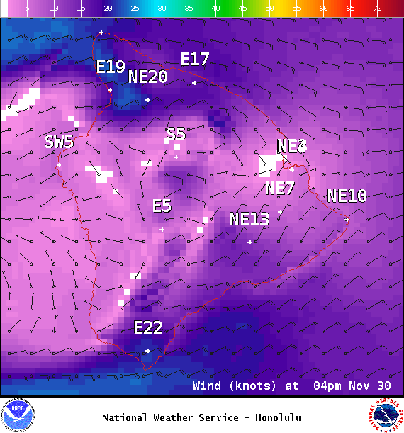
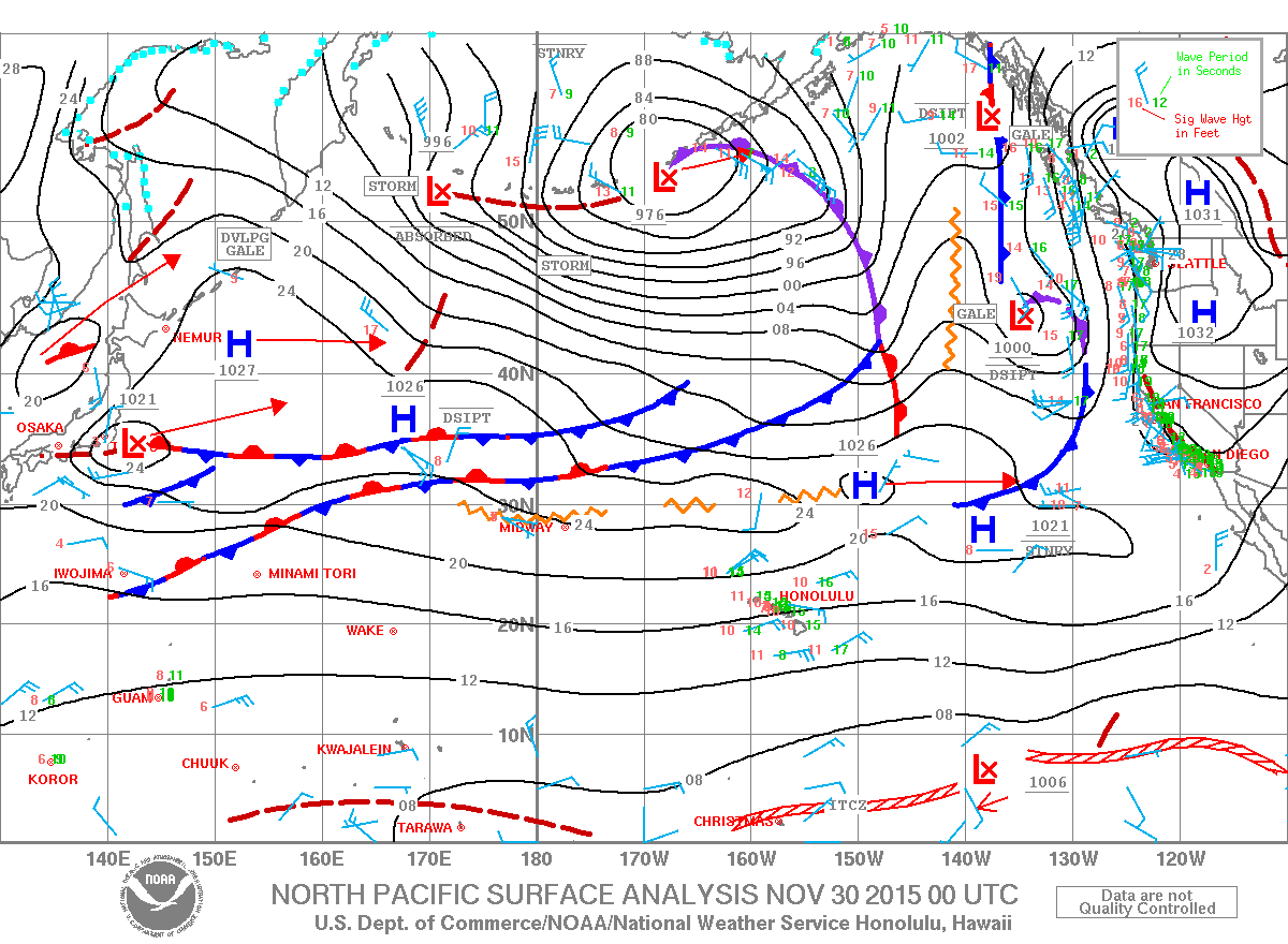
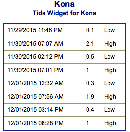
**Click directly on the images below to make them larger. Charts include: Big Island projected winds, tides, swell direction & period and expected wave heights.**
ARTICLE CONTINUES BELOW AD
ARTICLE CONTINUES BELOW AD
+
SWIPE LEFT OR RIGHT
Big Island Surf Forecast
Hilo side: Wave heights are expected chest/head high today with the best breaks getting overhead from time to time on the sets early in the day.
ARTICLE CONTINUES BELOW AD
Kona side: Wave heights knee/thigh high today.
South: Most breaks are knee high or less. Breaks open to the trade swell could still get up to waist/shoulder high.
Our current northwest swell is expected to hold through the morning before beginning a steady fading trend. A reinforcing northwest swell is expected to arrive late Tuesday, and then peak on Wednesday. This swell could once again bring advisory level surf to exposed shores. An even larger northwest swell is possible for the next weekend, which could bring surf to warning levels.
Our current south-southwest is mainly leftovers today.
ARTICLE CONTINUES BELOW AD
Trade swell continues but it’s bumpy and sloppy for most spots.
Keep in mind, surf heights are measured on the face of the wave from trough to crest. Heights vary from beach to beach, and at the same beach, from break to break.
This comments section is a public community forum for the purpose of free expression. Although Big Island Now encourages respectful communication only, some content may be considered offensive. Please view at your own discretion. View Comments


 Big Island Surf Forecast
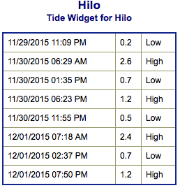 Our current northwest swell is expected to hold through the morning before beginning a steady fading trend. A reinforcing northwest swell is expected to arrive late Tuesday, and then peak on Wednesday. This swell could once again bring advisory level surf to exposed shores. An even larger northwest swell is possible for the next weekend, which could bring surf to warning levels.