

Showers Continue Today, Possible Thunderstorms
Alerts
A Flash Flood Watch is posted through Friday night for an area of moisture moving over the state. Locally heavy rainfall could lead to flash flooding. The highest threat of flooding exists for the Puna, Ka’u and Hilo districts. Flood Advisories and Warnings could pop up if conditions warrant. The chance of flooding will diminish Friday night at the moisture moves west of the Big Island.
A Small Craft Advisory is posted for most Big Island coastal waters and the ʻAlenuihāhā channel through 6 p.m. Friday for east to southeast winds up to 25 knots and seas up to 9 feet.
Check our breaking news section for any urgent weather alerts.
**Click directly on the images below to make them larger. Charts include: Big Island high/low forecasted temperatures, projected winds, chance of cloud cover, projected localized weather conditions, vog/SO2 forecast and expected wave heights.**
Looking Ahead
Deep moisture moving over the islands from the southeast will bring an increased threat of heavy rainfall through the weekend. East winds will turn southeast Friday, and then from the south over the weekend. A surface low forming near Kauai Friday will shift the majority of heavy rain to Kauai and Oahu Friday night and remain over the western islands through the weekend. Unsettled wet weather will continue into early next week before trade winds return by midweek.
Today
Today mostly cloudy skies are expected. Showers are likely for windward spots with a slight chance of thunderstorms. Leeward spots will cloudy with scattered showers. High temperatures from 80° to 86°. Northeast winds are forecast around 5 to 20 mph.
UV index at 5 (“moderate” exposure level)
Tonight
Northeast winds are expected in the evening from 5 to 20 mph. Low temperatures from 74° to 79°. Mostly cloudy skies are expected in the evening with showers likely for windward spots and a slight chance of thunderstorms. Leeward spots should be cloudy with scattered showers.
Our Big Island Now Weather homepage always includes daily: Sunrise | Sunset | Moonrise | Moonset | Moon Phase | Live Weather Cams | 5-day Forecast | Current Temperature & Conditions
**Click here for your detailed Big Island surf report.**
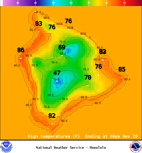
Image: NOAA / NWS
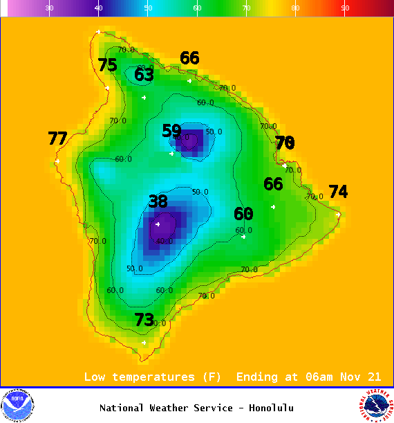
Image: NOAA / NWS
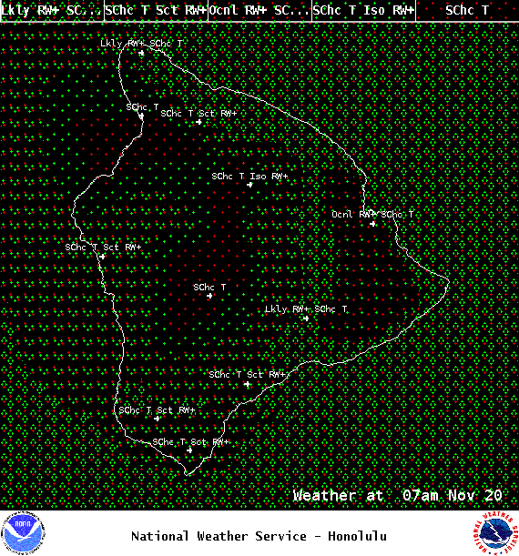
Image: NOAA / NWS
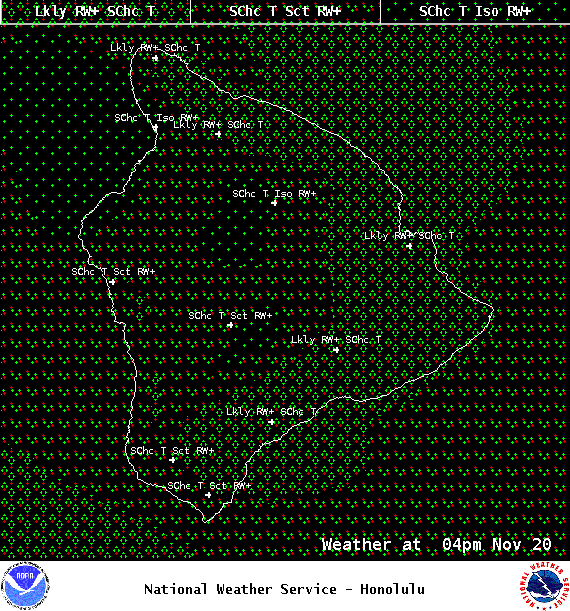
Image: NOAA / NWS
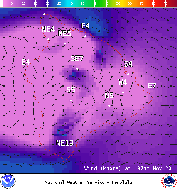
Image: NOAA / NWS
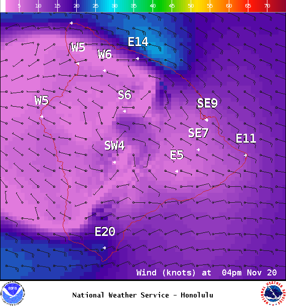
Image: NOAA / NWS
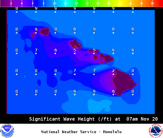
Image: NOAA / NWS
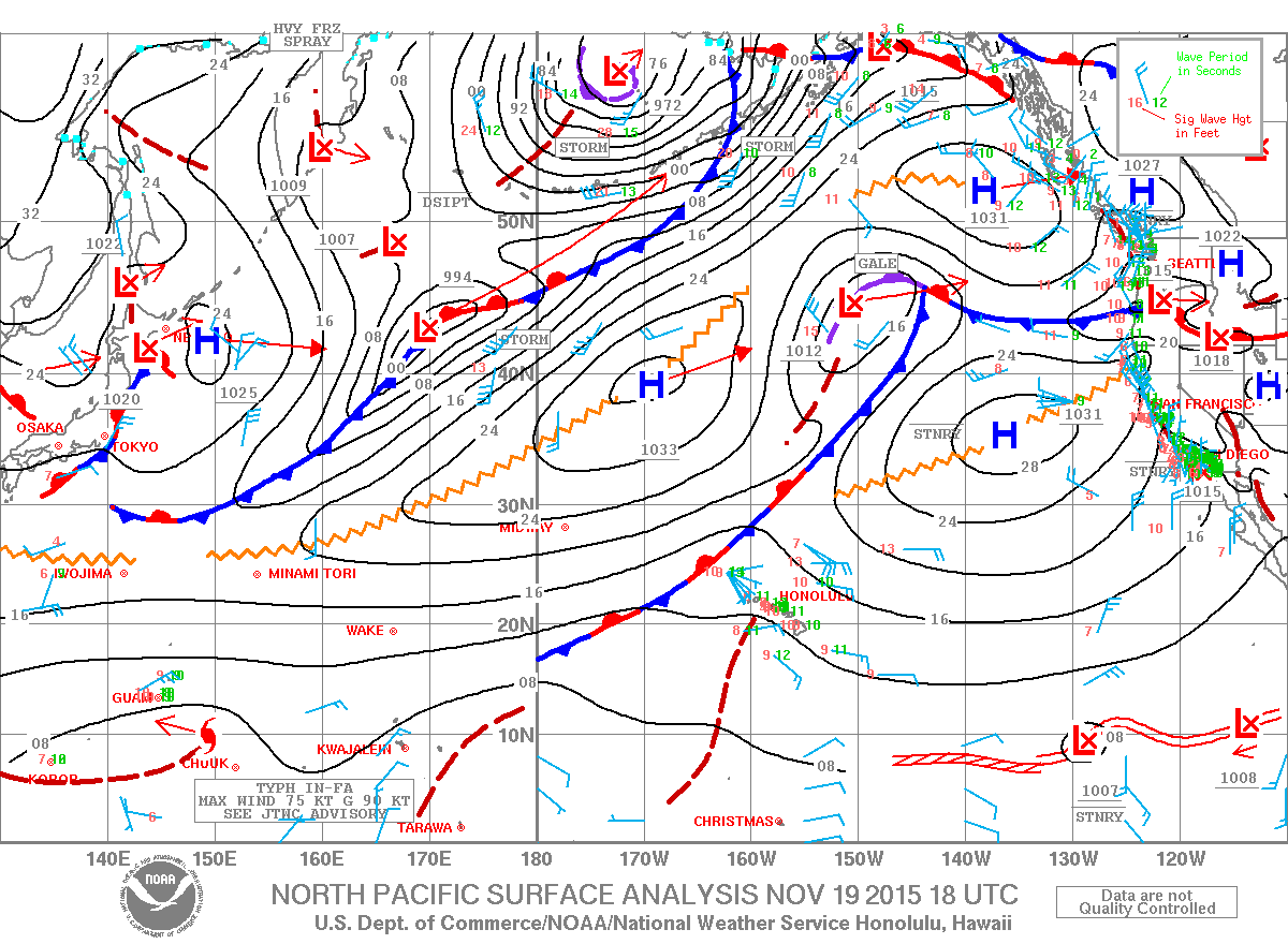
Image: NOAA / NWS
Sponsored Content


