

Heavy Rainfall Possible This Evening
Alerts
A Tropical Storm Watch is in effect until further notice. A Tropical Storm Watch means that tropical storm conditions are possible within the next 48 hours somewhere within the specified areas. A watch is typically issued before the possible arrival of tropical storm force winds which make continuing outside preparations dangerous. A watch is the time for you to prepare.
A Hydrologic Outlook has been issued by the National Weather Service. Heavy rain and flash flooding are possible Wednesday and Thursday. The latest forecast for tropical storm Guillermo continues to bring the system over the island chain later this week. Abundant moisture drawn into the circulation will bring the potential for heavy rainfall and flash flooding.
A Tropical Storm Warning is in effect for offshore waters beyond 40 nm and out to 240 nm.
**Click directly on the images below to make them larger. Charts include: Big Island high/low forecasted temperatures, projected winds, chance of cloud cover, projected localized weather conditions, vog/SO2 forecast and expected wave heights.**
Today
We expect high temperatures from 85° to 90°. Variable winds are expected up to 15 mph. Partly sunny skies are forecasted for windward areas with scattered showers. Leeward spots should be mostly sunny in the morning then become partly sunny by afternoon. Hazy skies are expected.
UV index at 13 (“extreme” exposure level)
Tonight
Mostly cloudy skies are expected with showers likely in the evening, then frequent showers after midnight. Leeward spots should be partly cloudy then become mostly cloudy as the night goes on. Locally heavy rainfall is possible after midnight. Variable winds are forecasted up to 15 mph. Low temperatures from 73° to 78° are expected.
Looking Ahead
The trade winds will remain light to moderate through Tuesday with just a few passing showers expected. Tropical storm Guillermo is forecast to pass near the eastern part of the island chain on Wednesday, then continue towards the western part of the island chain on Thursday. A moderate to locally strong trade wind flow will return Friday and into the weekend.
Guillermo Update
The latest on Guillermo will be posted each morning and the same link will be updated throughout the day. Our hurricane tracker is also up and running!
Our Big Island Now Weather homepage always includes daily: Sunrise | Sunset | Moonrise | Moonset | Moon Phase | Live Weather Cams | 5-day Forecast | Current Temperature & Conditions
**Click here for your detailed Big Island surf report.**
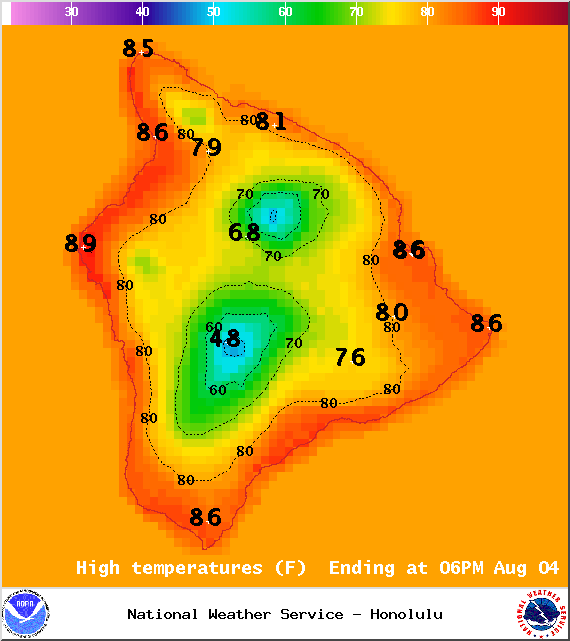
Image: NWS / NOAA
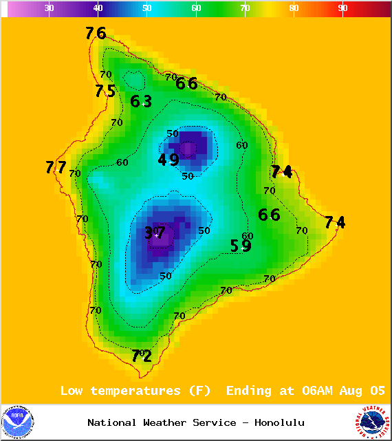
Image: NWS / NOAA
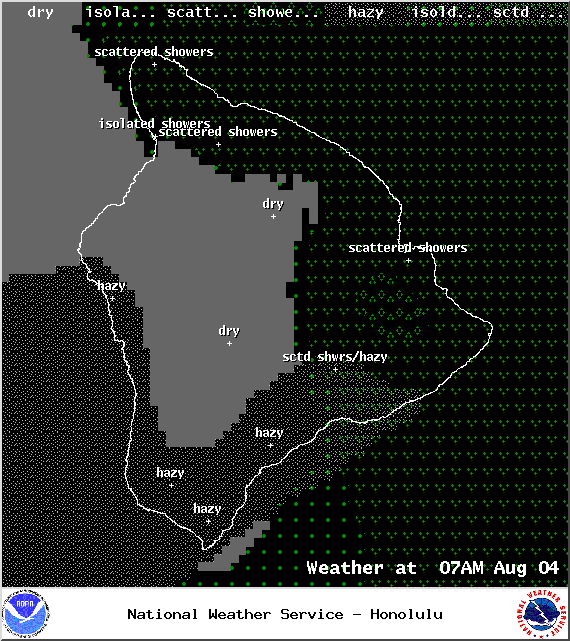
Image: NWS / NOAA
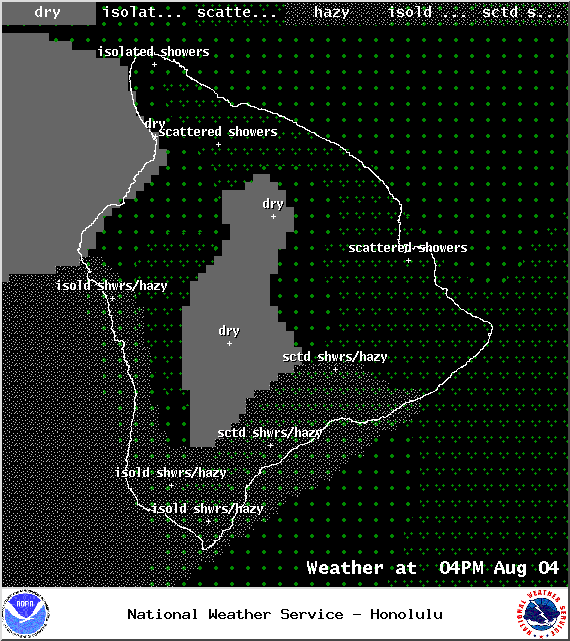
Image: NWS / NOAA
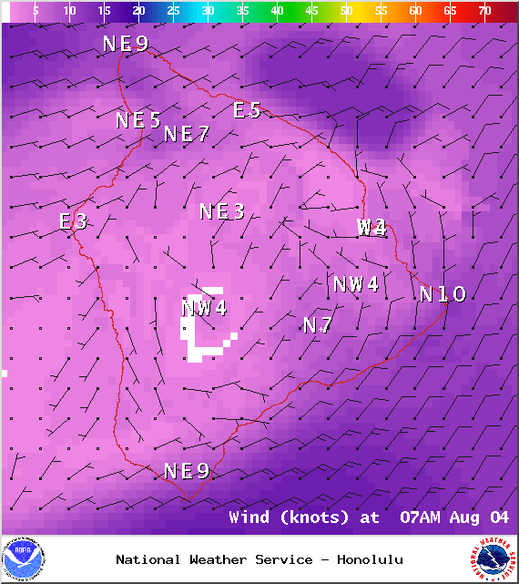
Image: NWS / NOAA
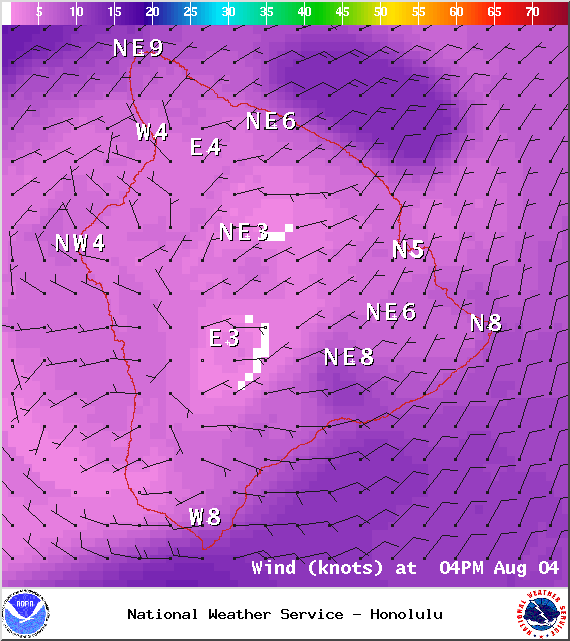
Image: NWS / NOAA
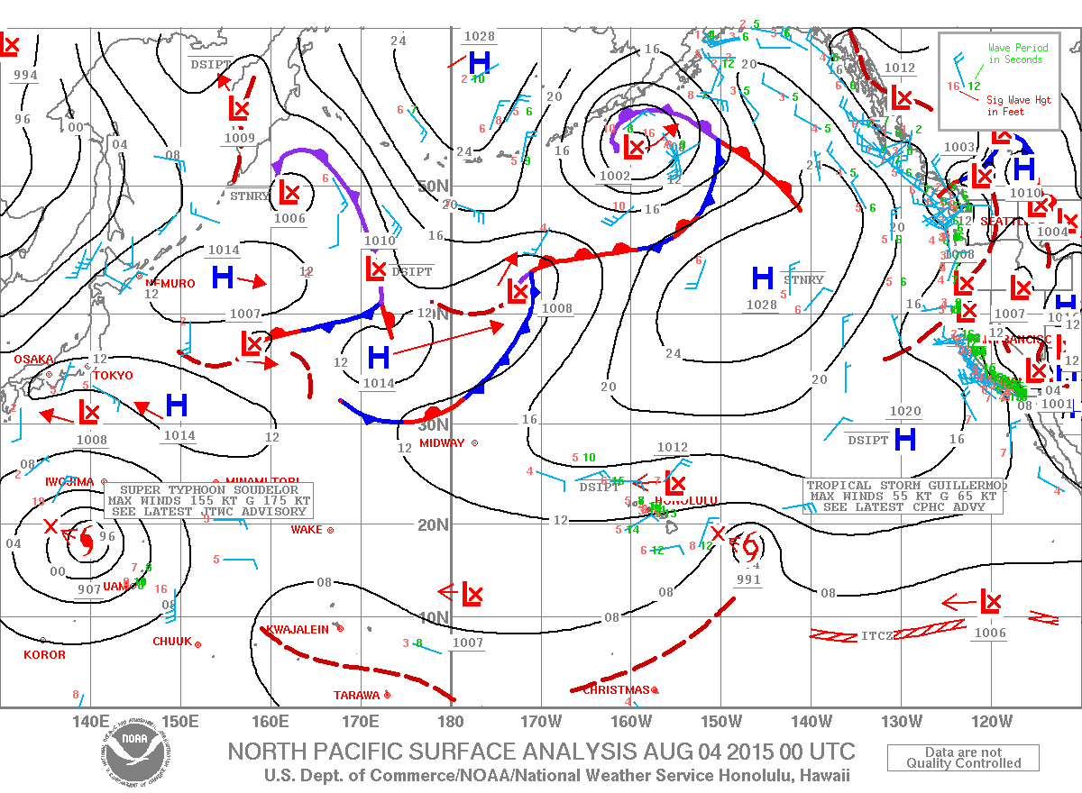
Image: NWS / NOAA
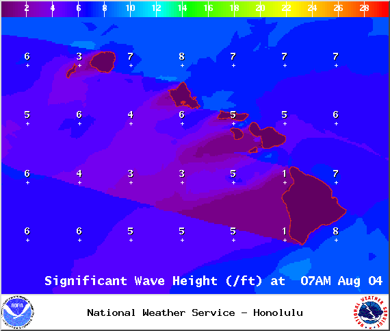
Image: NWS / NOAA
Sponsored Content


