

Update on Guillermo, Weekend Weather Forecast
Alerts
A Small Craft Advisory is in effect for the ʻAlenuihāhā channel as well as waters to the west and south of the Big Island through 6:00 a.m. Sunday. East winds up to 25 knots are expected with rough seas up to 11 feet.
**Click directly on the images below to make them larger. Charts include: Big Island high/low forecasted temperatures, projected winds, chance of cloud cover, projected localized weather conditions, vog/SO2 forecast and expected wave heights.**
Today
We expect high temperatures from 84° to 89°. Northeast winds are expected from 15 to 20 mph with higher gusts. Mostly cloudy skies are forecasted for windward areas with scattered showers. For leeward areas we expect a partly cloudy morning and afternoon clouds with isolated showers.
UV index at 12 (“extreme” exposure level)
Tonight
For leeward areas, mostly cloudy skies are expected tonight with isolated showers in the evening and showers likely after midnight. Windward spots are mostly cloudy and frequent showers are expected. Northeast winds are forecasted around 15 mph. Low temperatures from 73° to 78° are expected.
Looking Ahead
Moderate trades will continue through the rest of the weekend and into Monday. Showers will increase as moisture associated with former tropical depression 8°E reaches the islands during the next couple of days. The forecast for next week will be highly dependent on the eventual track of hurricane Guillermo.
Hurricane Guillermo Update
GUILLERMO STATS (8 a.m. 8/1/15)
Category 2 Hurricane
Maximum sustained winds: 105 mph
Hurricane force winds extend 25 miles from the center
Tropical storm force winds extend 140 miles from the center
Moving W at 14 mph
1140 miles from Hilo
Storm track and intensity: Guillermo is not looking as impressive on satellite this morning. Yesterday we had a hint of eye but today it looks like the system has already reached its peak and is on a downward trend with regards to intensity as well as forward motion. The NHC anticipates the storm will remain steady over the next 12 hours or so then begin to gradually weaken. By the time the system gets near the Hawaiian Islands we expect it to be a tropical storm.
Weather models are not in agreement as to where the system will end up going. One model shows Guillermo going north of the islands and the other brings it to the south or near the islands.Because the track is so uncertain we cannot say for sure what the effects will be to the Hawaiian Islands and will continue to keep a close eye on the situation.
**Remember: Tropical systems like these are very unpredictable. We always hope for the best but prepare for it just in case. It’s always best to prepare now.**
Our Big Island Now Weather homepage always includes daily: Sunrise | Sunset | Moonrise | Moonset | Moon Phase | Live Weather Cams | 5-day Forecast | Current Temperature & Conditions
**Click here for your detailed Big Island surf report.**
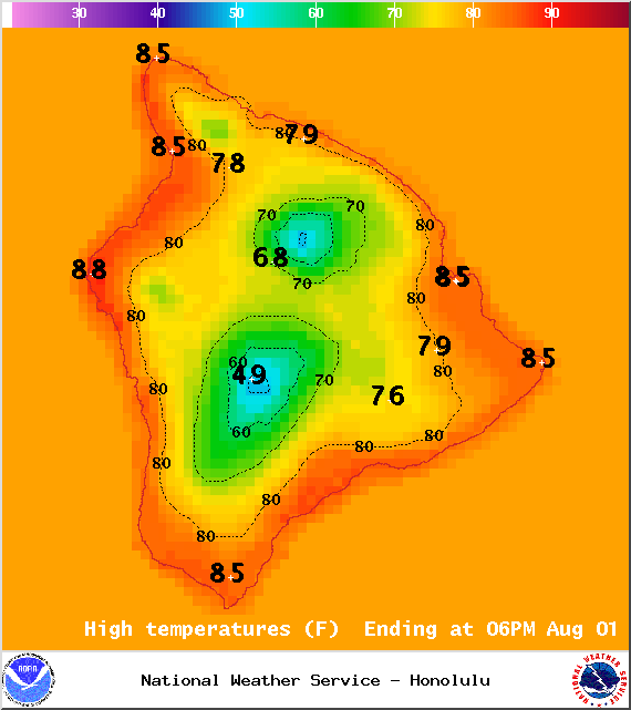
Image: NOAA /NWS
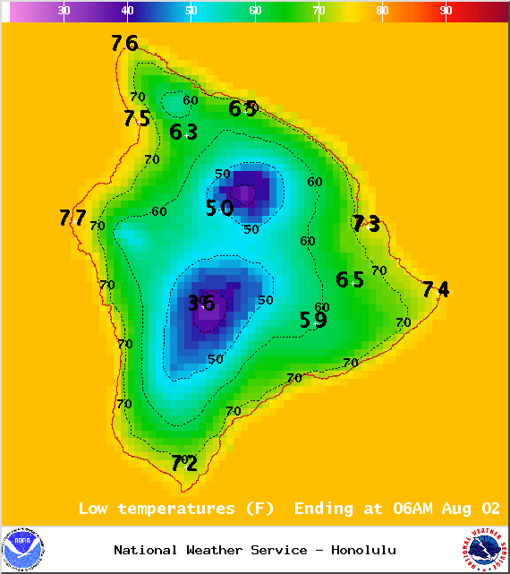
Image: NOAA /NWS
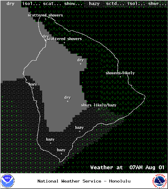
Image: NOAA /NWS
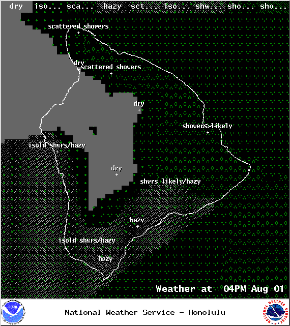
Image: NOAA /NWS
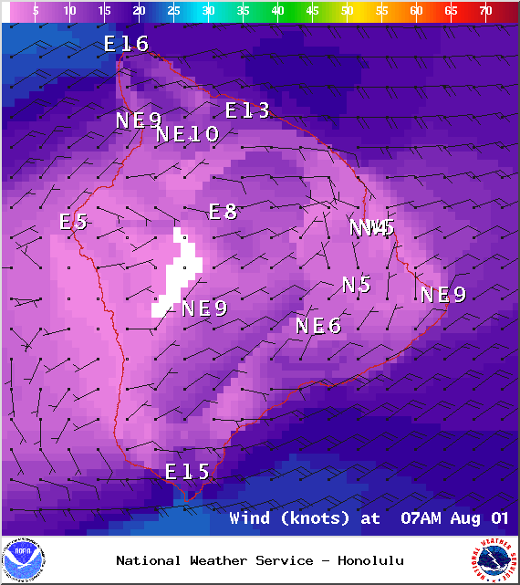
Image: NOAA /NWS
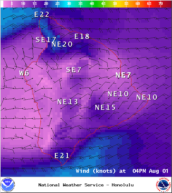
Image: NOAA /NWS
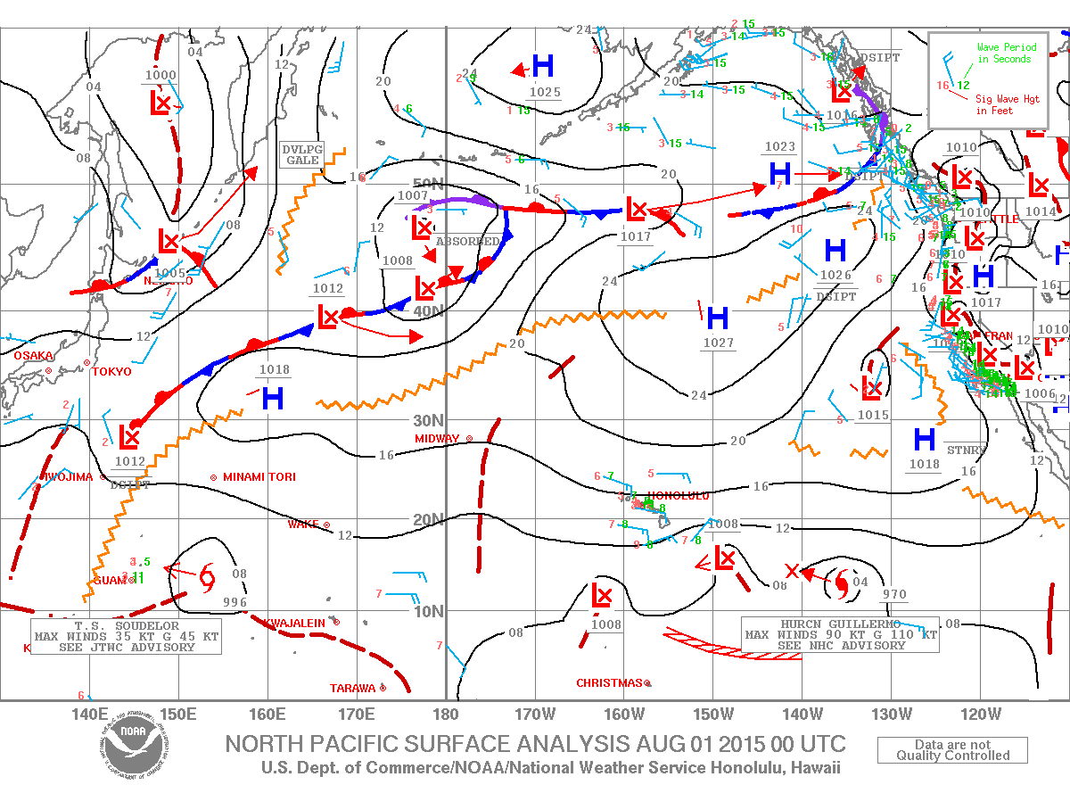
Image: NOAA /NWS
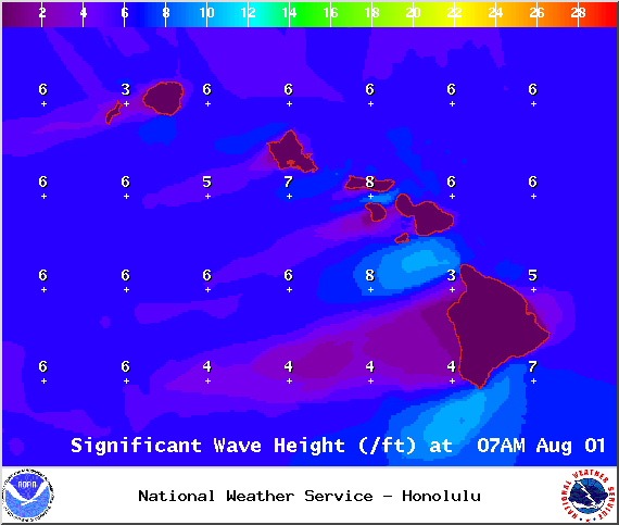
Image: NOAA /NWS
Sponsored Content


