

Light to Moderate Trade Winds Expected Today
Alerts
A High Surf Advisory is posted for the south facing shores of the Big Island through 6:00 a.m. Tuesday. Expect strong breaking waves, shore break and strong longshore and rip currents making swimming difficult and dangerous.
**Click directly on the images below to make them larger. Charts include: Big Island high/low forecasted temperatures, projected winds, chance of cloud cover, projected localized weather conditions, vog/SO2 forecast and expected wave heights.**
Today
We expect high temperatures from 85° to 90°. East winds are expected from 10 to 20 mph. Partly sunny skies are forecasted for windward areas with scattered showers. For leeward areas we expect a mostly clear morning and afternoon clouds with isolated showers.
UV index at 13 (“extreme” exposure level)
Tonight
For leeward areas, partly cloudy skies are expected tonight with clearing as the night goes on. Windward spots are partly cloudy with scattered showers. East winds are forecasted from 10 to 20 mph. Low temperatures from 73° to 78° are expected.
Looking Ahead
Easterly trade winds will remain in the gentle to locally moderate range today, weak enough to allow afternoon sea breezes to set up along most leeward areas. Showers will remain focused across windward areas, with spotty afternoon showers developing across leeward areas. Locally fresh trade winds and typical windward and mauka showers will return on Wednesday, with an increase in showers possible during the weekend. Uncertainty is rather high headed into the weekend. An increase in moisture associated with tropical depression 08°E is possible as early as Saturday night. The official forecast from the National Hurricane Center places the weakening tropical cyclone a couple hundred miles east-southeast of the Big Island on Saturday. Note that tropical cyclone forecasts this far out contain a high degree of uncertainty, so the forecast was broadly painted wetter Sunday and Monday.
Our Big Island Now Weather homepage always includes daily: Sunrise | Sunset | Moonrise | Moonset | Moon Phase | Live Weather Cams | 5-day Forecast | Current Temperature & Conditions
**Click here for your detailed Big Island surf report.**
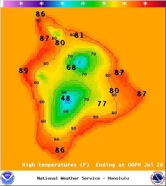
Image: NOAA / NWS
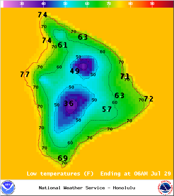
Image: NOAA / NWS
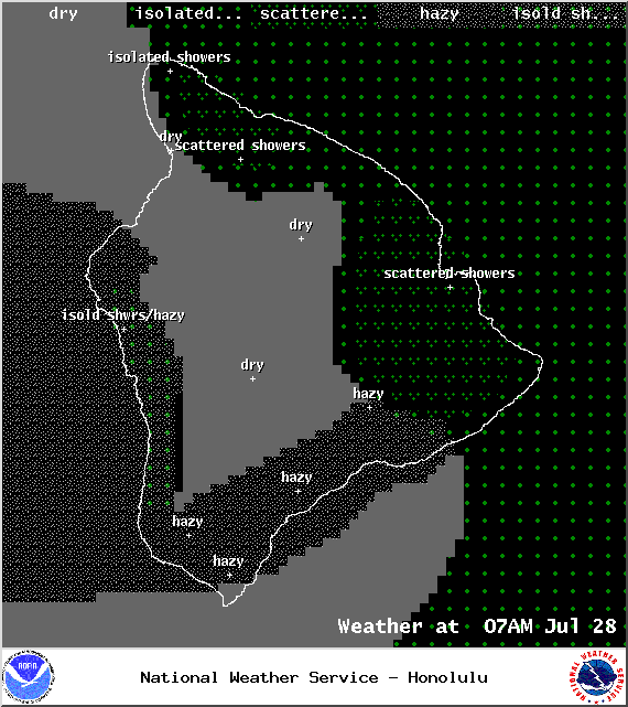
Image: NOAA / NWS
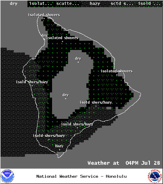
Image: NOAA / NWS
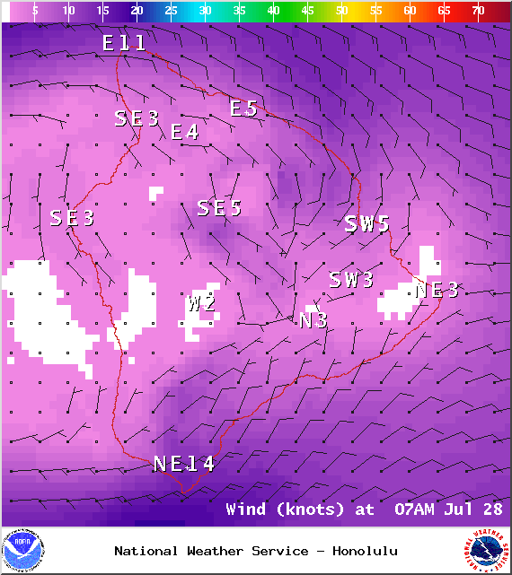
Image: NOAA / NWS
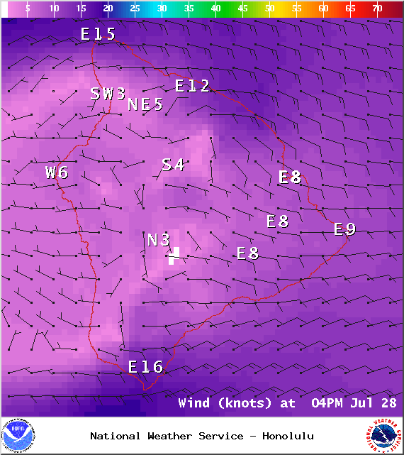
Image: NOAA / NWS
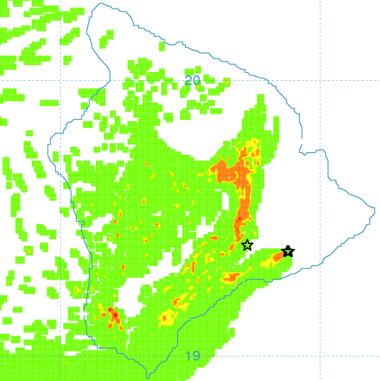
Image: UHSOEST
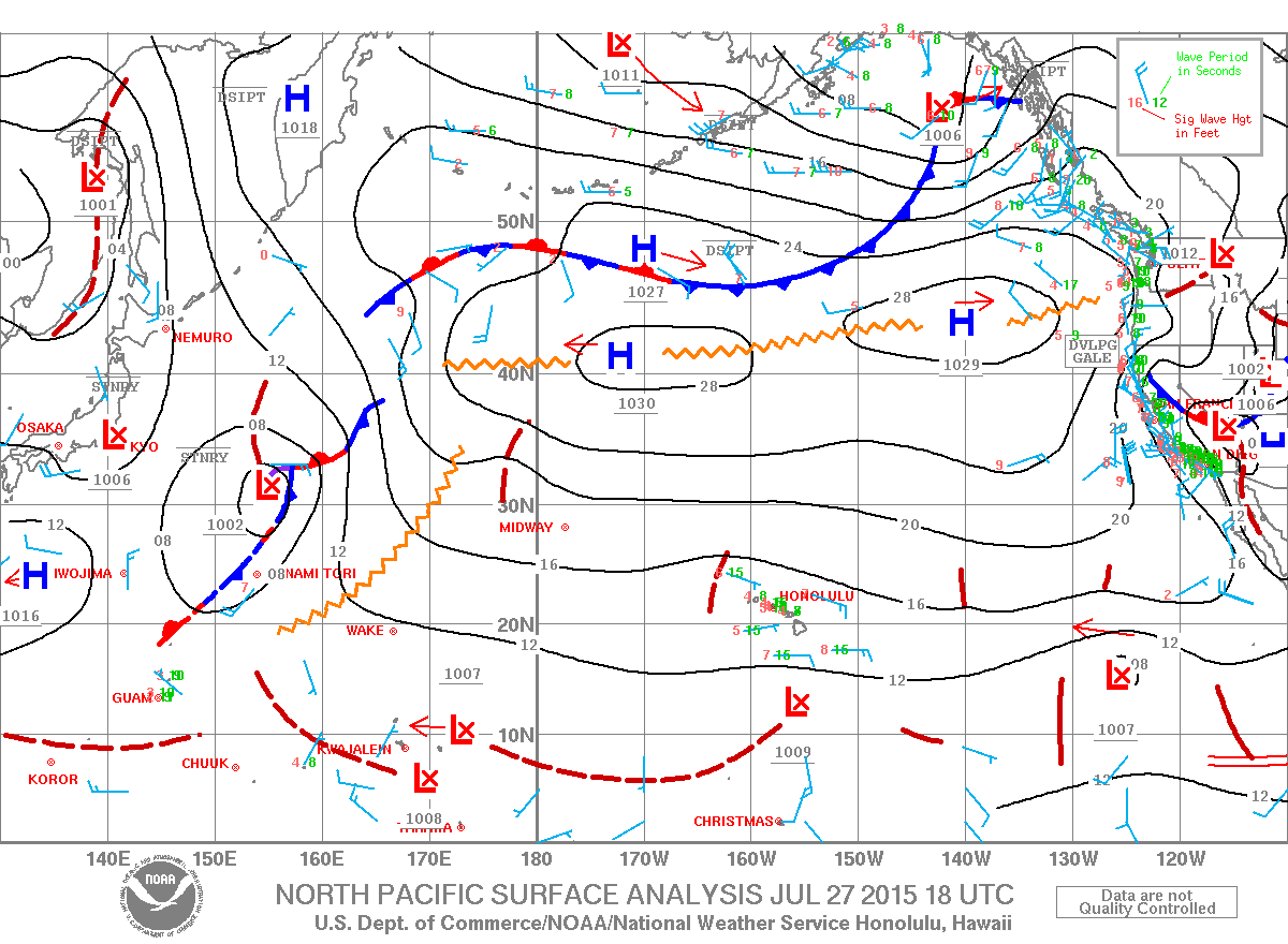
Image: NOAA / NWS
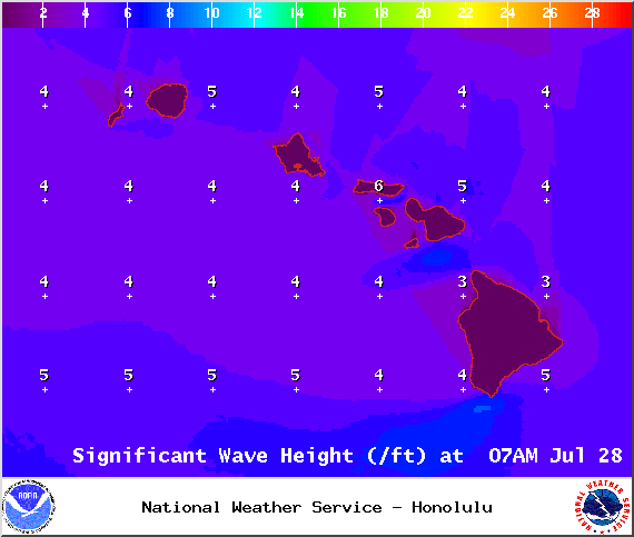
Image: NOAA / NWS
Sponsored Content


