

SSW Swell Builds Today and Peaks
Alerts
There are no weather alerts posted at this time.
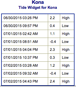
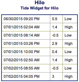
**Click directly on the images below to make them larger. Charts include: Big Island projected winds, tides, swell direction & period and expected wave heights.**
 Big Island Surf Forecast
Hilo side: Knee/waist/chest high waves expected today for east exposed breaks.
Kona side: Wave heights of waist/head high are expected. Overhead waves are possible on the sets at the best tides. Spots with less exposure to the south will get smaller waves.
South: Wave heights waist/head high are expected. Standout spots could get up to overhead on the sets.
 Our current south-southwest swell is expected to build through Wednesday, peaking Wednesday afternoon and holding through early Thursday.
Out of the North Pacific conditions will be pretty flat, just a little trade swell wrap expected. Models are showing a new swell for Friday.
Keep in mind, surf heights are measured on the face of the wave from trough to crest. Heights vary from beach to beach, and at the same beach, from break to break.
**Click here for your detailed Big Island weather report.**
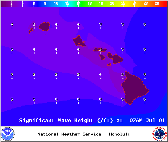
Image: NOAA / NWS
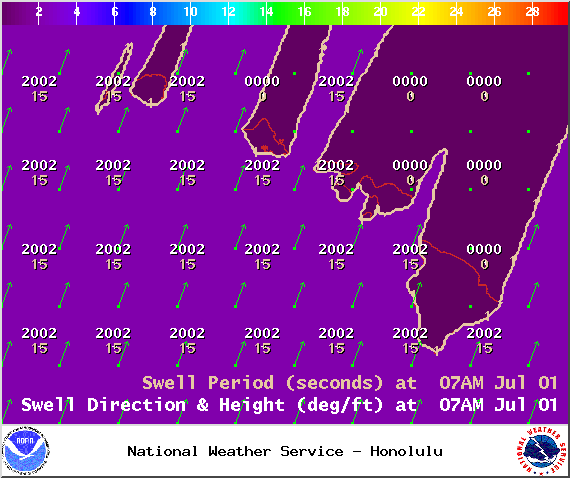
Image: NOAA / NWS
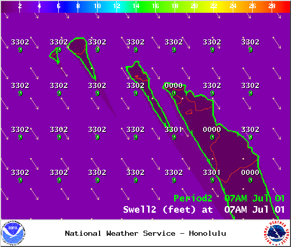
Image: NOAA / NWS
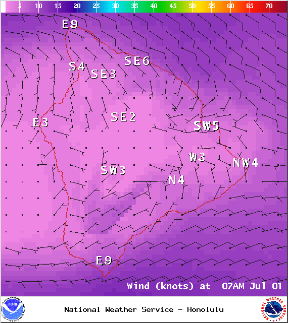
Image: NOAA / NWS
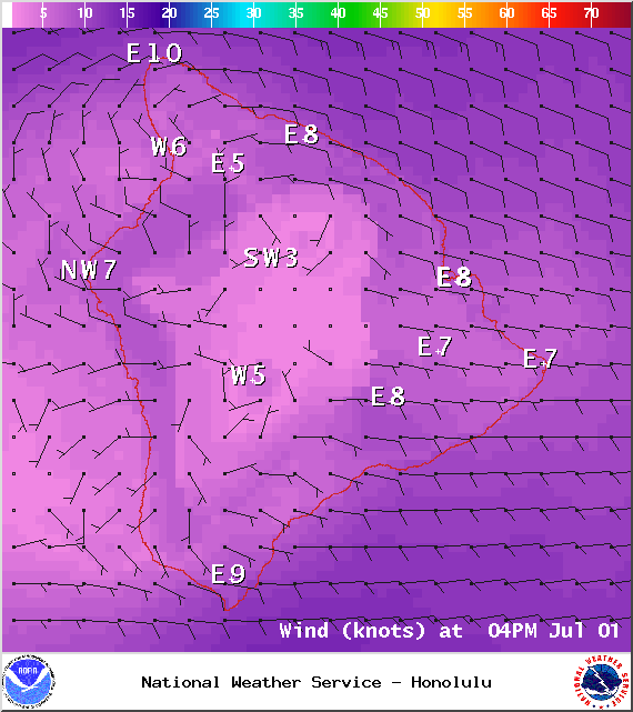
Image: NOAA / NWS
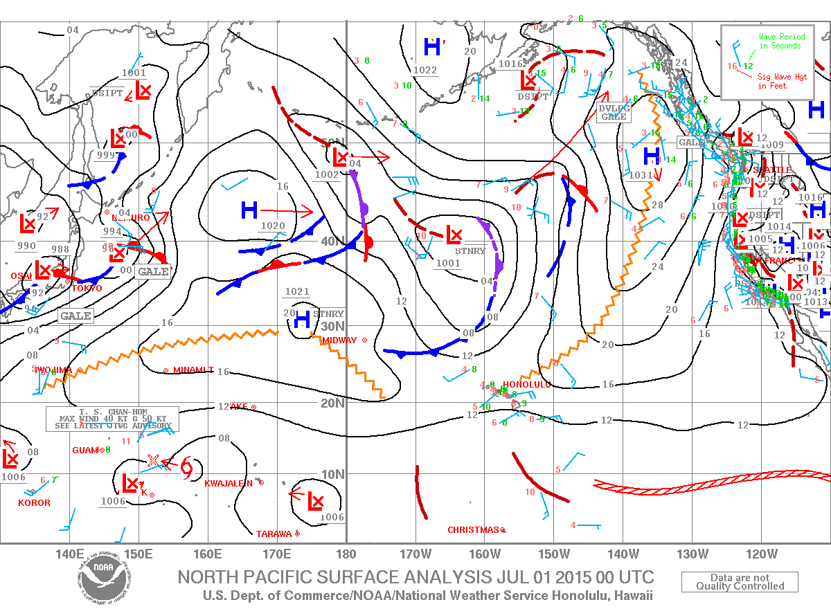
Image: NOAA / NWS
Sponsored Content


