

Breezy Trade Winds Today, Scattered Windward Showers
Alerts
A High Surf Advisory is posted for the west side of the Big Island through 4:00 a.m. Monday. Wave heights from 8 to 12 feet. Expect strong breaking waves, shore break and strong longshore and rip currents making swimming difficult and dangerous.
A Small Craft Advisory has been issued for all island waters through 6:00 a.m. Monday for winds up to 25 knots and rough seas up to 14 feet. For the ʻAlenuihāhā channel and Big Island southeast and leeward waters, we expect 20 to 30 knot winds and rough seas up to 14 feet through 6:00 p.m. Monday.
**Click directly on the images below to make them larger. Charts include: Big Island high/low forecasted temperatures, projected winds, chance of cloud cover, projected localized weather conditions, vog/SO2 forecast and expected wave heights.**
Today
Mostly cloudy skies are expected today for the windward side. Windward spots can expect scattered showers, while leeward spots will get mostly clear mornings and afternoon cloud cover. Northeast winds from 10 to 20 mph are forecasted. High temperatures should fall in the range of 81° to 86°.
Sunrise: 6:57 a.m.
Sunset: 6:09 p.m.
UV index at 8 (“very high” exposure level)
Tonight
Mostly cloudy skies are expected with scattered windward and mauka showers. Leeward spots will be cloudy to start but clear as the land breeze takes hold. Northeast winds up to 20 mph are expected. Low temperatures are forecasted from 66° to 71° degrees.
Moonrise: 11:47 a.m.
Moonset: 12:47 a.m. on Jan. 27
Next Full Moon: 1:09 p.m. on Feb. 3
Next New Moon: 1:47 p.m. on Feb. 18
Looking Ahead
Breezy trade winds are expected through Monday. The weather will turn drier and sunnier Monday as the frontal moisture moves off to the south. Dry weather will continue through mid-week, and winds will weaken as a high pressure system moves south near the islands. Clouds and showers will increase again late in the week as a front approaches.
Almanac for Hilo Airport
Maximum Temperature for today:
Normal 79°
Record 86° / Set in 1977
Minimum Temperature for today:
Normal 64°
Record 57° / Set in 1980
**Click here for your detailed Big Island surf report.**
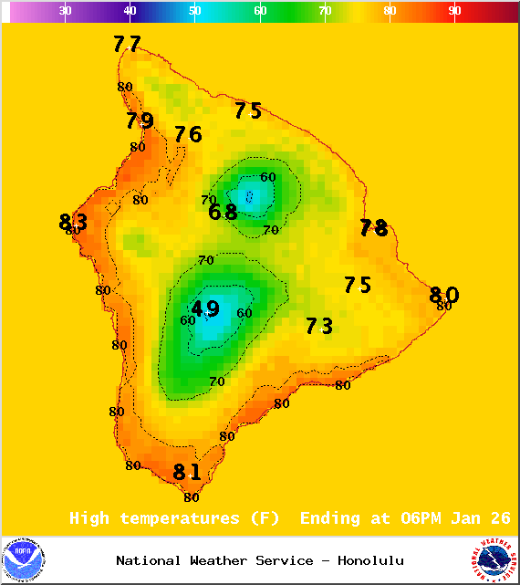
Image: NOAA / NWS
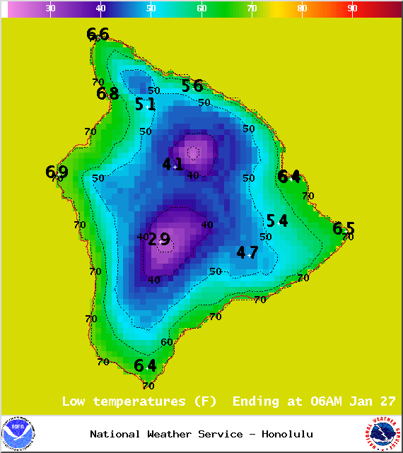
Image: NOAA / NWS
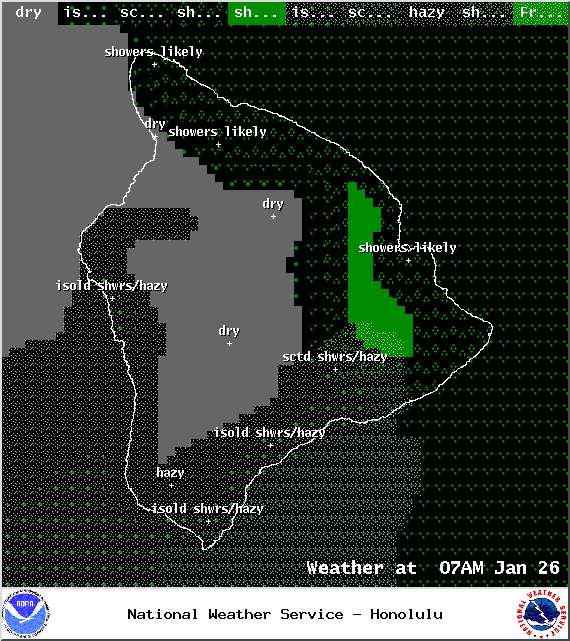
Image: NOAA / NWS
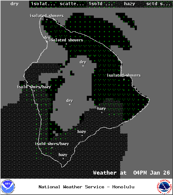
Image: NOAA / NWS
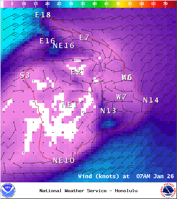
Image: NOAA / NWS
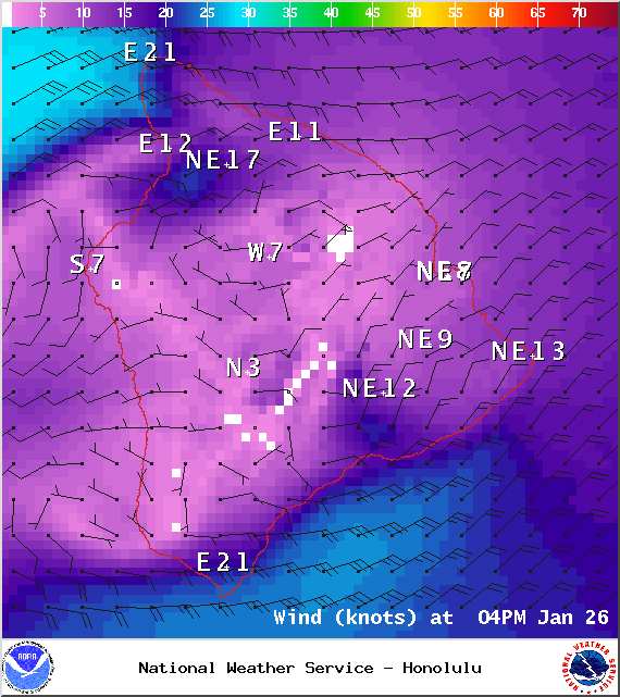
Image: NOAA / NWS

Image: UHSOEST

Image: NOAA / NWS
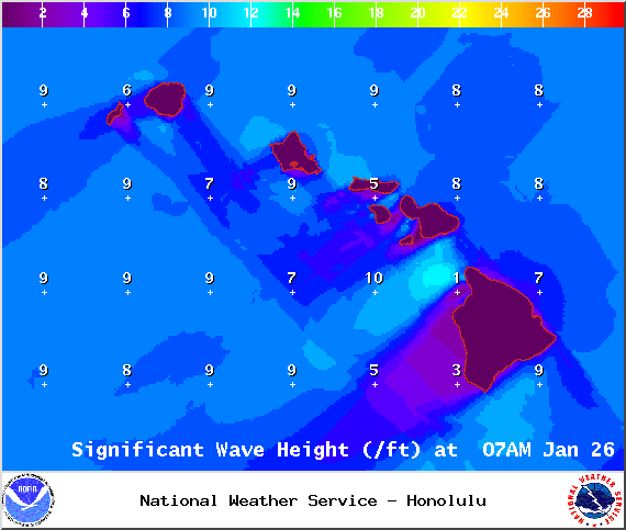
Image: NOAA / NWS
Sponsored Content


