The Winter Storm Watch has been replaced by a Blizzard Watch issued by the National Weather Service for the summits of Mauna Kea and Mauna Loa. Some weather models are showing deep moisture and layered clouds moving over the Big Island early Tuesday through Wednesday. The situation is still uncertain.
If the deep moisture does spread south to the Big Island, we expect very strong winds, bitterly cold wind chills, possible heavy snow, blowing and drifting snow and lightning strikes. Six inches or more are possible in this scenario.
The National Weather Service warns of extremely hazardous and possibly life-threatening conditions for anyone attempting to drive or hike to the summits.
Even if the snow does not materialize, winds are forecasted to gust to 70 mph Tuesday and up to 95 mph Tuesday night and Wednesday. Temperatures are forecasted in the upper 20’s to lower 30’s with wind chill in the teens.
ARTICLE CONTINUES BELOW AD
ARTICLE CONTINUES BELOW AD
A High Wind Warning is also posted from Tuesday morning through Wednesday for the wind conditions mentioned above.
A Flash Flood Watch has been issued by the National Weather Service from 6:00 p.m. tonight to 6:00 p.m. Wednesday. Locally heavy rain may produce rainfall amounts of 3 inches or more. If this occurs in a short period of time flash flooding may occur. Excessive runoff may produce rock and mudslides in steep terrain and fast flowing water may create life threatening situations.
A Flash Flood Watch means that conditions may develop that lead to flash flooding.
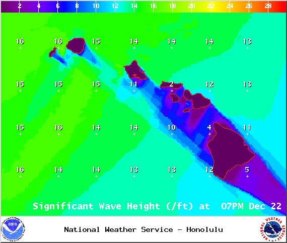
A High Surf Warning is in effect for the Kona side of the Big Island through 6:00 a.m. Tuesday for a large west-northwest swell.
A Small Craft Advisory is in effect for all Big Island waters from 4:00 a.m. through 6:00 a.m. Tuesday as well.
ARTICLE CONTINUES BELOW AD
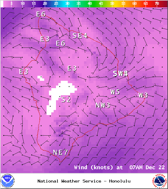
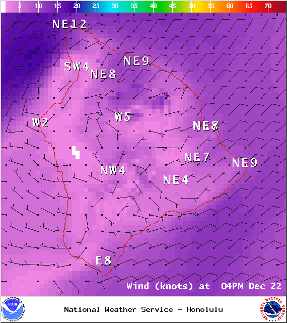
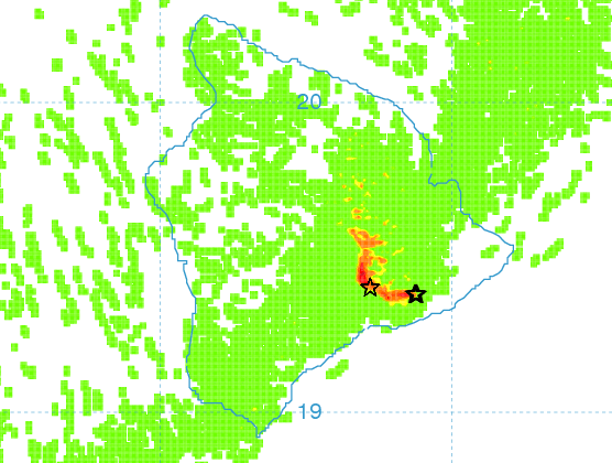
**Click directly on the images below to make them larger. Charts include: Big Island high/low forecasted temperatures, projected winds, chance of cloud cover, projected localized weather conditions, vog/SO2 forecast and expected wave heights.**
+
SWIPE LEFT OR RIGHT
Today, Monday, December 22, 2014
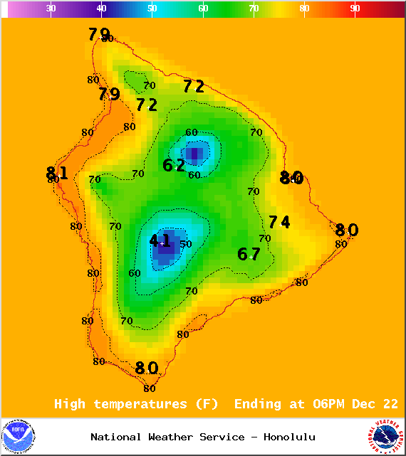
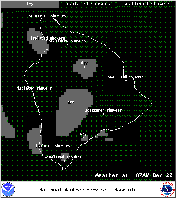
Today, we expect variable winds up to 15 mph which means local land and sea breeze conditions will again take control of the forecast. The UHSOEST vog model is showing widespread, heavy vog again today. Partly sunny skies for windward areas early on with scattered showers in the afternoon. Mostly clear in the morning for leeward spots. As the sea breeze kicks in due to daytime heating clouds will begin to build and may squeeze out some moisture. The atmosphere is unstable and there is a slight chance of thunderstorms in the afternoon. High temperatures should fall in the range of 79° to 84° and around 69° at 5000 feet.
Sunrise: 6:51 a.m.
ARTICLE CONTINUES BELOW AD
Sunset: 5:47 p.m.
UV index at 6 (“high” exposure level)
Tonight
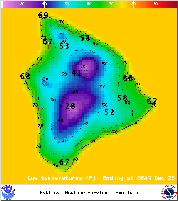
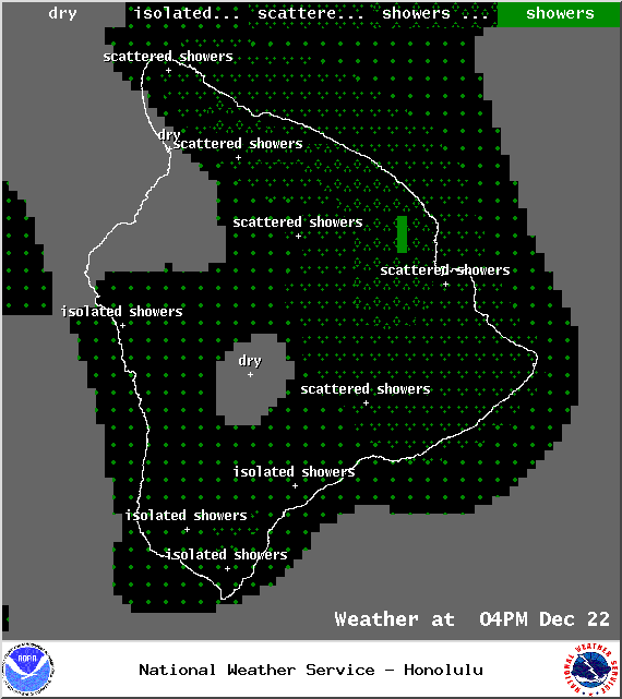
Mostly cloudy skies are expected tonight for the Big Island. Scattered thunderstorms are in the forecast with frequent windward and mauka showers and scattered showers for the Kona side in the evening becoming more frequent after midnight. Locally heavy rainfall is possible. Winds will be around 15 mph out of the northeast. Low temperatures from 66° to 71° degrees.
Moonset: 6:57 p.m.
Moonrise: 8:19 a.m. on Dec 23
Next Full Moon: Jan. 4 at 6:54 p.m.
Next New Moon: Jan. 20 at 3:14 a.m.
Looking Ahead
A cold front currently moving down the island chain. It is forecasted to reach the Big Island by Wednesday morning. It is expected to bring widespread showers and strong trade winds. Rainfall will be modest at first but instability high in the atmosphere may produce locally heavy showers, or even thunderstorms Monday night. Gentle north winds ahead of the feature will shift and become strong north or northeast winds as the feature passes by. Rainfall amounts will begin to taper off on Christmas eve. Trade winds will gradually weaken through the second half of the week.
Almanac for Hilo Airport
Maximum Temperature for today:
Normal 79°
Record 89° / Set in 1980
Minimum Temperature for today:
Normal 65°
Record 59° / Set in 1974 and tied in 1975 and 1978
This comments section is a public community forum for the purpose of free expression. Although Big Island Now encourages respectful communication only, some content may be considered offensive. Please view at your own discretion. View Comments