

Vog and Scattered Windward Showers Today
Alerts
A Small Craft Advisory is posted for all Hawaii County waters until Wednesday at 6 p.m. Winds of 20 to 25 knots are expected and rough seas up to 14 feet. Inexperienced mariners should avoid navigating in these conditions.
The High Surf Advisory has been extended for the east facing shores of the Big Island until 6 p.m. Monday. Surf along east facing shores could reach heights of 5 to 8 feet. Expect strong breaking waves, shore break and dangerous currents that make getting into the water hazardous and swimming difficult.
**Click directly on the images below to make them larger. Charts include: Big Island high/low forecasted temperatures, projected winds, chance of cloud cover, projected localized weather conditions, vog/SO2 forecast and expected wave heights.**
Today, Tuesday December 2, 2014
Partly to mostly cloudy skies are expected for windward and mauka areas today with limited showers in the morning then scattered showers in the afternoon. The Kona side will have a mostly sunny morning with afternoon clouds building and isolated showers. Areas of haze will linger on that side as well (see UHSOEST vog model image above). Trade winds are expected from 5 to 20 mph with higher gusts in our usually windier areas. High temperatures should fall in the range of 79° to 84° and around 69° at 5000 feet.
Sunrise: 6:39 a.m.
Sunset: 5:40 p.m.
UV index at 6 (“high” exposure level)
Tonight
Mostly cloudy skies are expected in windward and mauka areas tonight with likely showers in the forecast. Leeward areas should be mostly cloudy becoming mostly clear as the land breeze kicks in and pushes our clouds out to sea. Winds are out of the northeast from 5 to 20 mph. Low temperatures are expected in the range of 66° to 73° with a low of about 49° at 5000 feet.
Moonrise: 3:03 p.m.
Moonset: 4:00 a.m.
Next Full Moon: Dec. 6 at 2:27 a.m.
Next New Moon: Dec. 21 at 3:36 p.m.
Looking Ahead
High pressure is expected to weaken over the next couple of days. Showers will mainly favor windward and mauka areas with some passing leeward from time to time on our breezy winds. An increase in high clouds is expected starting the middle of this week particularly for leeward areas. Rainfall could also increase for the second half of the work week, will keep an eye on it.
Almanac for Hilo Airport
Maximum Temperature for today:
Normal 80°
Record 85° / Set in 1957 and tied in 1966 and 2007
Minimum Temperature for today:
Normal 66°
Record 59° / Set in 1972
**Click here for your detailed Big Island surf report.**
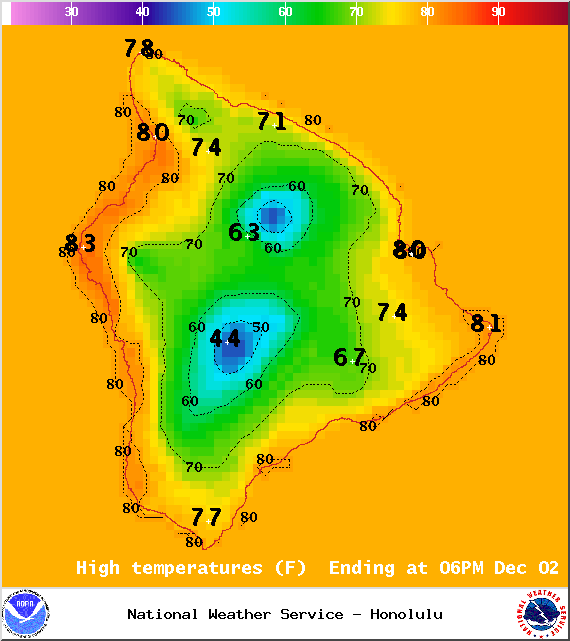
Image: NOAA / NWS
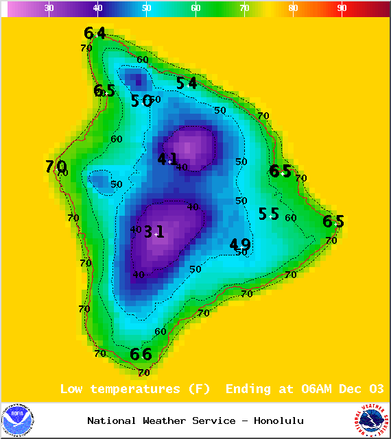
Image: NOAA / NWS
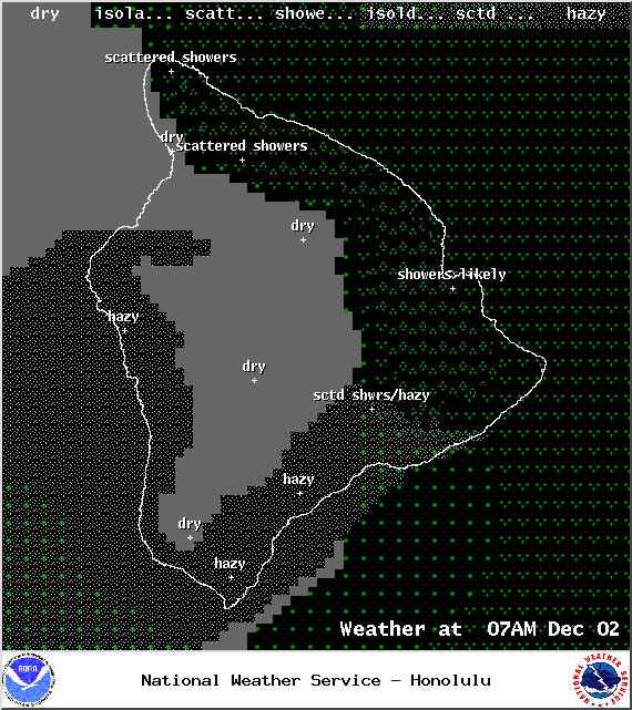
Image: NOAA / NWS
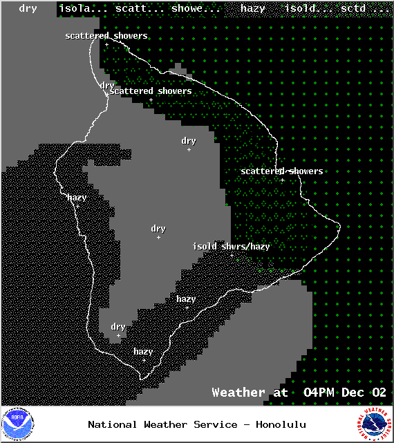
Image: NOAA / NWS
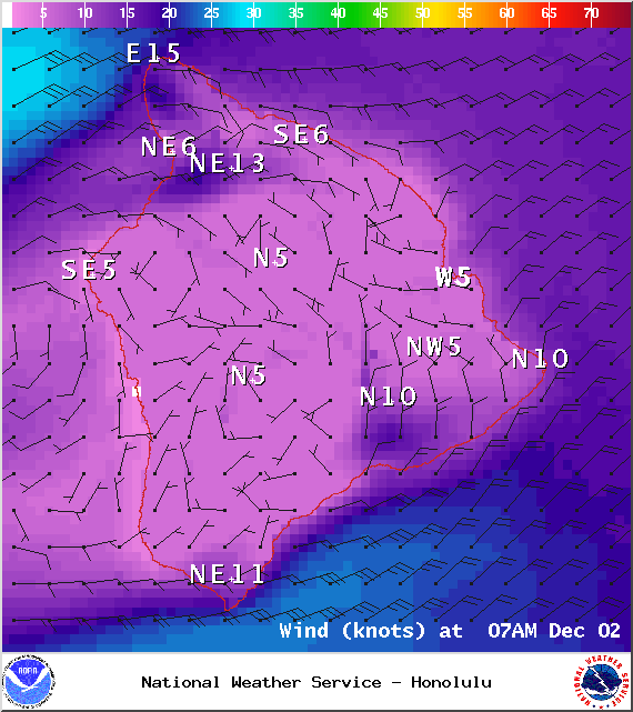
Image: NOAA / NWS
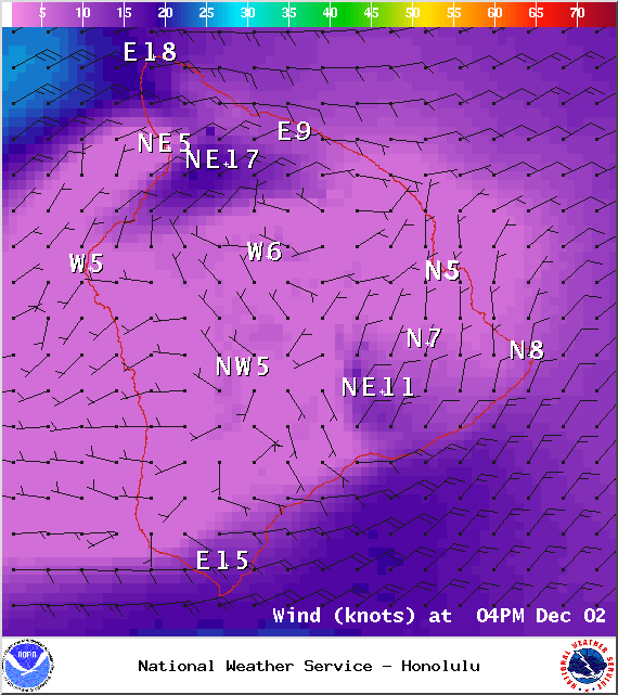
Image: NOAA / NWS
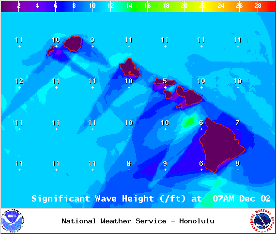
Image: NOAA / NWS
Image: NOAA / NWS
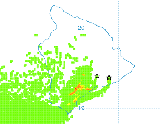
Image: UHSOEST
Sponsored Content


