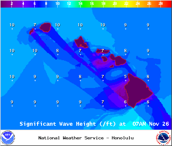
A High Surf Advisory is in effect for the north and east facing shores of the Big Island for a larger than expected north-northeast swell. Surf along north facing shores could reach heights of 12 to 15 feet. Surf along east facing shores could reach heights of 8 to 12 feet. The advisory is set to expire at 6 p.m. on Thursday.
Expect strong breaking waves, shore break and dangerous currents that make getting into the water hazardous and swimming difficult.
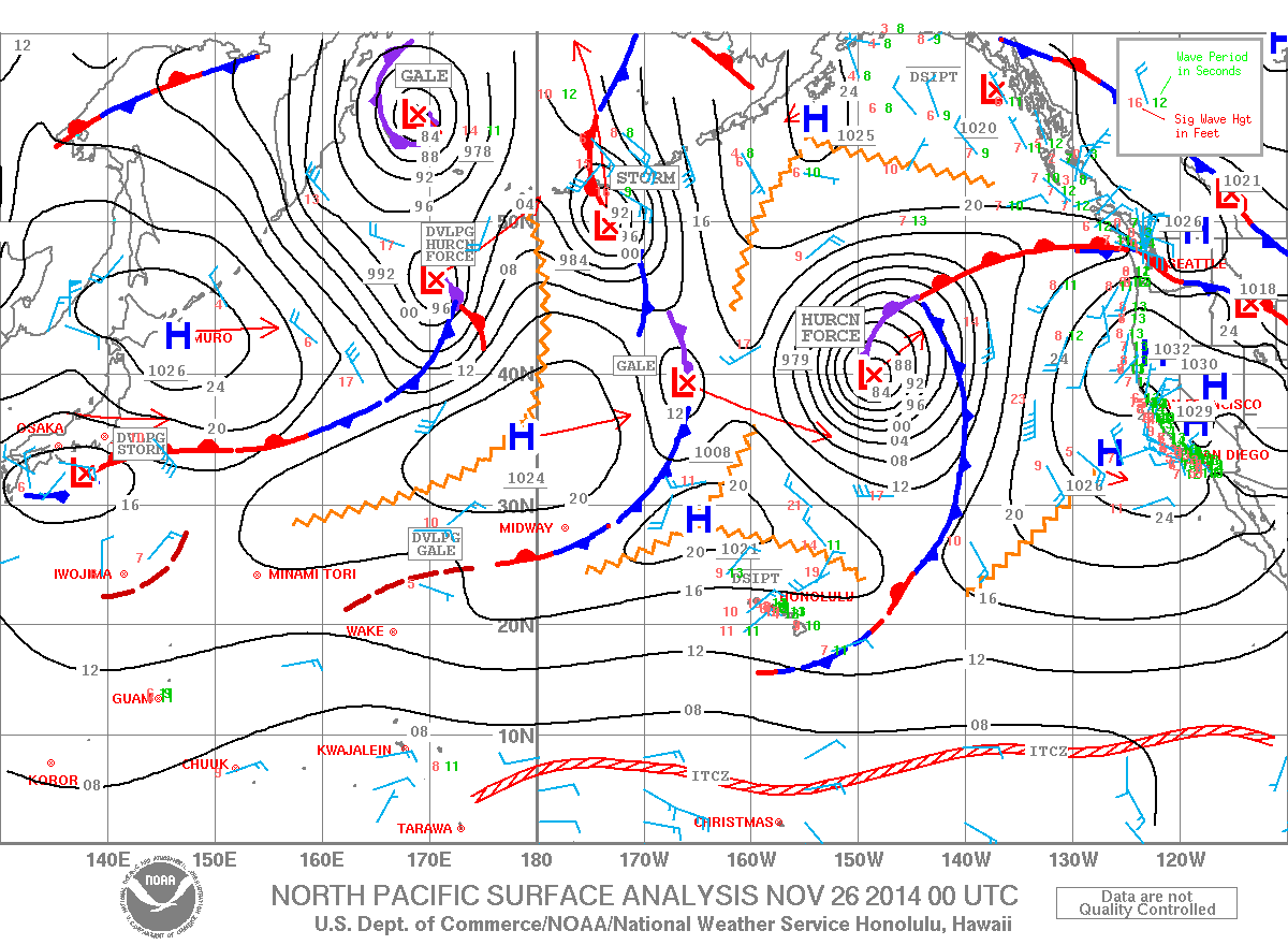
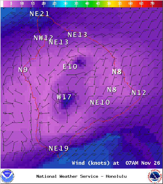
A Small Craft Advisory is posted for the ʻAlenuihāhā channel and Big Island windward and southeast waters until 6 a.m. Thursday. Winds from 20 to 25 knots are expected out of the northeast and rough seas up to 13 feet. Inexperienced mariners should avoid navigating in these conditions.
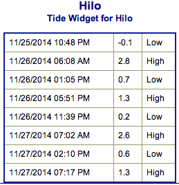
**Click directly on the images below to make them larger. Charts include: Big Island projected winds, tides, swell direction & period and expected wave heights.**
ARTICLE CONTINUES BELOW AD
ARTICLE CONTINUES BELOW AD
+
SWIPE LEFT OR RIGHT
Big Island Surf Forecast, Wednesday November 26, 2014
Hilo side: Surf is expected head high to overhead at the best breaks due to a mix of tradeswell and northwest swell.
ARTICLE CONTINUES BELOW AD
Kona side: Spots that catch some of the wrap could see a slight bump in wave heights from ankle to possibly waist high. Breaks not exposed to the swell will be flat today.
South: Southeast shores open to the trade swell could see waves up to head high or more, though sloppy and choppy conditions are expected. Minimal surf out of the southern hemisphere.
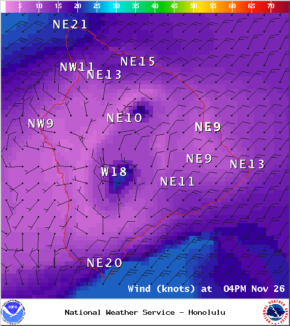
Trade winds are generating swell for windward spots on the Big Island. Conditions will be choppy and sloppy.
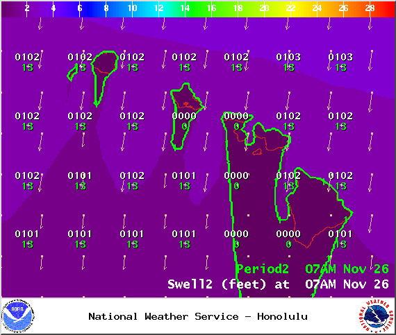
Our current northwest swell (305-330°) is expected to slowly begin to fade today. Kona side will be shadowed but still catch a fraction of the wrap. Late Wednesday a reinforcement of north-northeast swell will roll in keeping wave heights steady. This swell is expected to peak later tonight. Conditions will be rough and choppy due to the breezy winds.
ARTICLE CONTINUES BELOW AD
Another swell out of the northeast is expected to bring another round of overhead waves late this week. There’s also the possibility of a new northwest swell for the weekend.
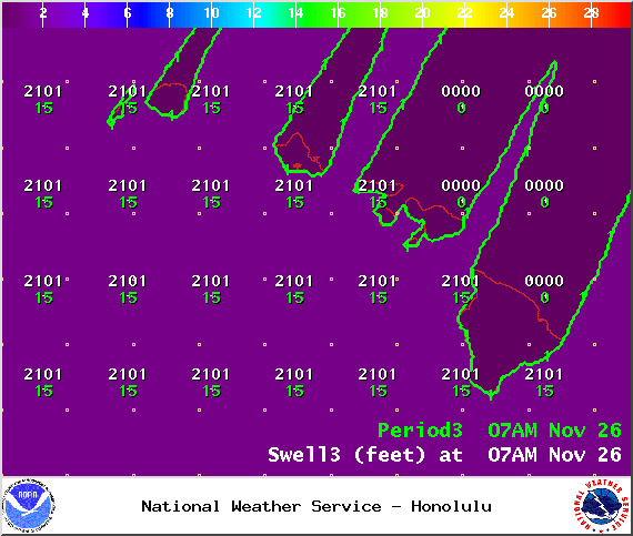
Super small trace amounts of swell expected out of the SPAC. Tiny to small surf is expected off and on for top spots through Saturday this week (180-220°). There isn’t much on the horizon to get excited about.
Keep in mind, surf heights are measured on the face of the wave from trough to crest. Heights vary from beach to beach, and at the same beach, from break to break.
This comments section is a public community forum for the purpose of free expression. Although Big Island Now encourages respectful communication only, some content may be considered offensive. Please view at your own discretion. View Comments


 Big Island Surf Forecast, Wednesday November 26, 2014
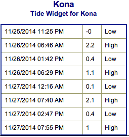 Trade winds are generating swell for windward spots on the Big Island. Conditions will be choppy and sloppy.