

Meteor Shower Peaks Tonight, High Temp Record Tied
Record
On Saturday November 15, we tied a record high temperature in Hilo. A high of 86° was recorded at the Hilo airport which is 4° higher than normal. This ties the records previously set in 1970, 1995 and 2006.
**Click directly on the images below to make them larger. Charts include: Big Island high/low forecasted temperatures, projected winds, chance of cloud cover, projected localized weather conditions, vog/SO2 forecast and expected wave heights.**
Today, Sunday November 16, 2014
We expect mostly sunny skies and isolated showers this morning. For the afternoon partly sunny skies and scattered showers are in the forecast. The UHSOEST vog model is predicting voggy conditions along the windward coast early on then shifting more south and west as the day progresses (see images above). High temperatures should fall in the range of 82° to 87° and around 71° at 5000 feet. In general, variable winds up to 15 mph are expected.
Sunrise: 6:29 a.m.
Sunset: 5:41 p.m.
UV index at 7 (“high” exposure level)
Tonight
We expect mostly cloudy skies tonight with scattered showers for windward and mauka areas and isolated showers in leeward spots. Our natural air conditioning is expected to begin building back in with winds out of the northeast around 15 mph forecasted. Low temperatures should fall in the range of 68° to 73° with a low of about 55° at 5000 feet.
Moonset: 1:58 p.m.
Moonrise: 2:19 a.m. on Nov. 17
Next New Moon: Nov. 22 at 2:33 a.m.
Next Full Moon: Dec. 6 at 2:27 a.m.
The Leonid meteor shower peaks tonight! For details on the show in the sky click here.
Looking Ahead
A weakening cold front has been impacting Maui County overnight and will move on to the Big Island later today. Cooler, drier conditions and breezy winds are expected to fill in behind the front. Trade wind weather is expected for much of the week.
Almanac for Hilo Airport
Maximum Temperature for today:
Normal 81°
Record 88° / Set in 1996
Minimum Temperature for today:
Normal 67°
Record 59° / Set in 1974
**Click here for your detailed Big Island surf report.**
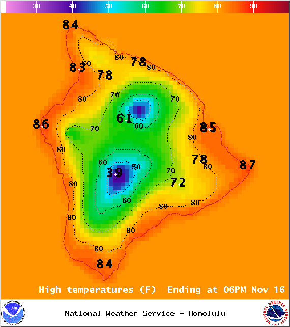
Image: NOAA / NWS
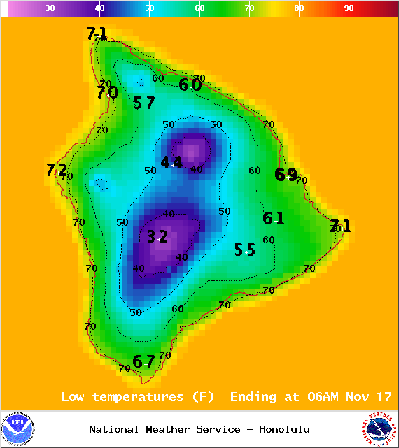
Image: NOAA / NWS
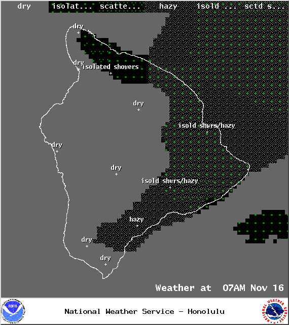
Weather conditions for 7am – Image: NOAA / NWS
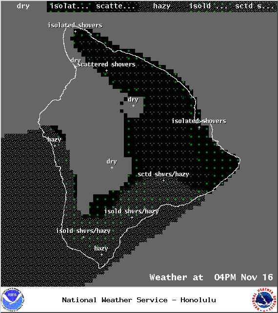
Weather conditions for 4pm – Image: NOAA / NWS
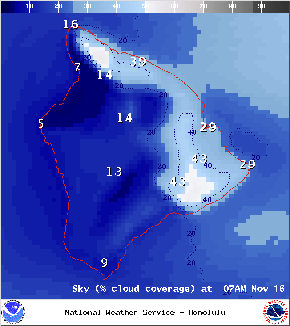
Chance of cloud cover at 7am – Image: NOAA / NWS
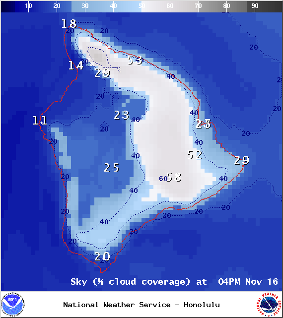
Chance of cloud cover at 4pm – Image: NOAA / NWS
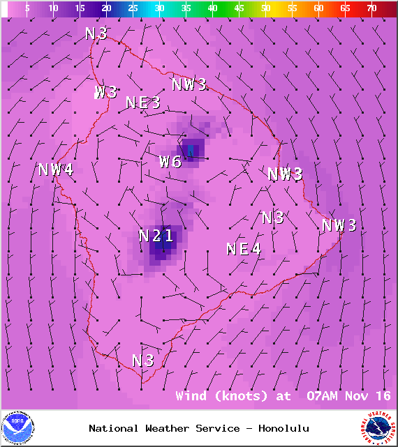
Winds at 7am – Image: NOAA / NWS

Winds at 4pm – Image: NOAA / NWS
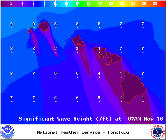
Image: NOAA / NWS
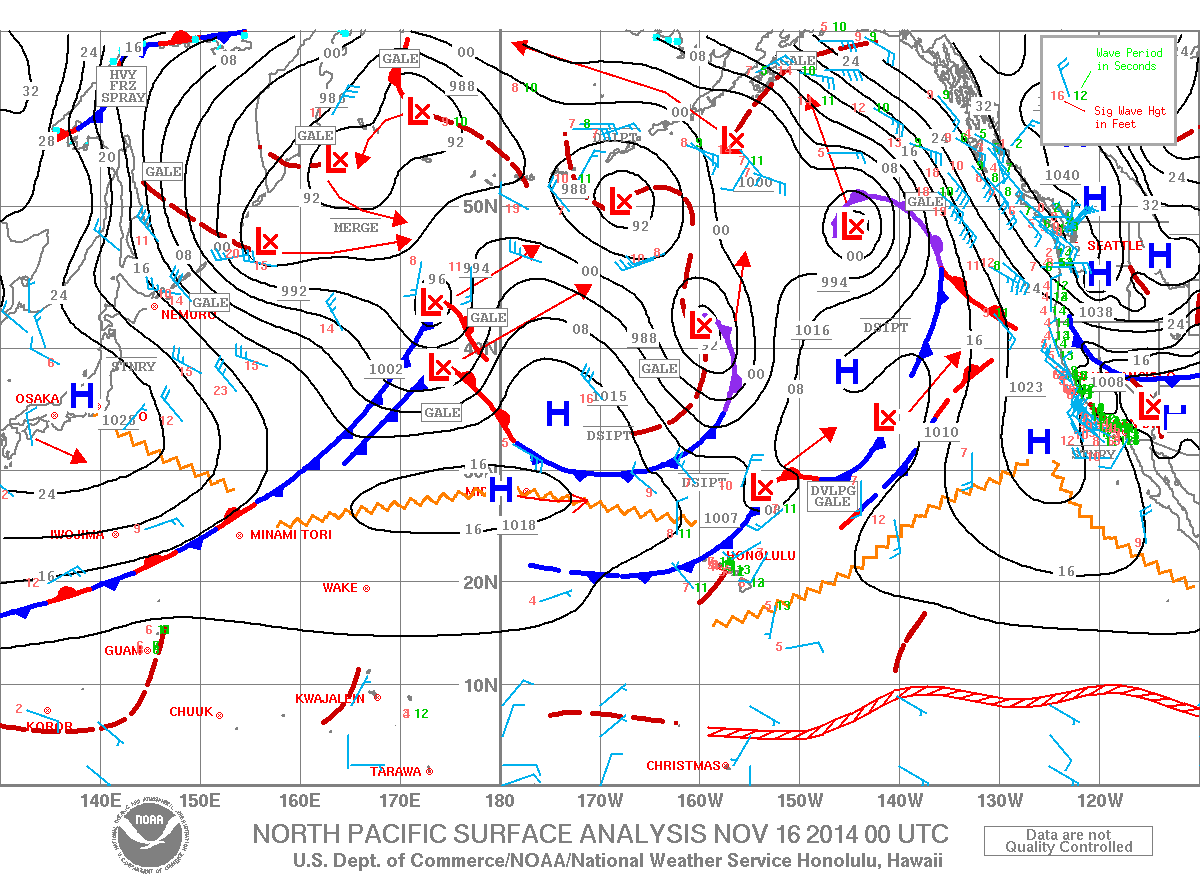
Surface map – Image: NOAA / NWS
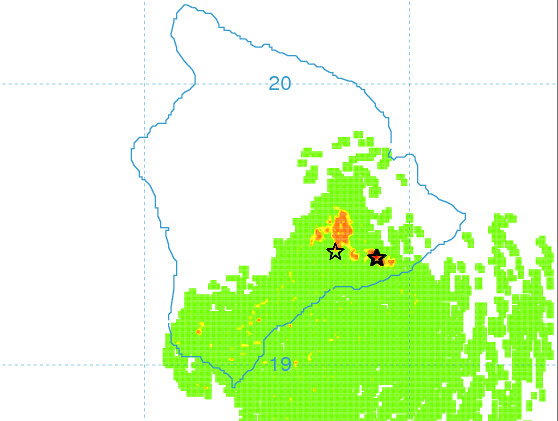
Morning vog forecast – Image: UHSOEST
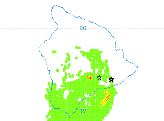
Afternoon vog forecast – Image: UHSOEST
Sponsored Content


