

Winds Weaken, Windward Showers
Alerts
A High Surf Advisory is in effect for the Kona side of the island through 6:00 a.m. Thursday. The National Weather Service is calling for wave heights of 6 to 8 feet. Expect strong breaking waves, shore break and strong longshore and rip currents making swimming difficult and dangerous.
A Small Craft Advisory is posted for the Alenuihaha channel and leeward / south waters of the Big Island through 4:00 a.m. Thursday.
**Click directly on the images below to make them larger. Charts include: Big Island high/low forecasted temperatures, projected winds, chance of cloud cover, projected localized weather conditions, vog/SO2 forecast and expected wave heights.**
Today
We expect partly sunny skies today with high clouds streaming overhead. Windward spots are expected to be wet in the early morning with scattered showers forecasted through the day. Scattered showers are expected in the afternoon for leeward areas as winds weaken and local sea breezes take hold. Breezy east to southeast winds are forecasted from 10 to 20 mph with higher gusts along the Hamakua coast. High temperatures from 79° to 84°.
UV index at 9 (“very high” exposure level)
Tonight
Partly to mostly cloudy skies are expected with isolated showers and areas of haze. Light and variable winds are forecasted from 5 to 15 mph. Low temperatures from 66° to 72° are expected.
Next Full Moon: 8:06 a.m. on Mar. 5
Looking Ahead
Trade winds are expected to deliver a band of showers to windward areas early Thursday, with a few showers drifting to leeward areas. Northeast trade winds are expected to strengthen over the weekend. An area of instability near the islands will act to focus clouds and showers over the islands, and a trend toward wetter weather can be expected into next week as the island atmosphere becomes increasingly unstable.
Our Big Island Now Weather homepage always includes daily: Sunrise | Sunset | Moonrise | Moonset | Moon Phase | Live Weather Cams | 5-day Forecast | Current Temperature & Conditions
**Click here for your detailed Big Island surf report.**
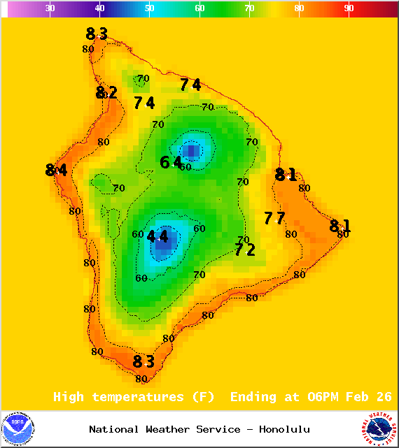
Image: NOAA / NWS
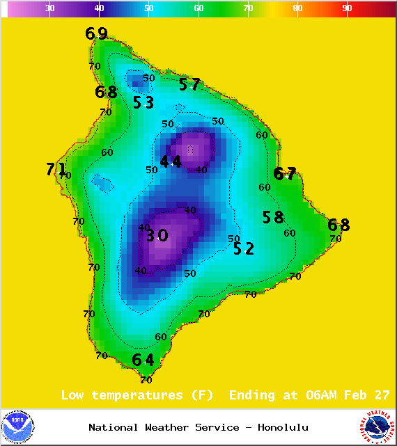
Image: NOAA / NWS
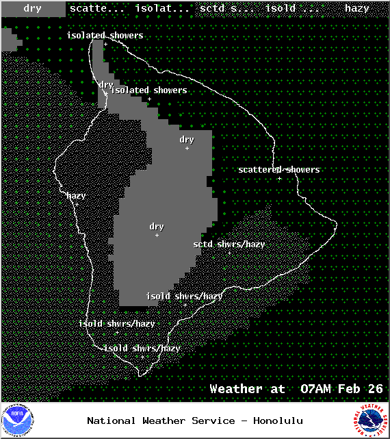
Image: NOAA / NWS
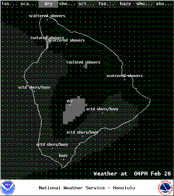
Image: NOAA / NWS
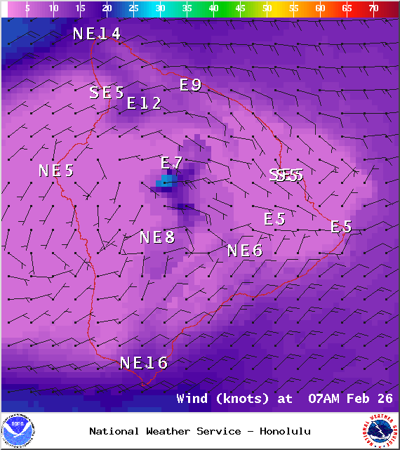
Image: NOAA / NWS
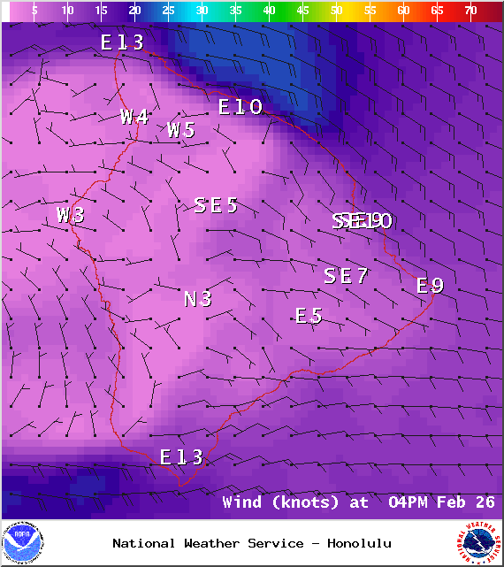
Image: NOAA / NWS
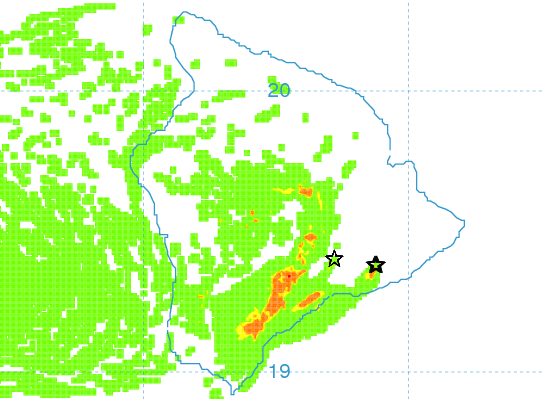
Image: UHSOEST
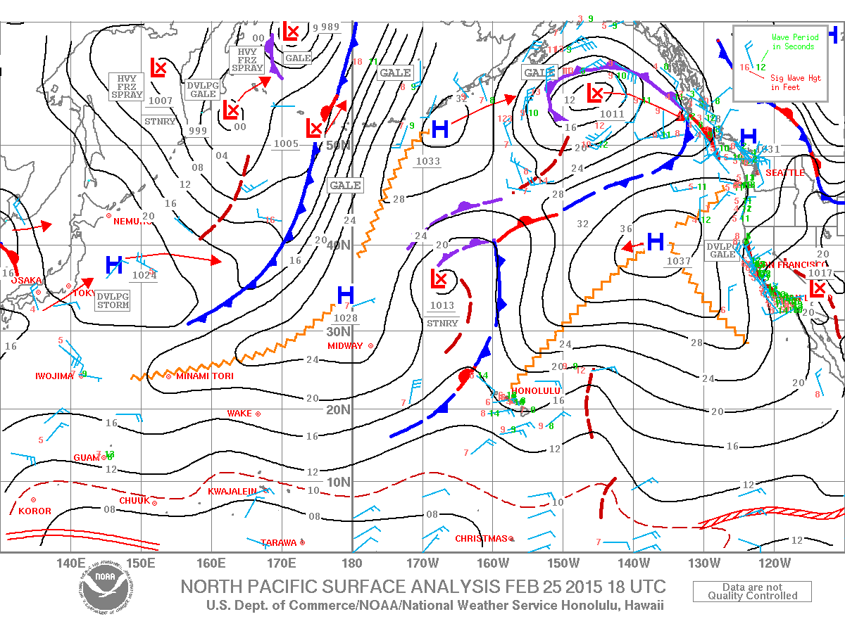
Image: NOAA / NWS
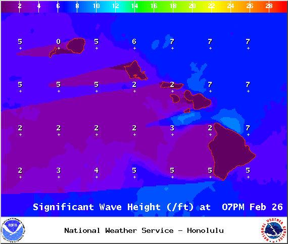
Image: NOAA / NWS
Sponsored Content


