Throughout the current weather event, all weather alerts will be posted HERE.
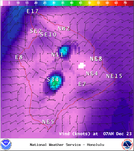
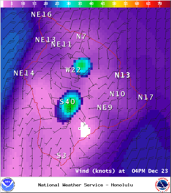
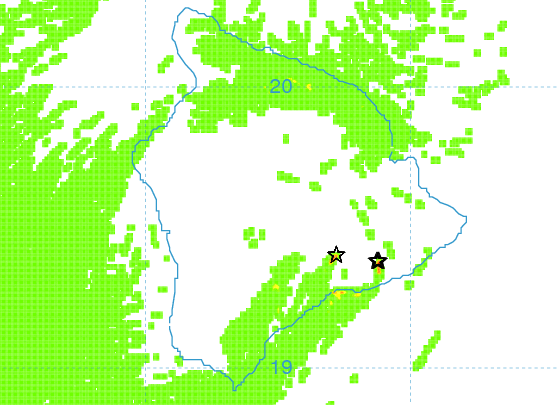
**Click directly on the images below to make them larger. Charts include: Big Island high/low forecasted temperatures, projected winds, chance of cloud cover, projected localized weather conditions, vog/SO2 forecast and expected wave heights.**
+
SWIPE LEFT OR RIGHT
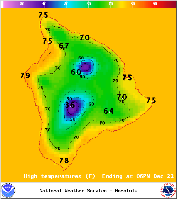
Today, Tuesday, December 23, 2014
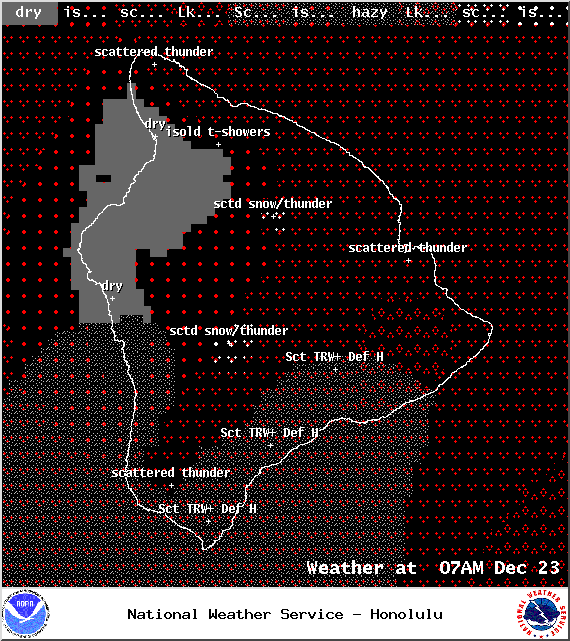
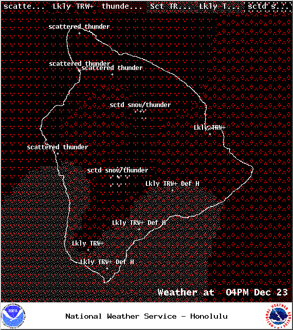
Today, we expect partly to mostly cloudy skies with scattered showers and thunderstorms in the morning for windward and mauka areas and these conditions likely in the afternoon. For leeward spots, isolated showers and thunderstorms are forecasted in the morning with showers and thunderstorms likely in the afternoon. Locally heavy rainfall is also possible. High temperatures should fall in the range of 75° to 80° with east winds from 15 to 20 mph. If thunderstorms develop they will be accompanied by gusty winds.
ARTICLE CONTINUES BELOW AD
ARTICLE CONTINUES BELOW AD
Sunrise: 6:51 a.m.
Sunset: 5:48 p.m.
UV index at 5 (“moderate” exposure level)
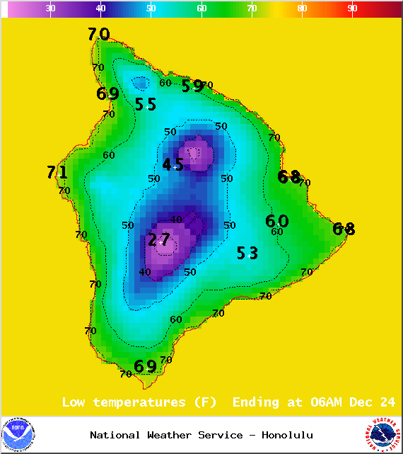
Tonight
ARTICLE CONTINUES BELOW AD
Mostly cloudy skies are expected tonight for the Big Island with showers and thunderstorms likely. Heavy rain is also possible. Winds will be around 15 to 20 mph out of the east. Low temperatures from 66° to 71° degrees.
Moonrise: 8:19 a.m.
Moonset: 7:59 p.m.
Next Full Moon: Jan. 4 at 6:54 p.m.
Next New Moon: Jan. 20 at 3:14 a.m.
ARTICLE CONTINUES BELOW AD
Looking Ahead
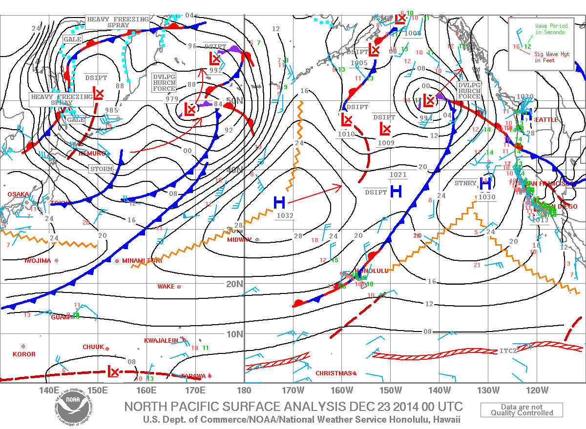
The leading edge of a slow-moving front will remain near the Big Island through today. When combined with a disturbance high in the atmosphere conditions are expected to be quite messy bringing widespread showers, strong winds, lightning, thunderstorms, hail and flooding conditions. Locally heavy showers are also possible. The threat for this potentially severe weather exists through Wednesday as the disturbance flaring up thunderstorms becomes a cutoff low and lingers in our area. The front is expected to fall apart on Tuesday but a surface low might develop which could suck moisture out of the south and up over the islands. The forecast is still a bit uncertain when it comes to the surface low developing and will be tweaked as it becomes more certain.
This comments section is a public community forum for the purpose of free expression. Although Big Island Now encourages respectful communication only, some content may be considered offensive. Please view at your own discretion. View Comments