

It’s the right to access public lands vs. ‘We can hear Waipiʻo Breathe’
At the mouth of the Waipi‘o River, where the water channels to the ocean, schools of ʻāholehole jumped. The splashes, in rapid fire succession, blended with the lull of the current and the roar of the nearby ocean surf.
Absent were voices.
Missing were footprints and tire tracks in the black sand.

Nothing filled the sacred valley where King Kamehameha was hidden as a baby to avoid persecution other than the sound of the small silver fish nipping at the surface in droves while birds called in the canopy of towering ironwood pine, African tulip and kukui nut trees.
Residents of the valley have become accustomed to that sound of nature for the past seven months. It coincides with Hawaiʻi County Mayor Mitch Rothʻs emergency order on Feb. 25 to close the steep road to the valley to all pedestrian and most vehicle traffic for safety reasons.
Residents of the valley say the pause in human activity has been restoring the area to its former natural and historic glory.
“You can feel it,” said Mahealani Maiku‘i, a supporter of the road closure. “You can hear Waipi‘o breathe.”
Sights they hadn’t observed in decades have become commonplace again: moi liʻi fish swimming with the abundant ʻāholehol and the first ball of silver ʻakule, a mackerel fish that has returned to swim in clusters near the surf break.
The massive mound of fish could be spotted from high above Waipi‘o Valley Road, a moving mass of color in the endless sea.
Those fish abandoned the Waipi‘o beach years ago, chased from an area that had become too active with human recreation.
“Waipiʻo is telling us it can heal if it is allowed to rest,” said Jason Mock Chew, a Waipiʻo kupuna and taro farmer.
But residents like Chew and Maiku‘i are worried that all the tangible progress will evaporate now that visitors have been allowed to return. All county residents and some tour companies have been allowed access again – under certain conditions.
The camps between those who want the road closed to people who don’t live there and those who want it open to the public are intensifying.

On Sept. 19, Mayor Roth, in response to a lawsuit challenging the legality of closing the public road, amended his emergency order to partially reopen the 1.5 mile route to the valley floor. The new order allowed the road to open to all Big Island residents, county-permitted tour operators and those seeking to practice their Native Hawaiian traditional or customary rights, as long as they had four-wheel vehicles. It remained closed to visitors not with tours, uncovered vehicles, ATVs, horses and pedestrians.
In response to Mayor Roth’s change in course, residents of the valley and supporters set up a checkpoint station at the top of the road near the Lookout, where they inform would-be drivers that kūpuna and landowners in the valley are asking people not to come down unless they have been invited.
At the beginning of the education campaign, valley residents said people who learned of the checkpoint’s wishes mostly obliged. But as time has gone on, more people have ignored the request and continued down the road to surf or enjoy the mostly empty beach.
“There’s a protocol to everything,” said valley resident Jesse Kunishige, who also serves as the Waipi‘o Valley Land Management Officer for Bishop Museum.
That protocol, as Kunishige describes, would be for guests who are invited to act graciously and respectfully once inside their host’s home. Sadly, he said that often wasn’t the case before the closure and could be headed in that direction again.
Visitors often ignored signs, trespassed on private lands, took photos of residents and littered.
“They’re not [acting respectfully] when they come to the valley,” he said. “It’s a lot of people’s home right here. A lot of the farmers are fed up.”
But others feel public access to a public beach and hiking trail should not be blocked, which was at the heart of the lawsuit filed by the community group, Mālama I Ke Kai ʻO Waipiʻo, when the road was first shuttered in February. The group has nine core members comprised of area residents and surfers who have enjoyed the valley beach for decades.
A petition they circulated after the closure garnered around 2,000 signatures and there were about 100 testimonials submitted to the county on the group’s behalf.
The legal quagmire was why the Roth Administration, after mediation with a judge, agreed to settle the lawsuit contingent upon it being reopened to county residents.

Mālama I Ke Kai ʻO Waipiʻo – referred to as MaKa – is planning a gathering at the Lookout at 10 a.m. today to promote open access to public lands and the ocean down below. The organization’s newsletter, which is circulating online, calls for supporters to wear all blue — the color of the ocean. The group says valley residents can ask people not to come down, but county residents don’t have to oblige, as public water access is meant for island residents.
“The assertions and actions by the Protect Waipiʻo Valley Group, which denies Native Hawaiian and Hawaiʻi Island residents access to the ocean, is concerning and a violation of constitutional rights,” Nancy Giaccone Roberson wrote on Facebook in a post advertising Saturday’s event. “Ocean access is vital to the health of our communities and is a protected right.”
The dispute is mired in exactly where the public portions of the land exist.
According to the Department of Land and Natural Resources, the road into the valley and to the beach, and the Muliwai Trail hiking trail that continues along the ocean to Waimanu are public lands.
The Queen Lili‘uokalani’s Highways Act of 1892 reserves all roads and trails built or planned prior to 1892 for the government in fee simple, a Department of Land and Natural Resources spokesperson said.
“The road that forks to the right and heads makai is government-owned,” the spokesperson said. That is the road to the black sand beach.
All other land in the valley is privately owned.
But valley residents maintain the county road cannot access the beach without crossing private land. The road that veers to the water at the dense valley floor belongs to Kamehameha Schools and is chained off, they said.
People used to traverse the private roadway out of habit, residents said. The beach area where people used to park their vehicles is also private property, as are all other roads once the county road ends. That beach parcel belongs to Bishop Museum. Both Kamehameha Schools and Bishop are prominent landowners of the valley.
But even if people drive down on the county-owned road, there is no public place to park their cars. The county road is too narrow to leave an unoccupied vehicle without blocking traffic, so if a person parks a car and leaves it, they are assuredly trespassing on private property.
The dichotomy of the situation – a public road that leads to private land – has left both residents and visitors frustrated.
Kunishige, whose family history traces back into the valley for hundreds of years, likened the situation to a public highway that leads to military base. The road may get you there, but it doesn’t allow you in.
“It’s like a false hope,” Kunishige said during a recent tour of the valley with a Big Island reporter on the reopening of the road. “Waipi‘o is open, but it’s all private property. You’re not even saying that. You’re letting the farmers and everyone else deal with the headache.”
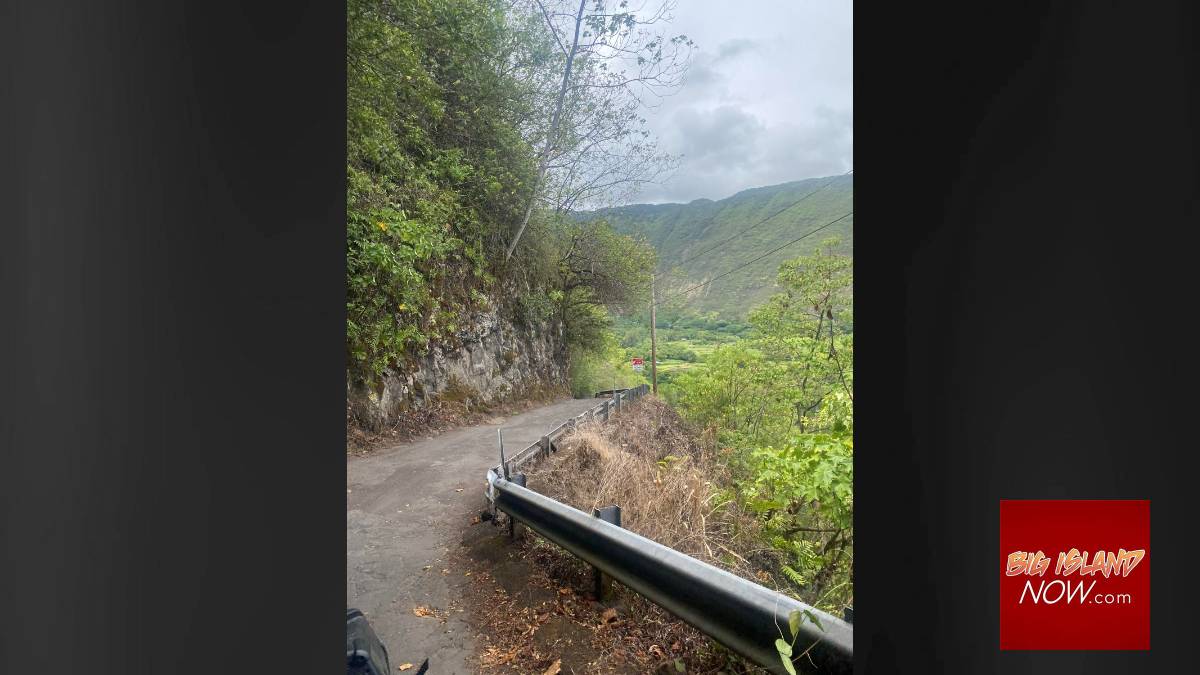
The road into Waipi‘o Valley was deemed structurally unsafe by a geotechnical study the county commissioned more than a year ago. The results were published earlier this year. The bumpy road, wide enough for one vehicle, is flanked by the sharp, pitched side of the mountain above it with the constant risk of falling rock, and the thick green forest beneath it.
Guardrails along the exposed side of the twisting road are conspicuously thin, and a handful of small turnouts lend just enough space for a vehicle to pull over to yield to oncoming traffic. Swallowed in the vegetation on the hillside below is the rusted remains of a fallen, dilapidated car.
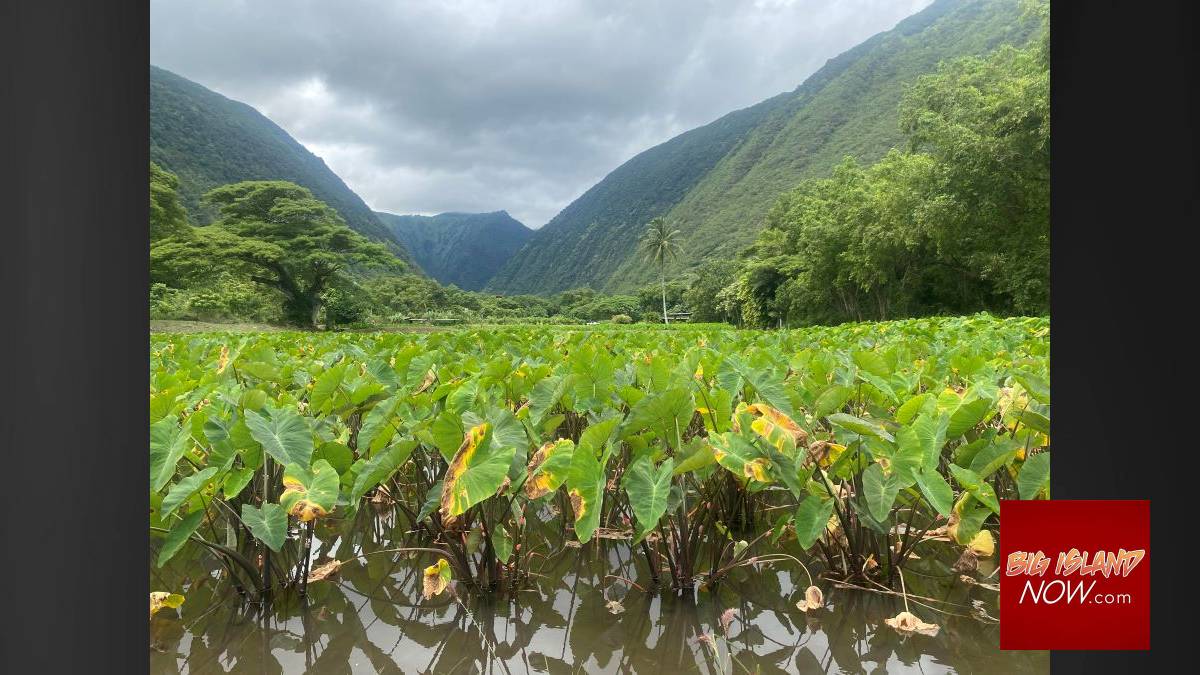
At the valley floor, trees like monkeypod and Japanese grapefruit, grow overhead and block the sky in a shield of dark green and brown branches. It is the valley where an infant King Kamehameha was successfully hidden to protect him from warring clans. After the death threat passed, he emerged from hiding to go on to unite the islands.
Inside The Valley of Kings, as it is known, is the beach where cars used to park and the site of an ancient heiau, or sacred burial site. Large, smooth gray stones still dot the landscape next to the river where the fish break the surface of the water.
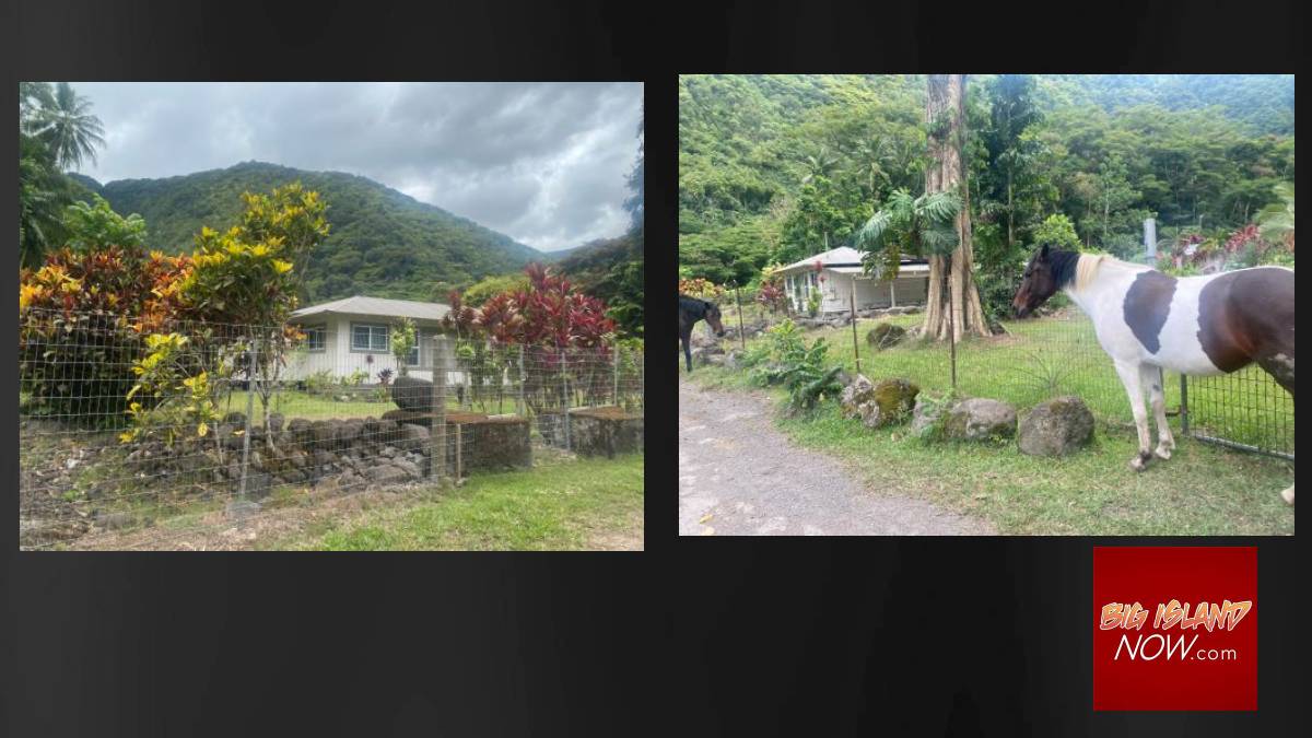
Further back in the pitched valley, after the county road ends at the valley floor, a private road leads to the taro fields. It is narrower than the county road and crosses multiple streams. Houses, with large plots of land, stand on either side of the dirt lane with private property signs hanging on their fences. They are the same red and black placards that are a ubiquitous sight in subdivisions everywhere. It is a reminder that the wild landscape is still residential.
Deeper into the valley, under the shadow of Kohala Mountain, is a taro farm tended by Marvin Cababay. The short plants with their broad, green leaves stand in a field of ankle-deep water, fluttering in the breeze. Not a soul is around, except for Cababay.
He, like his neighbors, was distraught when the mayor reversed his decision and reopened the road.
“For now, yeah, it’s serene and peaceful,” the farmer for the last 25 years said while taking a break from his work. “I love it.”
Lean and strong from endless hours of working the land, Cababay said he’s worried that it will only be a matter of time before things go back to the way they were. Big white tour vans parked on the private property, with up to nine people piling out each trip to gawk and snap pictures of him while he works — as if he was an attraction.
He was accustomed to picking up cigarette butts, soda cans, bottles, even the plastic tips on hiking poles after they left. The trash stopped the day after the road was closed.
“It’s really distracting, five to seven times a day, back and forth,” Cababay said. “Every day, every day, every day, weekends and everything.”
He said he wishes that people would understand that Waipi‘o is a wahi pana – a sacred and special historical site where a traditional lifestyle is still practiced. It is not a tourist destination. The Lookout at the top can serve that purpose, he said.
“People are like the stars,” the taro farmer said. “They’re gonna come and we can’t stop them, but we can control them. We can find a way to control them because there’s just too much.”
Since the checkpoint formed Sept. 19, the residents have had a couple of meetings with Mayor Roth and his administration, area surfers, KaMA and other stakeholders. Roth has said he hopes people can respect the kūpuna request that people only traverse the road if they are invited.
“This access only pertains to the roadway itself and not the land beyond where the county road ends,” Roth said when he amended his emergency order. “All land beyond our roadway is privately owned. That said, we understand that the residents, kūpuna, and kalo farmers of the valley are asking that no one enter the valley at this time unless they have an immediate responsibility there or are a resident. Our administration supports their efforts.”
He also acknowledged the now dangerous road must be fixed, and a permanent solution to the issue reached. The county will detail more about how it intends to make the road safe using mitigation, re-stabilization and reconstruction efforts during a community meeting Oct. 5, from 5:30 to 7 p.m. at the Honoka’a Sports Complex, 45-541 Lehua St. in Honoka’a.
But once the road is fixed, who will be allowed on it — and precisely where?
The two camps see the issue differently. Supporters of the closure said they want Waipi‘o Valley residents who are impacted daily to be working with the county to find a solution, not outside parties. No valley resident belonged to the lawsuit that eventually overturned the closure. But others say the issue affects everyone, and shouldn’t be reserved for the roughly 100 people who call the valley home.
Patrick O’Leary, member of MaKa, said both sides are working together to find a practical, tenable solution that benefits everyone. Saturday’s event is meant for both sides to come together and keep the dialogue continuing so that a balance can be struck.
He said the public access shouldn’t be blocked at the valley floor with a chained fence, and was disappointed that the checkpoint started after the mayor amended his emergency order. Protesting is one thing, but blocking access is another.
Still, he said, the similarities between the two sides is clear: Both groups want to respectfully enjoy what Waipi‘o Valley offers. Taro farming is incredibly important to the island’s history and culture, but ocean activity like surfing also runs deep in Hawaiʻi’s roots. The two sides are neighbors, after all, and it will be up to them, not the government, to reach a livable solution, which he believes they will do.
“We have more in common than differences,” he said.
In the meantime, deep inside the quiet valley, fish are swarming. The black sand beach is mostly tire tracks and footprint free. The magnificent habitat looks and sounds as it surely used to decades and even centuries ago, before the inevitable flood of change ushered in.
Editorʻs Note: This version of the story has been edited to show the correct location of the Oct. 5 community meeting. It is at the Honoka’a Sports Complex, 45-541 Lehua St. in Honoka’a.
Sponsored Content


