HVO Monitoring Lava Breakout Moving Through Forest
Hawaiian Volcano Observatory continues to monitor lava breakouts associated with the June 27, 2014 Kilauea lava flow, including one that that is starting to move through forested land to the northeast of Puʻu ʻŌʻō.
None of the lobes currently associated with the lava flow are a threat to any neighboring communities.
The most distal of the lobes, according to HVO, was measured on Friday to be about 4.7 miles to the northeast of Puʻu ʻŌʻō.
Seismic activity around Kilauea volcano is considered to be in background levels with some spattering reported along the edges of the lava lake. The lava lake is about 110 feet below the vent rim.
Over the last 48 hours, a minor deflation-inflation event happened at Kilauea’s summit. It started with deflation at 7 a.m. Sunday and switched to inflation about 12 hours later. The inflation continued on into Monday morning.
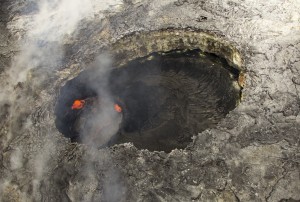
In the western portion of Puʻu ʻŌʻō Crater, there has been a small pit for nearly a year. The pit is about 60 m (200 feet) wide, and a small circular lava pond resides beneath the overhanging west rim of this pit. USGS/HVO photo.
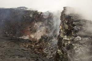
The altered and fractured rim of Puʻu ʻŌʻō Crater is prone to small collapses. Portions of the eastern crater rim, shown here, have collapsed onto the crater floor, covering the recent lava flows with rubble.USGS/HVO photo.
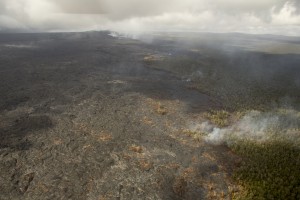
Another view, looking west, showing the activity along the forest boundary and northern flow margin. Scattered breakouts were burning forest in this area. In the upper left portion of the image, Puʻu ʻŌʻō can be seen. USGS/HVO photo.
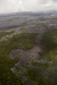
This photo looks southwest, and the front of the narrow lobe is in the foreground, with Puʻu ʻŌʻō near the top of the photo. The breakouts active at the forest boundary along the northern flow margin can be seen by their smoke plumes along the right side of the photo. USGS/HVO photo.
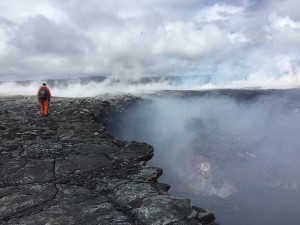
HVO geologists walk along the edge of the inner crater in Puʻu ʻŌʻō, making stops periodically to perform laser rangefinder measurements of crater dimensions. USGS/HVO photo.


