

Hilda Swell Fading, Brown Water Advisory Likely
Alerts
A Flash Flood Watch is in effect for the Big Island and posted through 6:00 a.m. Saturday. Abundant moisture from weakening Hilda is expected to produce the potential for excessive runoff, rock/mudslides and fast-moving water that could create life-threatening situations. Additional rainfall amounts of 3 to 6 inches are possible in some areas. For windward and Kau areas, the rains are expected to taper off on Friday but locally heavy afternoon and evening thundershowers are expected again over interior slopes. Brown water is likely at a lot of river mouths.
A Small Craft Advisory is posted for all Big Island coastal waters through 6:00 p.m. Friday for winds up to 30 knots and rough seas up to 11 feet. Inexperienced mariners should avoid navigating in these conditions.
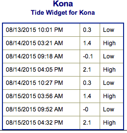
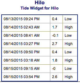
**Click directly on the images below to make them larger. Charts include: Big Island projected winds, tides, swell direction & period and expected wave heights.**
 Big Island Surf Forecast
Hilo side: Wave heights are expected to be chest/head high today for exposures open to fading mix of Hilda and trade wind swell. Winds and brown water will be a problem.
Kona side: Wave heights ankle/knee high are expected for the best breaks open to the SW swell. Thigh to waist high waves are possible on the sets.
South: Wave heights are expected to be chest/head high today for exposures open to fading mix of Hilda and trade wind swell. Winds and brown water will be a problem.
 Hilda swell is expected to fade as the system continues to move away from the islands. A mix of tropical (Hilda) and trade swell is expected to affect east and southeast exposures. However, size will be down a notch from yesterday and continue to fade over the weekend.
No significant swells are on the horizon out of the SPAC. Small south-southeast swell will continue Friday into the weekend. A new storm is forming near New Zealand that should send us a decent swell late next week and into the weekend. Will keep an eye on it.
Keep in mind, surf heights are measured on the face of the wave from trough to crest. Heights vary from beach to beach, and at the same beach, from break to break.
**Click here for your detailed Big Island weather report.**
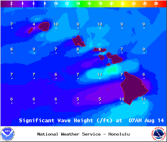
Image: NOAA / NWS
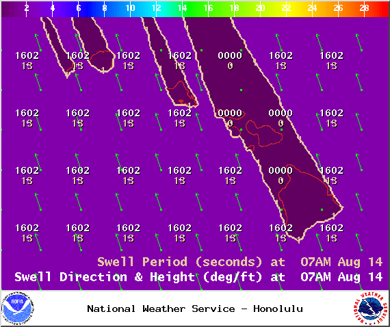
Image: NOAA / NWS
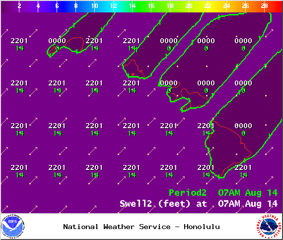
Image: NOAA / NWS
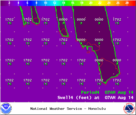
Image: NOAA / NWS
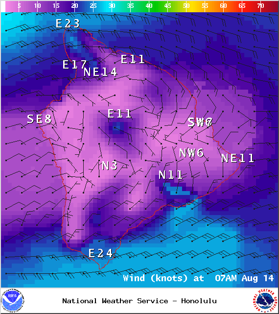
Image: NOAA / NWS
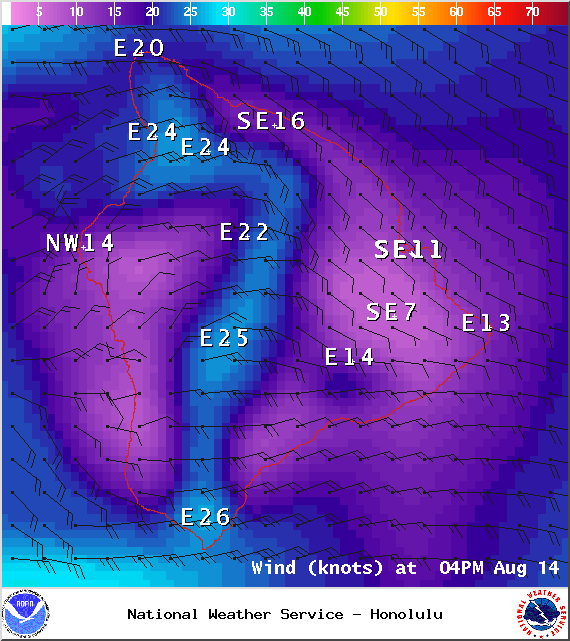
Image: NOAA / NWS
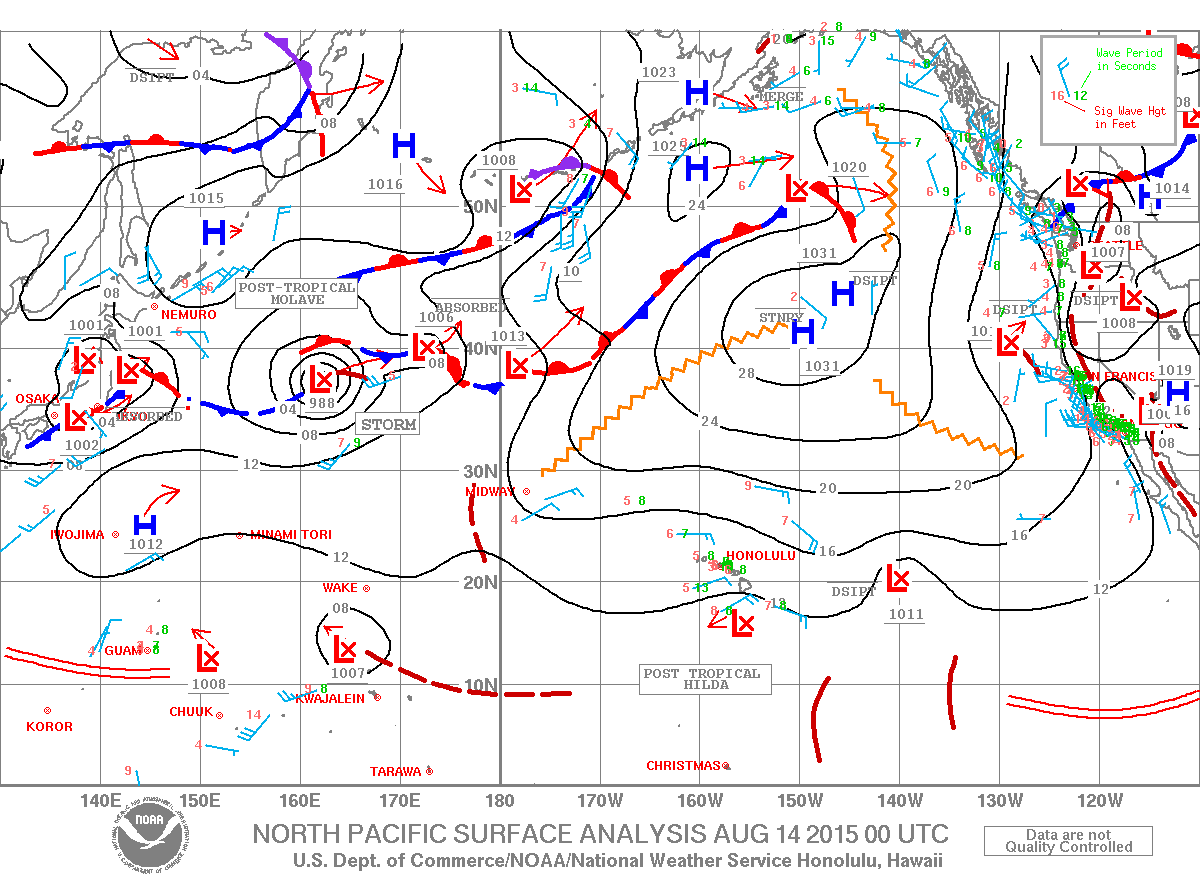
Image: NOAA / NWS
Sponsored Content


