***Updated at 5:00 a.m. to include upgrades to the High Surf Advisory and Small Craft Advisory.***
Alerts
A Hydrologic Outlook has been issued by the National Weather Service. Heavy rain and flash flooding are possible Thursday and Friday as Hilda approaches the state. The NWS warns that regardless of its strength, the system will have the potential to produce very heavy rainfall and flash flooding as moisture spreads from east to west over the island chain. Details of timing, location and amount of rainfall are still highly dependent on where Hilda ends up tracking.
A Tropical Storm Watch has been issued for the Big Island and its surrounding waters. Tropical Storm Watch means that tropical storm conditions are possible within the next 48 hours somewhere within the specified areas. A watch is typically issued before the possible arrival of tropical storm force winds which make continuing outside preparations dangerous. A watch is the time for you to prepare.
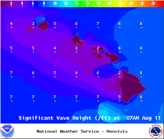
A High Surf Warning is posted for the east side as swell generated by hurricane Hilda builds. The warning is posted through 6:00 a.m. Wednesday. Wave heights of 10 to 15 feet are expected Tuesday. Expect ocean water occasionally sweeping across portions of beaches, very strong breaking waves and strong longshore and rip currents. Breaking waves may occasionally impact harbors making navigating the harbor channel difficult. Large breaking surf, significant shore break and dangerous currents will make entering the water very hazardous. Boaters should be aware of an increased number of surfers in the water.
ARTICLE CONTINUES BELOW AD
ARTICLE CONTINUES BELOW AD
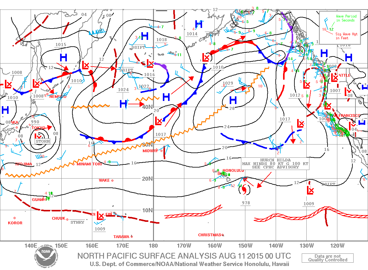
A Hurricane Warning is posted for Hawaiian offshore waters from 40 nautical miles out to 240 nautical miles until further notice.
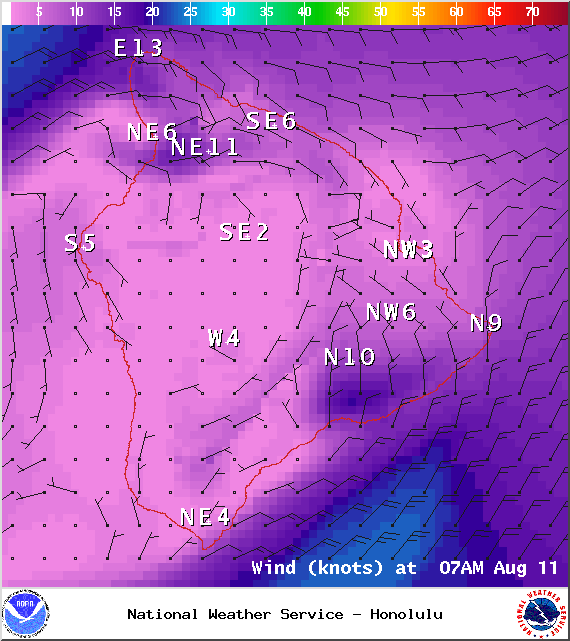
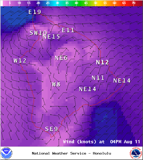
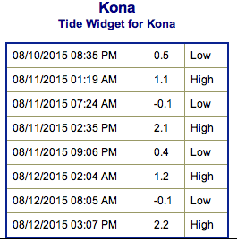
**Click directly on the images below to make them larger. Charts include: Big Island projected winds, tides, swell direction & period and expected wave heights.**
+
SWIPE LEFT OR RIGHT
ARTICLE CONTINUES BELOW AD
Big Island Surf Forecast
Hilo side: Wave heights are expected to be well overhead today for exposures open to Hilda swell. Dropping trend but still plenty big throughout the day.
Kona side: Wave heights ankle/thigh high are expected for the best breaks open to the SW swell.
South: Hilda swell builds for spots open to the ESE and could get into the head high to well overhead range.
ARTICLE CONTINUES BELOW AD
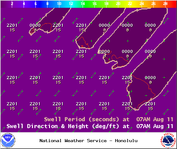
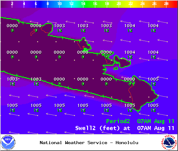
Hilda has generated a ESE/E swell for the islands. The swell is expected to slowly fade through Wednesday.
Our current south-southwest swell is expected to continue fading early this week. A very small southwest swell is also mixing in. No significant swells are on the horizon out of the SPAC. Small swells are expected the second half of the week but a bigger swell is possible middle of next week if a storm near New Zealand develops as expected.
Keep in mind, surf heights are measured on the face of the wave from trough to crest. Heights vary from beach to beach, and at the same beach, from break to break.
This comments section is a public community forum for the purpose of free expression. Although Big Island Now encourages respectful communication only, some content may be considered offensive. Please view at your own discretion. View Comments


 Big Island Surf Forecast
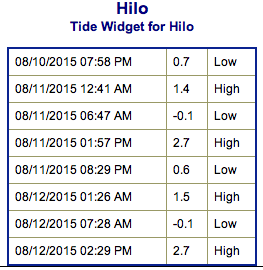 Hilda has generated a ESE/E swell for the islands. The swell is expected to slowly fade through Wednesday.